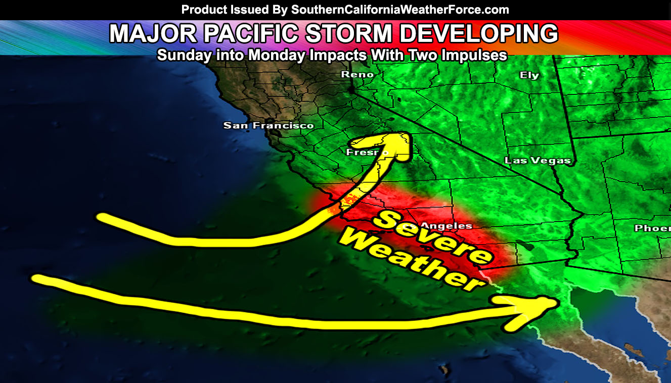
A storm train is coming into the area starting this weekend and going through Monday evening, with additional storm systems toward the next weekend … The developing system could be Major Pacific Storm Goliath … but could also be renamed to Gary. Read on for details.
The first named system however will be named over the weekend. The system for the Sunday-Monday time-frame has the potential for damaging winds along the front, with areas near the coast and a bit inland seeing gusts well over 50+ mph … which with the lack of rainfall in February would cause trees to topple over … and destroy property, including cars parked in the streets. Furthermore the Sunday-Monday time-frame does warrant the risk of thunderstorms with the front … and with those winds it would be a severe thunderstorm watch/warning producer through the forecast area. It has the potential at the moment to be a category four or five system.
NOTE: This is a free article. In order to get to read the micro-climate alerts like winter/snow/tornado/severe storm/wind/marine etc alerts for your area, issued custom from this service, check out the member section on how to be a member and what comes with it. Click Here For More Information – https://www.southerncaliforniaweatherforce.com/system-sign-up/
Damaging mountain/desert winds will accompany that system .. .A snow-level between 5,000 and 6,000 FT. also would accompany the main part of the front … tail-end being below 5,000 FT … expecting blizzard/blowing snow conditions with the storm at and above that during that period.
We have somewhat of a break during mid-week and set another storm line up by March 10th-12th for impacts between the 10th-14th respectively. Confidence is low in the amount of time-frame these storms will cover, but keep tuned to the updates for more.
If you’re a full SCWF Member, Please remember to go to the member section for updated maps as we head into this event to see where your area stacks up in the most precipitation for the coming systems … Click Here To Enter …