Showers will continue through most of the forecast area through Thursday with gusty desert winds. The storm pattern is returning by the weekend … how much? Read on …
Light showers will begin for the LA/OC/SD/IE metro areas overnight tonight and go into Thursday. HEavier showers will continue for Kern County, especially the mountains, increasing on Thursday where I have a Flood Advisory out for that area.
I’ve decided to wait to release the forecast because there are things I’ve been watching over the last week in monitoring this trend. One such pattern I’ve been seeing is on one of my models the storm has shifted west with each passing day. Although this won’t do much to weaken storms into Central/Northern California where we need it … it could however lessen the amount of rainfall we get between now and January 11th.
All kinds of TV talking heads and outlets have been barking the apocalypse is heading to Southern California in what is called an Atmospheric River, Pineapple Express, or whatever new term they want to say this year.
But … un a nutshell I do think it’ll rain during that period .. I do think we will have systems moving in … but I do not think it’ll be the flooding rains of an apocalypse. I’ve said before that the best thing to do for accuracy in the long range is to go vague at first and then bring those details out. I stated since a week ago that the storm pattern is returning … I did not officially go with who much.
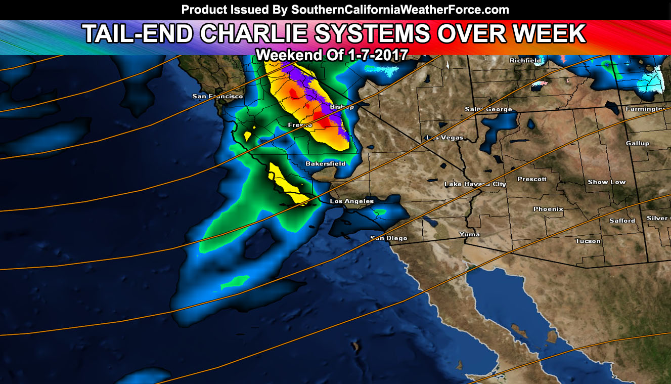
If the pattern remains this way … will think that all areas west of Los Angeles County, in areas like Ventura, Santa Barbara, San Luis Obispo, and Kern County would see much more rainfall than say Orange, Inland empire, and San Diego forecast areas, eastward into the low deserts.
So … here is what I’ll go with. An over-running shower event on Saturday with most of the rainfall west of Los Angeles and a trace in San Diego. Sunday into Monday will be the stronger front, impacting areas west of Ventura County with flooding rainfall so Vandenberg to San Luis Obispo … weaker as it moves east into the LA/SD/IE/OC metros.
I will touch more on this soon as it gets closer … but it isn’t the Apocalypse …
Not on our Facebook Page? Join thousands for updates.
Click Here To Join
Everyone else is going to have to click the link and go to your micro-climate section and await the alerts that come. Some are out now … and others will be issued.
Click Here To Go To Your Micro-Climate Section –
Full Members can see the snow level, snow amount, flood risk, rainfall maps and much more before events hit … Don’t miss out! … Click Here To Enter the Member Section
See ALL the alerts I issue here – https://www.southerncaliforniaweatherforce.com/