A series of storm systems will impact Southern California starting this Thursday, with the first in line named Major Pacific Storm Hillary, a projected Category Five pacific storm. A couple more lined up behind that one and they are all strong … Read on for details …
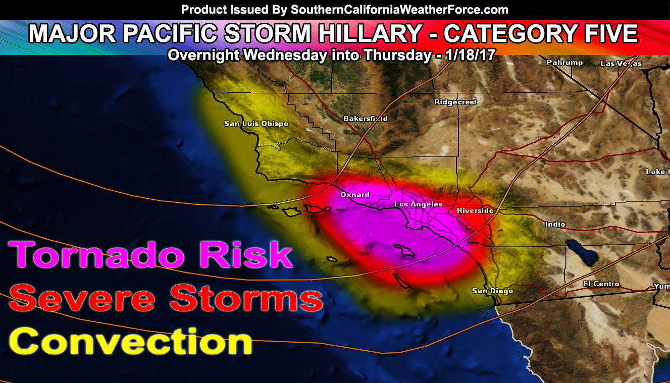
A very powerful dynamic driven storm system is aiming for Southern California later Wednesday night into Thursday and she has been named the next letter on the list … H … thus having the name Hillary. Because she will pack the dynamics for tornadoes, 50 mph wind gusts and higher, and heavy rainfall … she’ll be a Category Five and for this will have the title Major Pacific Storm Hillary.
Hillary; unlike the previous storm systems, will have the most severe impacts in the Ventura, Los Angeles, Orange County regions more so than Santa Barbara and San Luis Obispo County.
Instability seems to be playing a good factor in this system early Thursday morning before sunrise. Lifting along the front will work with strong instability and shear to produce thunderstorms. The Southern California Weather Force tornado model is pinpointing an area from the Ventura Basin/Coast east to the LA and OC Coast and Basin areas. Being we have unidirectional shear with the front, we could easily see supercells embedded within it. Strong low level southeasterly flow will be the final nail in the coffin for tornado dynamics and this could be a tornado watch issuance.
Since I will not be around on Wednesday evening to issue watches … final watch products for Major Pacific Storm Hillary will be issued for flood/winter/tstorm/tornado etc by 12pm Wednesday and no later.
As for snow levels … Snow levels with Hillary will be between 5000 and 4000 FT, which puts the system at higher ratios at the resorts for a system with all snow with the risk of Blizzard conditions in the LA/SBD/RIV Mountains.
SECOND SYSTEM (IVY) : Timing is around Friday …
THIRD SYSTEM (JAIDEN) : Timing is around Monday …
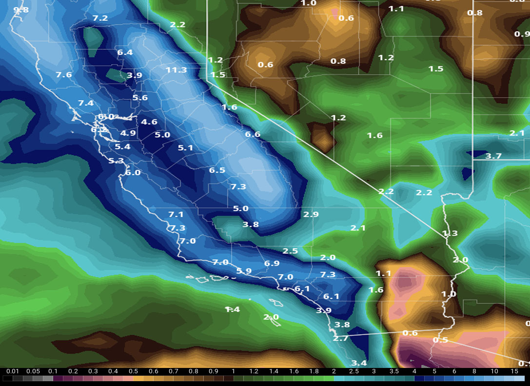
All these systems have one thing in common … a strong southerly flow. This means that areas in the SBA/VT/LA/OC/IE areas would see flooding rains and less in San Diego. Now don’t get me wrong … San Diego will see good rainfall … just it will not even come close to the damage I expect surrounding the Los Angeles forecast area.
Not on our Facebook Page? Join thousands for updates.
Click Here To Join
Everyone else is going to have to click the link and go to your micro-climate section and await the alerts that come. Some are out now … and others will be issued.
Click Here To Go To Your Micro-Climate Section –
Full Members can see the snow level, snow amount, flood risk, rainfall maps and much more before events hit … Don’t miss out! … Click Here To Enter the Member Section
See ALL the alerts I issue here – https://www.southerncaliforniaweatherforce.com/