Well I am back from my trip over the pond for two weeks and it looks like my original forecast back in Mid-January for February is looking the same, with a storm train returning after February 18th so read on for details.
A surface ridge is in place west of the forecast area, which will keep storms from impacting high through the early part of this next week, with off and on cloudy conditions and sometimes light rain showers moving through, mainly Los Angeles westward.
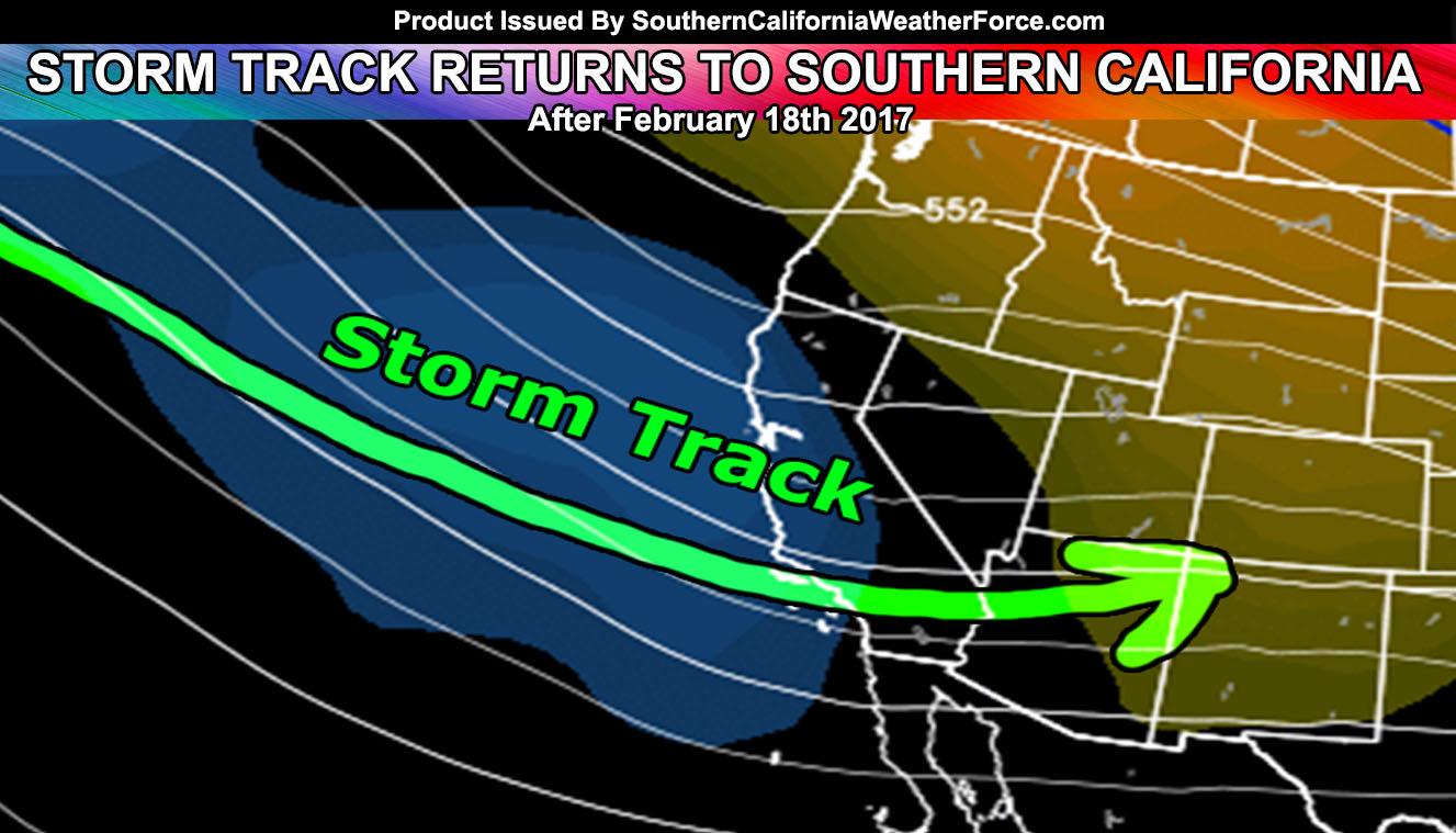
Ridging will continue for drier than normal weather through the next two weeks so maybe this is when I should have taken my trip. Regardless, after February 18th my long range is showing up as a trough in the area and not a ridge. This would yet again shift the storm track jet stream into California for a parade of strong storm systems. We had Hillary, Ivy and Jaiden for the January impacts … the next three on the list are Kahlua, Lucifer, and Maleficent.
Regarding storm strength … do feel the jet stream position relative to the frontal zones will certainly up the severe weather risk again and these will be damaging.
My long range temperature forecast for February is for above average temperatures ..
It’ll remain quiet for a bit, however as the event gets closer I’ll start updating once again like before.