We will go with rain, wind, and then a round of storms so read on for details …
Southern California is within the southern end of a trough right now which is why we have rain today in SBA/VT/LA with lighter rain south of Los Angeles and into San Diego … Pretty dull situation.
Chart shows by Friday we have an upper level trough in the area. The trough digging looks to be far enough south for a full front to move across the area so it looks like a pretty good round of rainfall will hit.
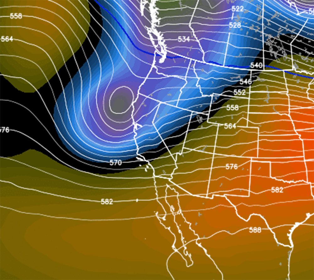
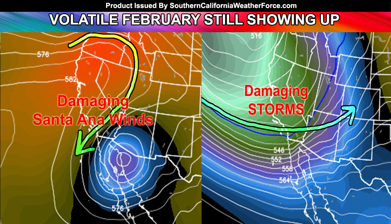
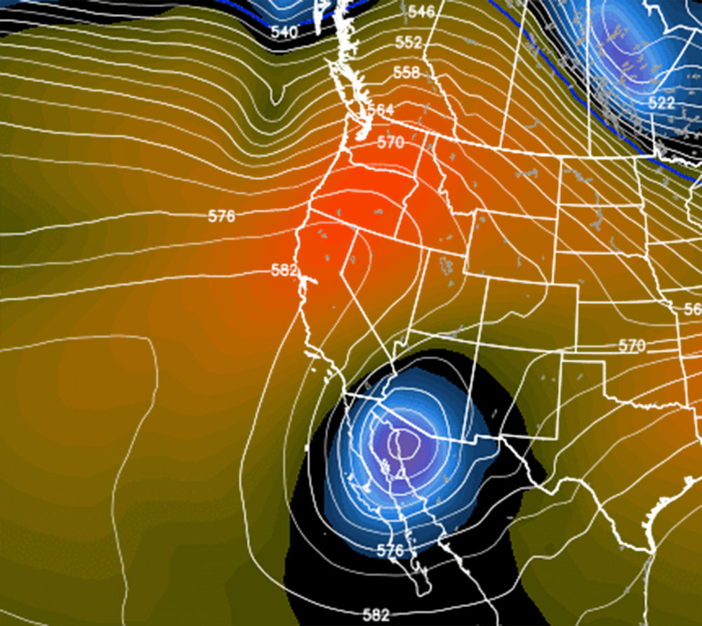
After that hits, over the weekend .. .the trough would move southeast of the area into Mexico. This kind of pattern would bring a damaging Santa Ana Wind event centering the 12th of February. Lows that drop that far south are usually known to bring those damaging winds so if you live in Santa Ana Wind prone zones then heed this warning.
Again as stated in the previous article around the 18th give or take a day ahead or behind of that date we begin the storm parade like January had and major storms are set to hit. This trough here shows up as cold and wide and just screams a major 150+ mph jet stream into the area. This type of pattern brings damaging winds, flooding, and even the risk of severe storms for tornado risks to elevate …
This will last through the end of the month … with a small break then around the end of the month to March 1st …

Avalanche danger will be ELEVATED through the rest of this month … DO NOT GO OFF THE TRAIL