[vc_row][vc_column][vc_column_text]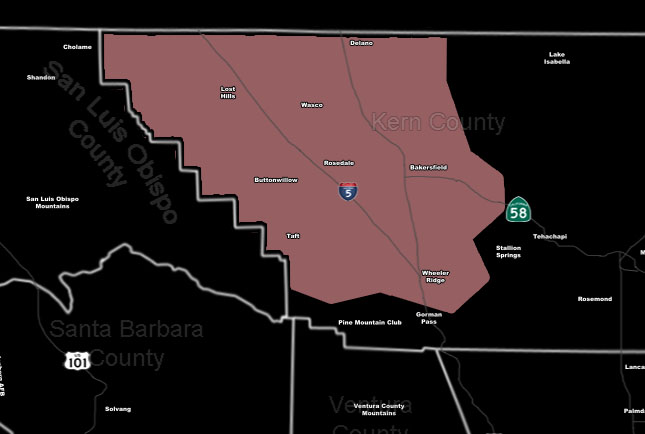 [/vc_column_text][vc_column_text]Issued Zones: Kern County Valley …
Site: SouthernCaliforniaWeatherForce.com has issued a Thunderstorm Watch effective now through this evening …
Date: 3/22/17 at 9:45am PT
Forecast: The south end of the front that will cause severe thunderstorms in the California Central Valley will end in the Kern Valley areas. This frontal zone will work with the March sun angle instability to produce the needed instability for convective updrafts.
Given the 70 kt mid-level jet streak coming in, with drier air in the mid/upper levels, strong thunderstorms will be likely in the Kern Valley later afternoon into the evening. Some to the east of I-5 in this valley may have supercell structures and we could have hail and even a risk of an isolated tornado.
10 mile rule: These alerts issued on this site means that within your zone and 10 miles from you will see the event forecast for. You may or may not see the event but it means you are in the zone or 10 miles from where someone will.
Forecaster: KM[/vc_column_text][/vc_column][/vc_row][vc_row][vc_column][vc_column_text]
If this doesn\’t say “you like this” below then click the LIKE button if you thought this was good information! This helps spread the word by just ONE LIKE … Do it every time if you enjoy these … Thanks for helping!
[/vc_column_text][vc_facebook type=”button_count”][/vc_column][/vc_row][vc_row][vc_column][/vc_column][/vc_row]