So far this season we have seen tail-end charlie systems with no real storms. This is a bit worrying right now in the beginning but middle to end is where the focus will be this season. Will it be colder? Will it be wetter? Read for details …
Latest atmospheric profile suggests that we are stuck in a northwest to southeast flow over the California area while the Eastern United States gets the colder storms. As I stated before, called the Martin UJEAS pattern, or Upper Jet Extended Analog System, the pattern in the Fall does tell a lot of what the winter will bring. So far the pattern has been stuck with tail-end charlie systems. I do not believe this will change anytime soon.
LIKE ME ON FACEBOOK for updates! Click Here and join thousands …
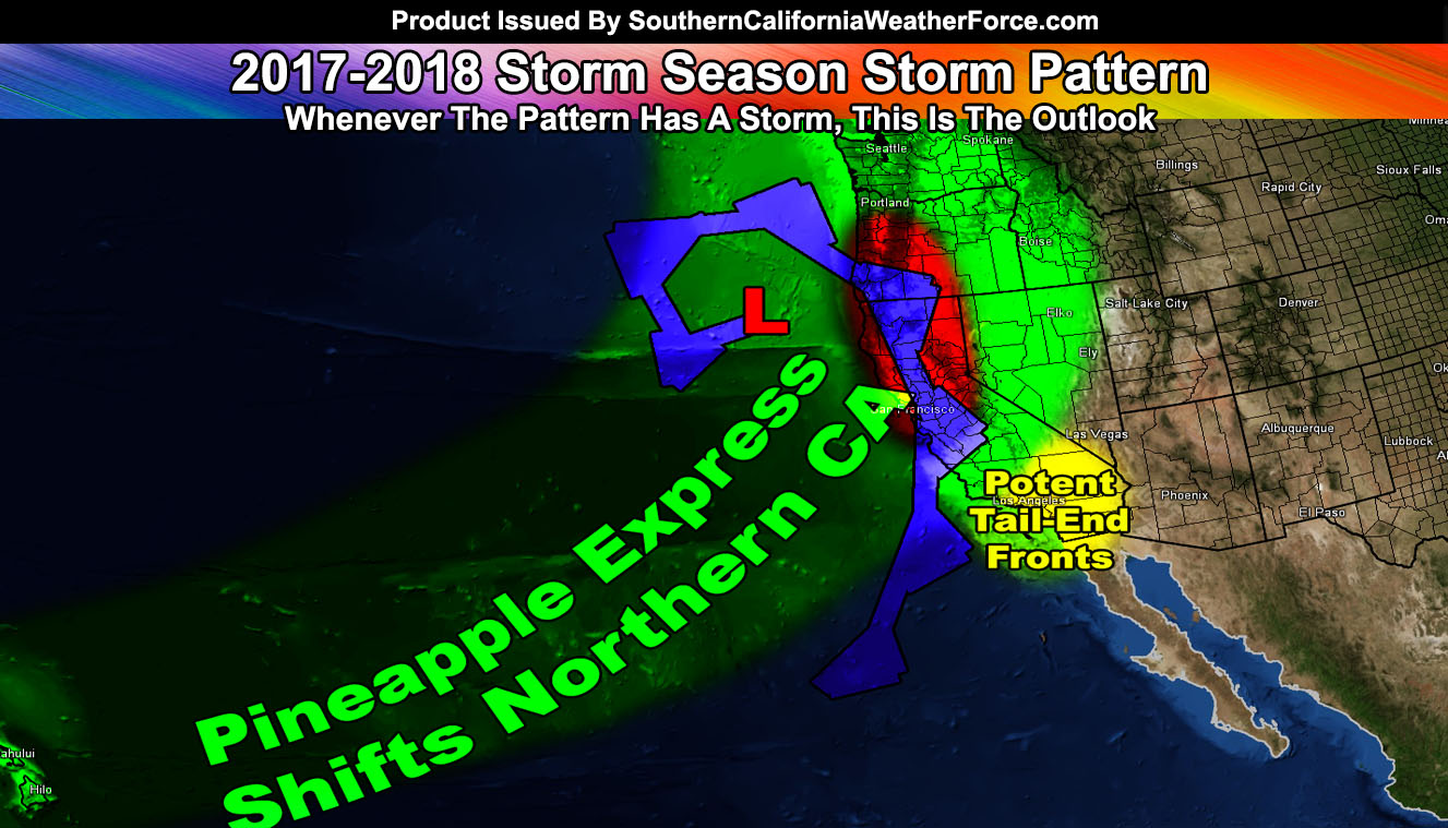
This is all in part of the warmer water off the coast of Southern California stretching to Hawaii. The colder water off Oregon and Washington is where the troughs will be. We do not have much of a southerly dig during December to warrant scooping up any pineapple express systems into Southern California. However … we do seem to have the atmospheric profiles for a Pineapple Express into Central and Northern California at the end of the year, starting into the new year for 2018. This will highly affect Northern California with flooding than it will Southern California. Targets to watch will be the Rose Parade week. Such strong systems impacting up north would drag a strong front through Southern California as well .. .but it will remain rather quick hitting.
January is also when we start seeing snowfall in our local mountain resorts. Yes, this likely will be a late-season start for you. We run storm systems through then, February, and the coldest storms will hit in March.
HATE THE ADS? Become a premium member and support the service along with other perks …
Click Here To Learn More …
Why March? Well we are stuck in this tail-end charlie pattern for much of the next month or even 45 days. But… as January moves into February the jet stream will again start to alter as Summer’s pattern starts to develop down the line. The jet stream will be affected during this time and change once again, ending this horrible tail-end charlie pattern. February and March will be our months for storms as a result of the jet stream finally breaking the winter pattern. Snowfall at the Big Bear Resorts will be 75″ to 90″ should this follow my forecast … with 10″ to 15″ of rain in Los Angeles.
So given this, the season looks pretty boring in the beginning, so-so in the middle … and going out with a bang at the end. We likely will see less storms this season, however the ones that we do get will be high precipitation producers so not many storms being light/moderate … but few storms and them being strong.
Temperatures will be average to slightly below average, the coldest being March.
Members, follow ANY updates daily in your member section by clicking here –
Click Here To Find Your Zone On Facebook For Updates Now and In The Future
Click Here To Find Me On TWITTER.
VISIT THE MEMBER SECTION FOR 2017-2018 SEASON – SIGN-UP OR READ ABOUT IT HERE