Pacific Storm Osiris is becoming a headache, but tracking remains going with him as I’m not ready to sign-off on the forecast area just yet. I do think like I did a week ago that it would hit harder for areas south and east of Los Angeles so read on for those details and the current thinking of the track. Always read the articles, not just the title.
So Pacific Storm Osiris was promising to be a Martin Diamond storm system. He still is… however in a different form. The system concerns I had in the SCWF Member Section discussion last week pinpointed what is happening with it now. The track at which it takes is very important and I would have to take it one step at a time. A closed low would be best for precipitation and thunderstorms across the area. A closed low turning into an open-wave shortwave through the Martin Storm Diamond would only bring storms on the north side of it and thus the focus remains LA eastward. Given what I see in the short term the system will bring developing activity across the Lancaster to Barstow zones tonight… and weather advisories are in place for it.
Furthermore the member section models did pinpoint LA eastward having the worst of it with no flooding problems for the Montecito zones over a week ago so this seems on track … A reason I didn’t stress the system would add problems in the flood zones there
If it does not say “Liked” LIKE The Page Below and join thousands of informed weather forecast viewers in our region for more of the updates!
As for the Eastern LA to OC/IE/SD areas … the system is dropping down into the region and is going to begin bringing back upslope activity this evening into tonight. A snow level of 4,500 FT in the Riverside Mountains will bring an inch or so of snowfall above 5,000 FT with a dusting down to the 4,000 FT level (Anza).The San Diego Mountains will have a snow level of 5,000 FT with little east push on the eastern side of the system backing out into the Pacific… which will bring only a dusting in peak level with nothing at town level at the moment for you there.Elsewhere … upslope activity will bring scattered showers through the flat-lands listed in the zones at the beginning of this paragraph.
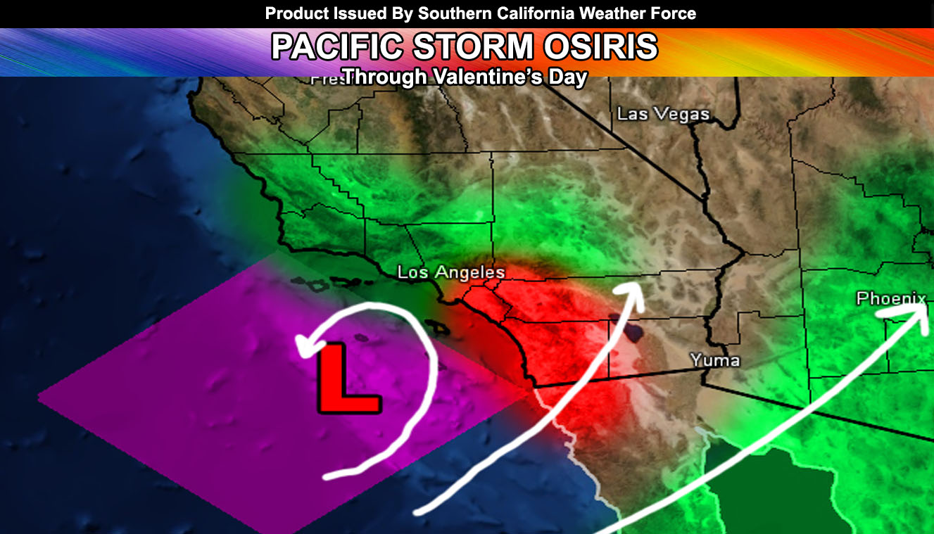
As for the rest of the week … the storm is snapping back into the Martin Storm Diamond on Tuesday and into position on Valentine’s Day. The open-wave track will determine who gets the increase shower/thunderstorm activity but as it stands right now it’ll be anywhere south and east of Los Angeles with less west of there.
We take a break and the end of the week … however the major ridging like we saw all winter seems to be going away and allowing for the atmosphere to continue bringing the risk of storms through this month. The target was 1-3″ again for Los Angeles and we are not seeing that with Osiris so there are other systems behind this for this month.
NOTE: If you’re going into Phoenix or anywhere in Southern Arizona there will be flooding this week with Osiris as Arizona will take a much harder hit than Southern California with sub-tropical moisture
Click Here To Find Your Zone On Facebook For Updates Now and In The Future
Click Here To Find Me On TWITTER.
This is the end of the public article …
This is now members only and subscriptions can be looked into on the following link – https://www.southerncaliforniaweatherforce.com/system-sign-up/