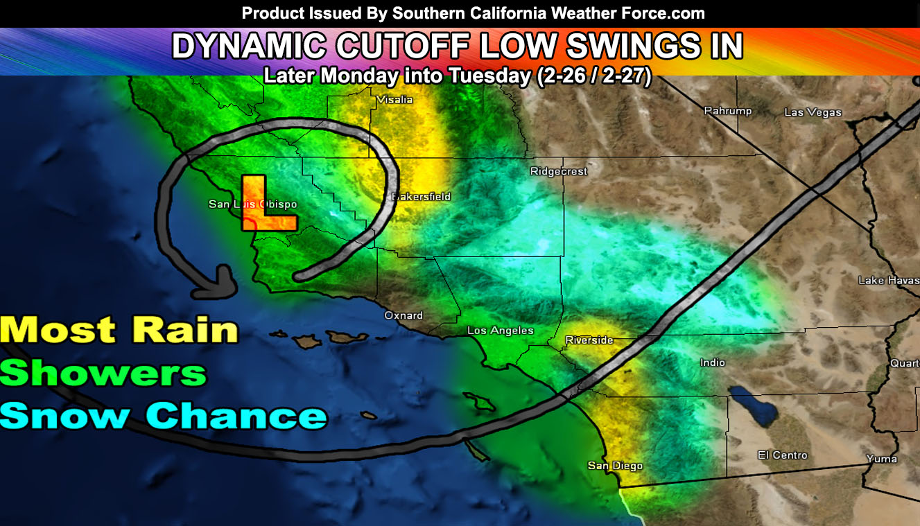
Another cold night expected out ahead of our next system. This next system, poised to hit on Monday into Tuesday of this next week, is going to be a dynamic cutoff low system. Such systems like this do have the power for thunderstorm development within the small area of upper divergence associated with the center of the upper level low, which will be in the Kern County to SLO/Kern County line.
Given what I see, confidence is high that the track will not change much from my initial thought of it. The most rain will be in the Kern County zones with the upper divergent band, and the areas east of Los Angeles proper, in the Inland Empire to San Diego County zones and neighboring mountain areas.
The weakest zones for precipitation will remain the Ventura and Downtown Santa Barbara zones to the Imperial Desert.
Snow Level will be starting at 3,500 FT lowering through the 2000 FT Level Monday night into Tuesday. Because of this lowering, low elevation snowfall in some High Desert locations will be possible should the front ignite
convection up there. This will be monitored.
The SCWF Member Section will have updates on precipitation and snowfall forecasts … as well as preliminary thunderstorm forecasts as we near Monday … so over the weekend.
If you are interested in the SCWF Member Section the link to that is below in the Southern California Weather Force comment area of the page. Member section has maps/forecasts/details that this page does not hold.
Stay tuned to Southern California Weather Force for the latest official updates and alerts.