A frontal zone is expected to hit San Luis Obispo overnight tonight and Santa Barbara/Ventura by the morning, before going eastward to Los Angeles over the day on Friday and weakening as it passes the LA/OC areas. Flood Watches issued days ago remain in place for the San Luis Obispo, Santa Barbara, and Ventura County areas.
Based on what I see with this, gusty winds along the front are likely, some happening west of Santa Barbara even at this hour.
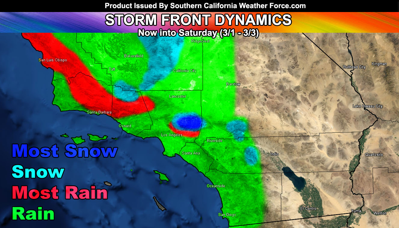
Flood risk charts here at Southern California Weather Force shows a moderate flood potential in the watch areas listed at the beginning of this write-up. Low risk extends to the Los Angeles areas, including the San Gabriel Valley. In reality we could see a brief heavy rain event in those areas with the main frontal zone passage. However, as this front heads eastward it loses low level wind support and direction and thus values of over an inch in West Covina would dumb down to under a quarter inch in Riverside, but an inch is possible still near the foothills of the San Bernardino Mountains, with a half inch for the Hemet zones. The weakening cold front will make for little rainfall in the San Diego areas, with the exception of a half inch in the foothill/mountain areas.
Snow levels are higher with this system and the weakening rate of the front I expect would bring the snow totals for the Big Bear areas to 2-4″ with isolated 6″ marks near the dam and an inch for Sugarloaf. Gusty winds will accompany it so in spots blowing snow is possible. Idyllwild could get away with a dusting to an inch, and no snow is expected in the San Diego Mountains. Pine Mountain Club at 1-2″, Tehachapi at a dusting, Wrightwood 2″, and along the top of the Angeles Crest Highway at 8,000 FT a foot of snow.
Not much else to say about this system other than it’ll be stronger west of the Inland Empire and Orange County areas … Premium members can see the flood, snow, and rain charts on the member section for this system with zoom-able maps down to your area.
Gusty desert winds through the weekend looks likely even after the main front with a west flow in the low levels.
No rain is expected in the far Riverside Deserts or Imperial County.