March 2018 is projected on my numbers to be slightly above average in rainfall with average temperatures as a whole. The month is starting with a trough to our north and bringing most of the rain Los Angeles westward. The ill effects of the lack of snow potential in Big Bear was seen days ago in my final forecast write-up, mentioning that I do not understand why they have a Winter Storm Warning in the San Bernardino Mountains when an advisory for under 2-4 inches on the rim and a dusting in Sugarloaf looked the most possible.
The reason I went much lower than any other forecast is the moisture levels were shallow and the rim is high. The end result would simply be fog on the rim as you’d be at the top of the clouds with clear skies in Big Bear for the most part. But, as some of you saw if you are members of a group and/or the premium member alert system, Big Bear was issued a Winter Weather Advisory this morning by me. A slight increase in moisture is expected by the evening and this should be sufficient ti temporarily bump the clouds over the rim and into the lake-level zones. Still, less snow in Sugarloaf and more on the rim, but nothing on warning levels is expected. They (NOAA) still even have it out up there for today, which is the wrong forecast to follow.
With any case though let’s get on with the March 2018 forecast.
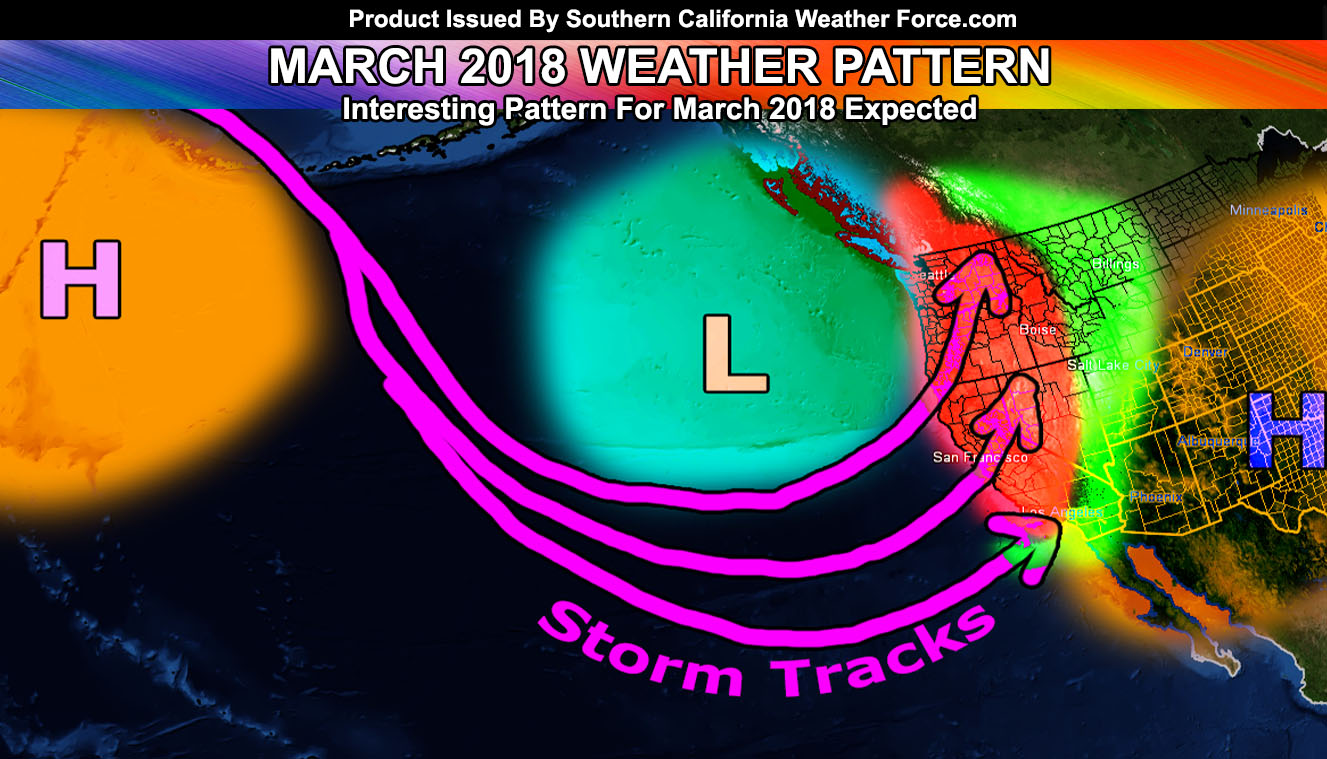
The ridge will be pushed further west into the Northern Pacific with a trough over British Columbia and the Pacific Northwest. A ridge would be forming over the center of the United States as well. For the most part, it means the ‘blocking’ would be Arizona and New Mexico and allowing for the jet stream to be rather southwest to northeast over California and the Pacific Northwest. Of course, more rain for the Pacific Northwest and Northern California is expected with tail-end activity storm systems into our region by the middle of the month is what I am going for. Because the ridge is lacking overhead, do feel temperatures will not be too high with the trough influence to the northwest so average temperatures I expect will be the end result.
With the moisture out of the southwest under the trough, expecting a slightly above average precipitation pattern for Los Angeles north and westward with average for areas south and east. Overall it is an interesting pattern for March as we continue through the stormy pattern without the blocking ridge.