Major Pacific Storm Raylene will continue to pummel the burn areas of San Luis Obispo, Santa Barbara, and Ventura County through today, intensity increasing by Thursday. Read on for details.
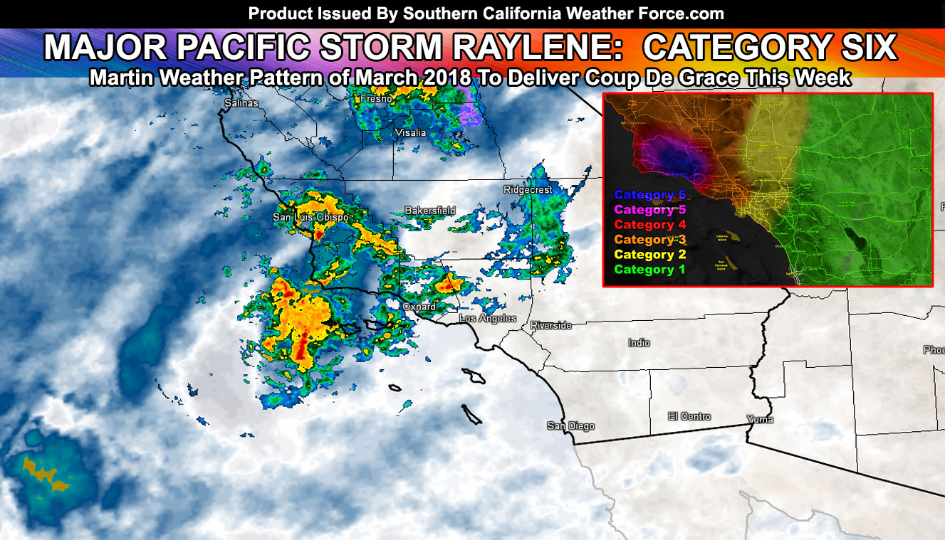
Thunderstorms are expected in the burn areas today and lightning has already been detected. SCWF Member Section updated models do show thunderstorms likely with this upper divergent section across Santa Barbara and Ventura County, moving in off the Pacific. It will rain all day across the burn areas and then dry out a bit tonight as we hit a break in the activity, or the calm before the rest of the storm. The lifting of the front will bring slight instability across the Kern Valley zones as well this evening/early night and we could see thunderstorms there as well.
If it does not say “Liked” LIKE The Page Below and join thousands of informed weather forecast viewers in our region for more of the updates! noticeable
Overnight tonight, the worst areas for heavy rainfall and flooding will lift into the San Luis Obispo and Western Santa Barbara County areas (Vandenberg AFB). This is when you will see the heaviest rainfall out of the entire storm. With such strong southerly flow, strong wind gusts will bring the risk of falling trees.
As we start through Thursday morning the upper level low will start shifting east and with that will be the front will move across the burn areas. With southerly flow being pretty strong out of the south, the heaviest precipitation in the Los Angeles, Orange, and Inland Empire zones will be on Thursday, with scattered left-over convective showers overnight into Friday morning when it will diminish. Because of the strong southerly flow on Thursday, downed trees are possible.
San Diego.. as stated in every update.. you will see far less rainfall from this storm and this really isn’t the system pattern for you. You’ll have high wind gusts out of the south however on Thursday.
Snow levels remain high with this so no snowfall products will be updated in the SCWF Member Section.
It will be windy in all desert zones on Thursday, but it will be dry across Palm Springs, Morongo Basin, and Imperial County.
Click Here To Find Your Zone On Facebook For Updates Now and In The Future
Click Here To Find Me On TWITTER.
If it does not say “Liked” LIKE The Page Below and join my main weather office page that gives you updates during the events and insights from my weather office that the other pages do not give.