An inside slider will bring some snow to the Kern County Mountains this weekend and a strong Santa Ana Wind Event is looming early this next week so read on for details.
An inside slider will move through the area on Saturday evening and going through the night and into Sunday for the Kern County Mountains. The snow level will lower to 4,000 FT and a dusting to at max 2 inches in the upper elevations will be likely … Use caution when traveling the passes. This will not be a major system …
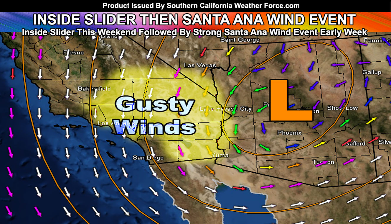
First I will get into later Saturday but mostly Sunday in all desert areas. I’ll merge this watch so I don’t have to overlap advisory/warnings but it will be very gusty this weekend in all mountain and desert locations, with the highest wind gusts across Barstow at 50+ mph on Sunday.
With any-case, this Santa Ana Wind Watch is for Monday evening through Tuesday evening. During that time-period an inside slider will move to the east of Southern California.
A strong upper level jet will bring gusty winds out of the north across the entire watch area. Because the support is there in the mid/upper levels it will transfer the energy down to the surface and thus all desert locations have been issued this watch, including rare pattern zones in the Coachella Valley where I expect these winds to surface as well.
Wind gusts over 35-55 mph will be likely in all the watch affected areas between Monday evening and Tuesday, waning by mid-week.
It will be a cold one Sunday and Monday night with the passage of the dry cold-front in the metros.