Inland heat is being felt across the Southland as temperatures move into the 90s inland and 100+ in the deserts. Dry lightning potential is on the increase in the eastern mountains so read on for details on where and when the heat will subside.
I’ve issued a heat advisory lasting through Thursday for the Inland areas. Low deserts will see 110 degrees through the period with the Inland Empire to Santa Clarita Valley seeing 95F or higher. A good time to get out to your pools. The beaches will be nice, in the 70s. This isn’t considered a true heatwave for the metro areas as June normally already should be seeing many many days of 100F+, even out to Downtown Los Angeles. We continue with slight onshore flow so this isn’t a true heatwave ridge.
Ongoing Text Ad: Furthermore we parted with our main summer-time advertiser and will need help from viewers/readers this Summer. So if you are interested in helping you can donate to SCWF in just a couple clicks by CLICKING HERE. I do appreciate all the help to make it through this Summer Monsoon Season. We are now over 1/2 to the goal to keep operations this Summer without an advertiser. Thank you everyone who has helped thus far. If the monsoon kicks up in July you’ll want to have this service operational.
SOUTHERN CALIFORNIA ONLY: if it does not say “Liked” LIKE The Page Below and join thousands of informed weather forecast viewers in our region for more of the updates! noticeable
By the weekend the temperatures in the Inland zones will be 20+ degrees cooler than now so this is one of those temporary ones I said could happen in my June 2018 forecast.
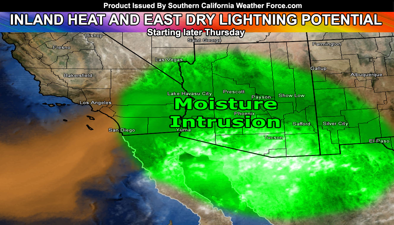
As for the dry lightning potential. Have issued my Fire Weather Watch for the San Diego and Riverside County Mountains effective now for Thursday evening into Friday. The eastern edge of shallow mid-level moisture will edge into San Diego/Imperial County and move northward later Thursday and into Friday. This should work with some instability and be enough for the risk of lightning strikes. Out of that, the lack of deeper moisture in the low levels will make for a dry lightning scenario with less rainfall with the lightning strikes, thus a fire hazard is starting to grow. The finalized forecast for that will be made on Thursday before the moisture enters the area.
After this we remain with comfortable June temperatures.
The ridge is placing in July in the position that will allow the monsoon to finally develop across the Southwest United States. I am looking at a pretty good position for us here in Southern California to get more in on the shower/thunderstorm activity in July.
BEHIND THE SCENES FORECASTS/UPDATE PAGE: if it does not say “Liked” LIKE The Page Below and join thousands of informed weather forecast viewers in our region for more of the updates! noticeable
Things to note are as followed;
- A colder than normal Summer does not mean we won’t have times of a heatwave or two. It means overall it’ll be colder than normal.
- Tornado activity will remain this Summer in the desert and Central/Eastern Inland Empire areas. Thunderstorms elsewhere likely …
- Monsoon Season starts June 15th, however this year will be a mid-start, likely toward or in July.
- To remain active this Summer we are keeping the member section open to the public but as a ‘donation’ for help, by Clicking Here you’ll help this service remain into Summer.