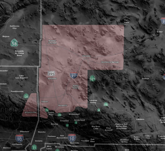
Issued Zones: Metro High Desert near the El Mirage Convergence Zone …
Site: Southern California Weather Force has issued a Thunderstorm Watch effective now through today …
Date: 8/16/18 at 1:00pm PT
Forecast: The El Mirage Convergence Zone along and west of I-15 from Phelan/Adelanto/Helendale will ignite thunderstorms later today in the western edge of the monsoon moisture plume.
Gusty winds, hail, and heavy rain will be likely in those areas. Movement will be nearly stationary so a flood issue could elevate directly under them.
PREMIUM MEMBERS – Click here to check out what is updated today in the SCWF member area …
Join A Micro-Climate Group On Facebook For These Alerts – Click Here To Find Your Location Served By SCWF Today!
10 mile rule: These alerts issued on this site means that within your zone and 10 miles from you will see the event forecast for. You may or may not see the event but it means you are in the zone or 10 miles from where someone will.
Forecaster: KM