Been watching the long range for awhile now and hence my forecast of 0.5 to 1.5″ of rain in Los Angeles for the month. This looks on track as my further long range numbers value the storm window to be in the area even around the Thanksgiving travel period. Read on for details …
The November 2018 forecast I released here at Southern California Weather Force ( Click To Read That ) went as followed; “Generally the 1960s-1970s era was really good for precipitation in our region and is something I am highly leaning toward this season. We already are slightly below average for the season with a slightly above average October 2018 having the majority of the rain. So with this now being a weak to moderate El Nino and gaining strength each week, it would make sense to push November to have a number of rainfall events in our region, mixed with some offshore flow.”
“My gut is telling me dry up through November 19th for the most part.”
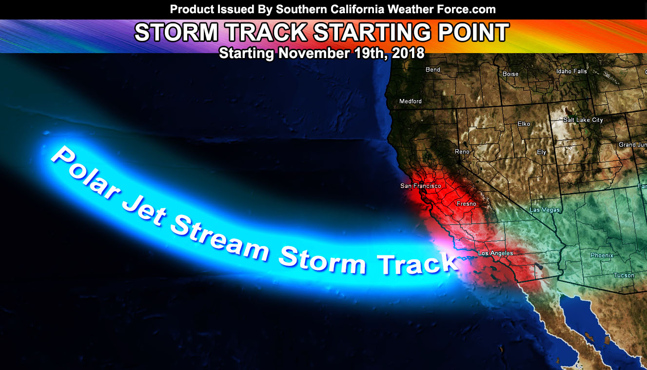
I am seeing the Pacific Storm Track dipping down into our region once again, without the aid of cutoff lows. These are actually polar jet stream induced storm systems so they will have the dynamics for heavy rainfall, thunderstorms, mountain snow, and gusty frontal zone winds. This El Nino is now a weak to moderate El Nino and officially my numbers continue to climb through December into moderate El Nino strength. The effects of a moderate El Nino is good for our area for the drought.. but sadly very very bad for the fire zones as major flooding is expected. I will release my final El Nino forecast in article and video form by next week.
This shouldn’t just be one storm system. This is a polar jet influenced pattern and thus it will bring a number of them through starting near November 19th and even going passed Thanksgiving. If you do have travel plans I highly expect you to continue monitoring my forecasts for future updates.
So there we have it … a number of my models are continuing to show the increase in storm probabilities for Southern California with the first of this season’s storms arriving between the 19th and the 22nd.
End
NOTE: Premium members. If you are signed up, your login is your e-mail address and the username and password as the password. You can change the password
Ongoing Ad – The Southern California Weather Force has a member section with LIVE UPDATES FOR EVENTS and rain, wind, thunder, tornado etc models that are personally updated by me with each Santa Ana Wind or storm event. You also can get e-mailed alerts via a slew of micro-climates. Check the member section for details on how you can support this service.. along with getting service in return… Click Here To Join or Upgrade Via The Member Section
Please remember if upgrading to CANCEL YOUR PAYPAL PAYMENTS. Login and cancel the reoccurring payments.
The Southern California Weather Force has different Facebook groups that you can ask for notifications from in order to get the latest posts affecting those regions. If that area is talked about in an article, alert, and such .. it’ll be posted there and you can be notified.
Comments are usually DISABLED as we do like to keep this as an information giving group and replies from others in the notification may annoy some.
Find your micro-climate group here – https://www.southerncaliforniaweatherforce.com/scwf-weather-alert-facebook-groups-by-region/
EMAIL ALERTS? Many micro-climate zones to choose from to get custom alerts from thunderstorm, wind, flood, surf, heat, cold, storm, and much more with the premium e-mail alert system, the most advanced zone alert system in Southern California – Click Here To Join!
SOUTHERN CALIFORNIA ONLY: if it does not say “Liked” LIKE The Page Below and join thousands of informed weather forecast viewers in our region for more of the updates! noticeable
BEHIND THE SCENES FORECASTS/UPDATE PAGE: if it does not say “Liked” LIKE The Page Below and join thousands of informed weather forecast viewers in our region for more of the updates! noticeable