The January 2019 forecast (Click Here) went without a hitch with all aspects and storm patterns down perfectly, including this one. This is a major streak as since these monthly forecasts began long ago have been able to go far out and get your prepared for the possible storm and/or temperature windows. What will February hold? El Nino is about to flex peak muscle so prepare even more than ever now if in the Flood Zones. Read on …
The Martin Storm Pattern is coming back and January could consider having had one major one and one start of one. As quoted from the January 2019 forecast. ” Between January 4th and 12th would be the next round of cold-fronts hitting the Southern California area. These should be on the cooler variety being the cold air is remaining in place. Another system will come in several days after Pacific Storm Simon, the T name.. Trump. That system is still being watched as it could be worse than Simon.. depending on the track. It still is well over a week away.” Major Pacific Storm Trump ended up being a Category Six storm out of my one through six scales for determining the strength and danger of storm systems impacting Southern California. Click for that article.
Furthermore, the January 2019 forecast said warm-up between systems through mid-month and we already have seen this break. Last but not least … it stated that end month would be the start of another storm pattern with “We have the chance of another storm window end month or early February after the brief break we will have between systems as a ridge takes hold.” All that can be found by clicking here.
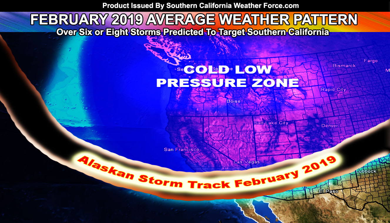
As for February 2019, we are in for a lot more rain than January 2019 has brought. I am going for four to six inches of rainfall with room for a bit more if these patterns continue. Based on what I am seeing in my numbers, the beginning of the month is still projected to bring nearly half that rainfall forecast. We have breaks in-between and I want to say we will get yet another pattern by mid-month so watch those Valentine’s Day forecasts. Now after the 20th or around there, it seems like yet another break before we get some systems in toward the end week of the month. Quite literally this next month’s forecast has very little break periods and a persistent area of low pressure that would keep the onshore flow and a lack of major ridging over the area for moisture to continue pumping in.. even if it is light rain at times.
Because of the persistent low-pressure system, I have decided that the month will have colder than normal temperatures as a result.
As for the coming pattern stay tuned to Southern California Weather Force on Facebook if you do not have it. Click Here To Join –
And if you are not a member, members get e-mail alert notifications of these articles and a major list of micro-climate alerts I issue as well as various custom models that you can zoom into your location when available during events. Join today below.
End
NOTE: Premium members. If you are signed up, your login is your e-mail address and the username and password as the password. You can change the password
Ongoing Ad – The Southern California Weather Force has a member section with LIVE UPDATES FOR EVENTS and rain, wind, thunder, tornado etc models that are personally updated by me with each Santa Ana Wind or storm event. You also can get e-mailed alerts via a slew of micro-climates. Check the member section for details on how you can support this service.. along with getting service in return… Click Here To Join or Upgrade Via The Member Section
Please remember if upgrading to CANCEL YOUR PAYPAL PAYMENTS. Login and cancel the reoccurring payments.
The Southern California Weather Force has different Facebook groups that you can ask for notifications from in order to get the latest posts affecting those regions. If that area is talked about in an article, alert, and such .. it’ll be posted there and you can be notified.
Comments are usually DISABLED as we do like to keep this as an information giving group and replies from others in the notification may annoy some.
Find your micro-climate group here – https://www.southerncaliforniaweatherforce.com/scwf-weather-alert-facebook-groups-by-region/
EMAIL ALERTS? Many micro-climate zones to choose from to get custom alerts from thunderstorm, wind, flood, surf, heat, cold, storm, and much more with the premium e-mail alert system, the most advanced zone alert system in Southern California – Click Here To Join!
SOUTHERN CALIFORNIA ONLY: if it does not say “Liked” LIKE The Page Below and join thousands of informed weather forecast viewers in our region for more of the updates! noticeable
BEHIND THE SCENES FORECASTS/UPDATE PAGE: if it does not say “Liked” LIKE The Page Below and join thousands of informed weather forecast viewers in our region for more of the updates! noticeable