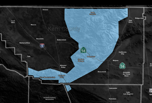
Issued Zones: Kern County Mountains …
Site: Southern California Weather Force has issued a Blowing Snow Advisory effective now for Sunday …
Date: 2/9/19 at 7:45pm PT
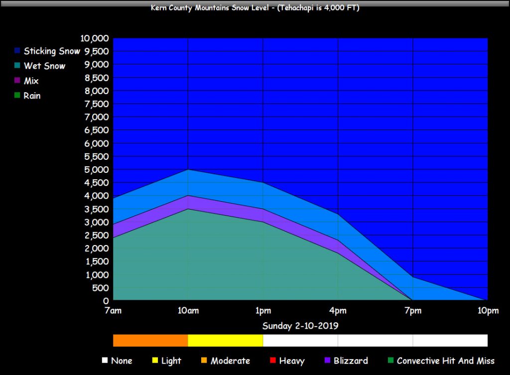
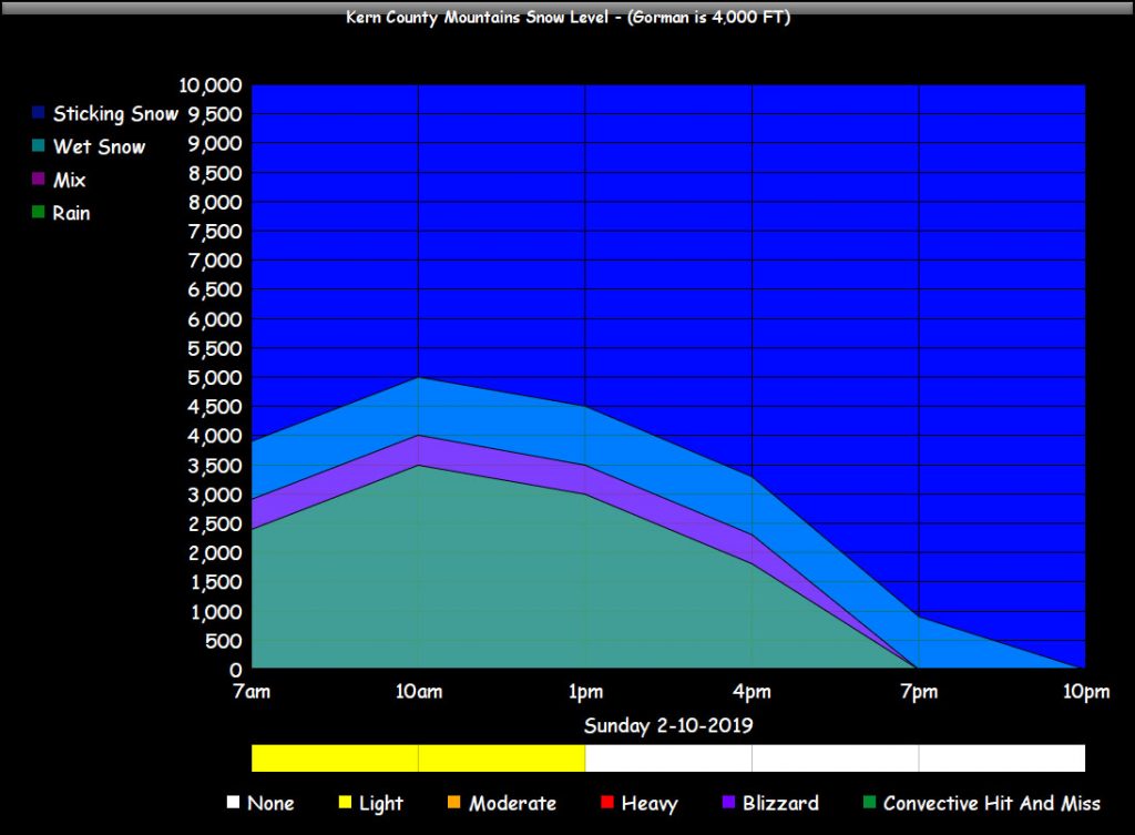
Forecast: A frontal zone will come into the Kern Mountains early Sunday morning and last to just before noon. It will be a fairly quick hitting frontal zone. Moderate snowfall will be likely for the Tehachapi section of the Kern Mountains, with lighter snowfall in the Gorman/Frazier/PMC zones.
Expecting Tehachapi over 2″, BVS over 6″, Gorman over 2″, Frazier between 2-4″, and PMC somewhere in that 2-4″ mark, with higher amounts in the way upper elevations.
Gusty winds will accompany the system so this is a blowing snow advisory … Members you can check the snow-model through tonight and tomorrow at the link below. The rest of you can check the snow-level forecast below.
PREMIUM MEMBERS – Click here to check out what is updated today in the SCWF member area …
Join A Micro-Climate Group On Facebook For These Alerts – Click Here To Find Your Location Served By SCWF Today!
10 mile rule: These alerts issued on this site means that within your zone and 10 miles from you will see the event forecast for. You may or may not see the event but it means you are in the zone or 10 miles from where someone will.
Forecaster: KM