The Southern California Weather Force wind alerts were issued yesterday, which covered the entire region. In addition to that, yesterday’s video ‘This Week In Weather’ Episode 3 did mention Wednesday’s storm risks east of Los Angeles, and this looks to be happening so read on for details.
Off and on showers will continue for the Kern areas south through the Gorman Pass, into the areas near the foothills of Los Angeles, The Inland Empire, and San Diego County for the foreseeable couple of days, with an increase in this possible later during this weekend but what about the short-term?
I issued within the previous forecast video a Hurricane Gust Warning, High Wind Warning, and Wind Advisory for the entire region for (Tuesday), or today. The Hurricane Gust Warning is for the upper eastern ridges of the San Bernardino, Riverside, and San Diego County Mountains, including the Palm Springs Aerial Tramway where my personal calculations have 85 mph wind gusts up at the mountain station later on Tuesday. The High Wind warning is for the mountain and desert regions. Wind gusts from 45 to 65 mph will be likely with it with damaging gusts over 60 mph, which is centering the city of Barstow, on up through the Fort Irwin Military installation.
As for the wind advisory, the entire non-mountain and desert zones through the valley/coastal zones will be in this. I fully expect widespread wind gusts of over 35 mph with some along the coast breaching 45 mph with 30-40 mph in the inland valleys.
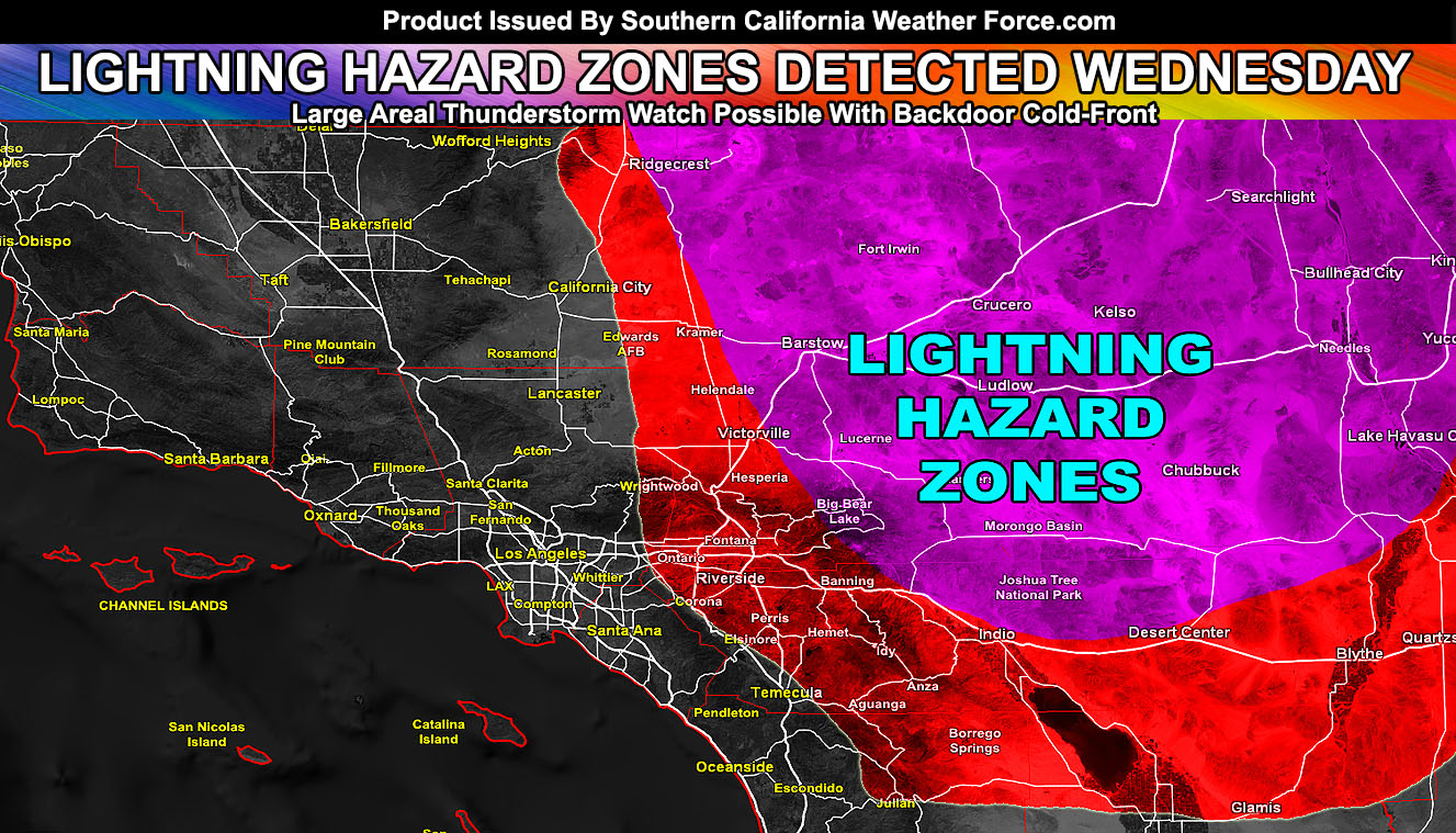
Over your day on Wednesday, the back-door cold front does slide in from the north for renewed precipitation chances mainly northeast and east of Los Angeles. Given what I see in the coming upper lifting and divergent zone, deep-layer moisture will increase with the instability from Ridgecrest southward through the entire San Bernardino Desert and Mountain Region into the Coachella Valley areas at the center of it. This is likely a widespread lightning event in that area so I am expecting to issue a large Thunderstorm Watch box for Wednesday in those zones. In addition to those zones, lifting along the Los Angeles and San Bernardino Mountains would make it possible for storms to leak southward into some Inland Empire areas, south into the Riverside County Mountains. Furthermore, storms could leak south as well into the Northern Imperial County areas south of I-10.
The graphic within this article shows the red outline zones for the outlined areas and the magenta shade for the heart of where I do believe the most widespread thunderstorms will be for your Wednesday.
As always, stay tuned to official forecasts from Southern California Weather Force for updates …
For The Main Weather Facebook Page Click Here and Join.
End Article
OPTIONAL: Southern California Weather Force main page now has models, agendas, the alert map, and other things updated during storm events. You can bookmark the main site and check back during an event for the latest updates.
Click here to view the main page
EMAIL ALERTS AND ASK THE WEATHER OFFICE A QUESTION: It pays for itself in one storm system. A very affordable e-mail alert system that only gives you SCWF weather alerts in YOUR micro-climate area. Also, you can ask the weather office a question at any time if you get that add-on.
Click here to join
MICRO-CLIMATE ALERT FACEBOOK GROUPS: Find yours today!
Click here to join
FACEBOOK PAGES TO JOIN!
SOUTHERN CALIFORNIA WEATHER FORCE MAIN: if it does not say “Liked” LIKE The Page Below and join thousands of informed weather forecast viewers in our region for more of the updates! noticeable
BEHIND THE SCENES FORECASTS/UPDATE PAGE: if it does not say “Liked” LIKE The Page Below and join thousands of informed weather forecast viewers in our region for more of the updates! noticeable
FOR THE CALIFORNIA FAULT STRESS MODEL PAGE: if it does not say “Liked” LIKE The Page Below and join the official page to the California Fault Stress Model
INSTAGRAM AND TWITTER ACCOUNTS TO JOIN!
Instagram – https://www.instagram.com/socalweatherforce/
Twitter – https://twitter.com/SCweatherforce