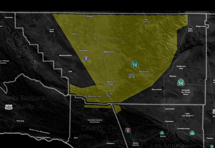
Issued Zones: Kern County Mountains / Gorman … Kern Valleys (Central/East) …
Site: Southern California Weather Force has issued a Severe Weather Statement, Pending active convective watch …
Date: 5/24/19 at 2:25pm PT
Forecast: An impulse rounding the coast will enter the Kern County region out of the west on Saturday afternoon and evening. This impulse will carry some upper divergence with it.
Instability profiles look rather impress with the high May sun angle and this will work with upslope activity for the chance of thunderstorm activity from the Central/Western Kern Valley south to the Gorman/PMC areas and east to the entire Tehachapi Mountain Range.
Hail is very likely to be with these storms and also a good amount of lightning strikes.
Given what I see, a thunderstorm or severe thunderstorm watch will be needed so stay tuned …
EMAIL ALERTS: Get these to your e-mail by upgrading to a full member. It pays for itself in just ONE weather event: Click Here To Learn More
Additional Models: Visit the main site to see what was updated in terms of rain/snow/flood risk and more – Click Here
Join A Micro-Climate Group On Facebook For These Alerts – Click Here To Find Your Location Served By SCWF Today!
10 mile rule: These alerts issued on this site means that within your zone and 10 miles from you will see the event forecast for. You may or may not see the event but it means you are in the zone or 10 miles from where someone will.
Forecaster: KM