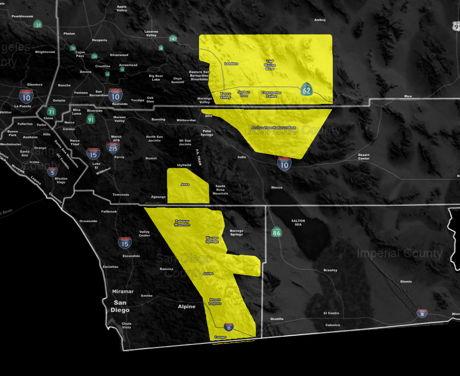
Issued Zones: San Diego and Riverside County Mountains … Morongo Basin …
Site: Southern California Weather Force has issued a Severe Thunderstorm Watch effective now through the evening …
Date: 7/23/19 at 9:25am PT
Forecast: Monsoonal moisture has been working its way through the forecast area for a couple days now. Today, with clearing, we would see thunderstorms popping back up over the severe thunderstorm watch area and within this would be the risk of hail up to an inch in diameter, damaging winds, and even torrential downpours for a flood issue.
Given what I see, these storms will move very slowly through the afternoon hours so this certainly is a flood issue.
Additional storm activity is expected with the south to north flow over the Morongo Basin as well so you will get storms …
Today would not be a good day for outside activities … The watch will expire in the evening …
Join A Micro-Climate Group On Facebook For These Alerts – Click Here To Find Your Location Served By SCWF Today!
10 mile rule: These alerts issued on this site means that within your zone and 10 miles from you will see the event forecast for. You may or may not see the event but it means you are in the zone or 10 miles from where someone will.
Forecaster: KM