With the successful predictions here at National Weather Force of both Isaias and Laura I thought I would go ahead and get a bit more in-depth on the outlooks for the month of September and October for the Gulf States and Eastern Seaboard so read on for details …
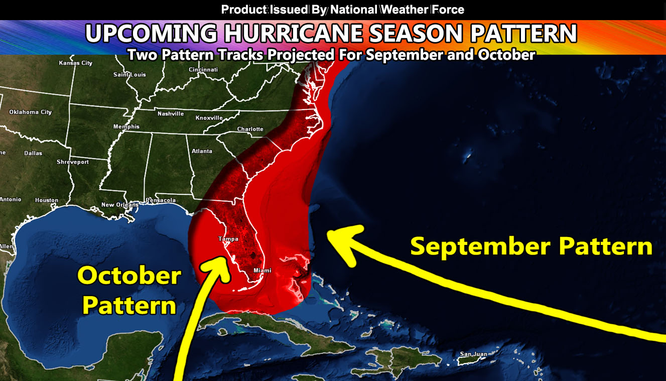
With September moving along we will have a seesaw pattern where troughs dig into the Eastern United States and ridges build in. This is when most of the hurricanes turn away from the United States. When troughs are in place, the troughs turn them away. A tropical wave must sneak in when a ridge builds between these troughs and this is very possible this year because the troughs will be deep so the ridges will be strong. Should be mid-month or so when we start to focus on another Hurricane in the area.
As October moves along, the troughs will be deep enough to reach the Jamaica areas and pull systems out of the Caribbean into the Florida areas or up the East Coast. This is a similar pattern to Wilma so again, IF a tropical wave is down there then it would spell trouble.
All tropical waves must be in the right areas at the right times to have patterns like this develop. Never-the-less I will be concentrating hard on September and October for you and will continue to bring you the most accurate forecasts here at National Weather Force
Stay tuned to official forecasts here at National Weather Force
NOTE: This is the SCWF Website but it is being used for national updates until ad placement is ready on the NWF site.
Your Facebook Page to join for this update is linked here – https://www.facebook.com/nwfweather/