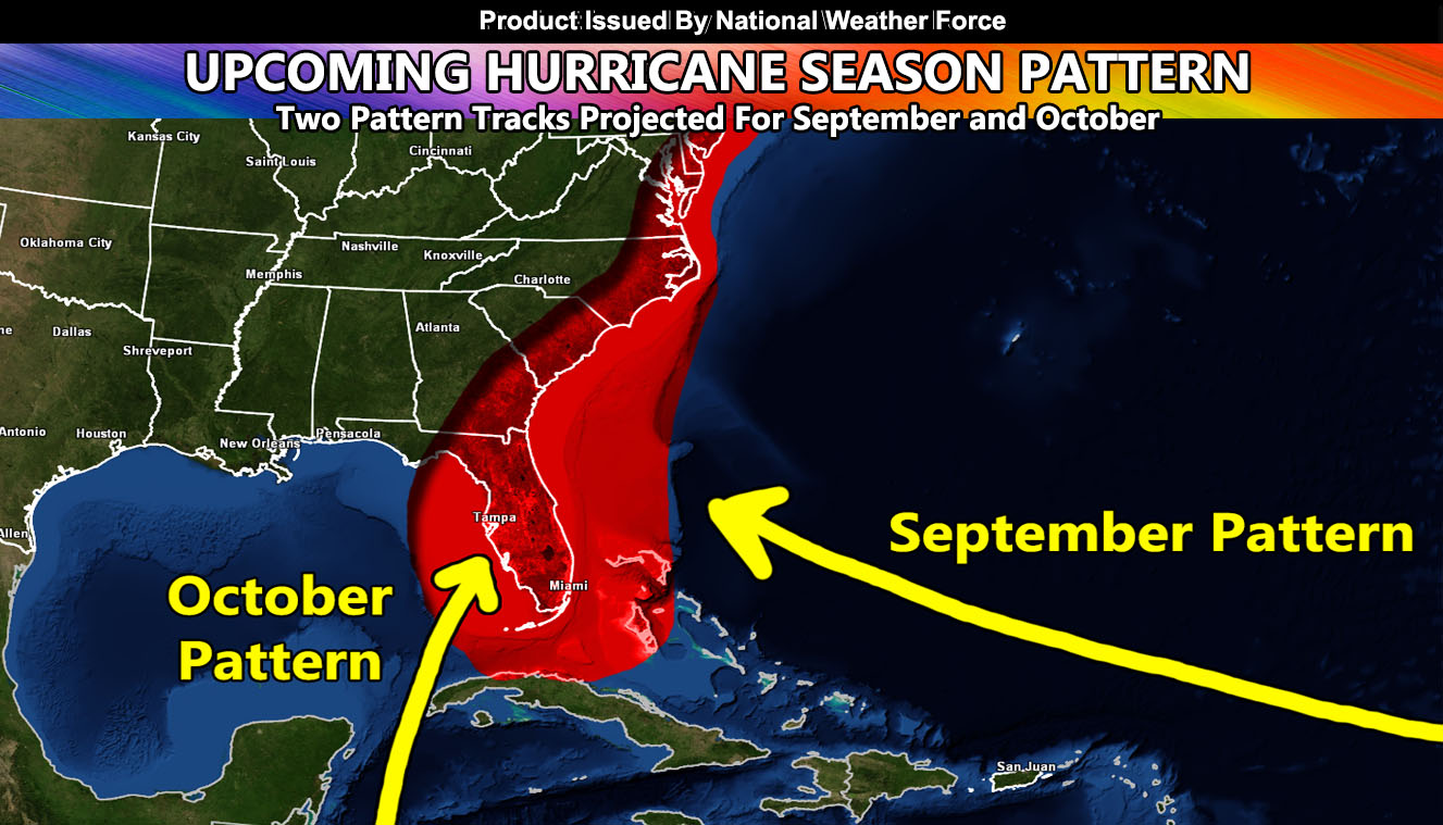
On August 30th I released a forecast for the September and October hurricane patterns. The September pattern was them coming out of the Atlantic and threatening the region. This is a direct update to that forecast for the Gulf States and up the Eastern United States zones so read on for details.
The article released on August 30th stated that we would need to continue to watch by at least mid-month (September) on the pattern for more hurricanes in the Atlantic (Click here for that article). The pattern right now has Paulette and Rene out there, which a deep trough will allow them to curve away. However, as the deep trough lifts, disturbances under it can develop and make their way under the base of these troughs and shove more west of these two systems. This should happen with the next trough lifting out around the 21st of this month. The next named system will be Sally, which will be the one to watch.
Sally could threaten Florida or go into the Eastern United States. It is a bit far at the moment, however the pattern supports another United States threat and will need to be watched over the coming week. As we near October and move into that month, the threat shifts with storms forming near the Southern Gulf of being dragged north/northeast into the states from there.
Stay tuned to official forecasts here at National Weather Force
NOTE: This is the SCWF Website but it is being used for national updates until ad placement is ready on the NWF site.
Your Facebook Page to join for this update is linked here – https://www.facebook.com/nwfweather/