Thunderstorms were scattered across the southland today in what is called ‘popcorn’ storm activity. Basically storms pop-up anywhere and at any time. Gorman (Grapevine) was affected as well, however, Friday looks to be the most active day for select areas so read on for details …
Join Southern California Weather Force main Facebook Page by clicking here for future updates if you like what you are reading or seeing below!
One thing I will say about Southern California Weather Force forecasts is they are micro-climate involved. This means that if I say thunderstorms inland, I MEAN THUNDERSTORMS INLAND. I do not want to hear “my area didn’t get a thunderstorm” and you live on the coast. I take my precision very seriously and if you cannot read the simple fine print then that is not my fault.
Moving on … Gorman was affected today with a closure and CHP escorts under heavy snow and that convergence zone ignited the SCV Thunderstorms as well. This was all projected in the morning outlook so any readers who were using the pass today had a good 5-6 hour lead-time. Click here for that article.
As for tonight. The upper level low will place itself in such a way that an onshore flow will produce shower and storm activity again for the San Diego County areas, all the way north to some Southern half of the Orange County and Inland Empire zones. This is when San Diego proper will see something more from this event. I’m projecting that to start sometime around 9 pm and go for a good 6 hours before waning down over the early morning hours.
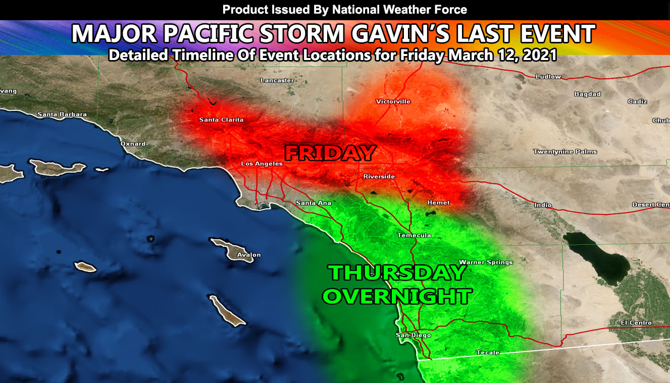
Friday is going to be interesting. As I stated above, my forecasts are highly detailed. What will happen on Friday is the upper level low will be over Las Vegas, or near the NV/AZ/CA border. The counter-clockwise flow around it will bring a north-to-south flow over Southern California. This will also work with upper dynamics on the west end of it on Friday afternoon and evening. Convergence from a low-level onshore flow vs the northerly flow will create a convergence zone from the SCV eastward through the San Gabriel Valley, further east through Ontario, Fontana, Redlands, and Big Bear Lake. This convergence zone will also work with a zone in the High Desert near Barstow. The activity will move north to south and then into the adjacent Los Angeles and Inland Empire zones with time. There are indications this could be a strong thunderstorm event. Wind dynamics do not warrant gusty winds with it so a severe thunderstorm watch would not fit. It could easily have numerous lightning strikes, a lot of hail, and torrential downpours in those zones, including the metro High Desert areas surrounding the VIctor and Lucerne Valley areas.
In other words, the dynamics I am talking about are within the RED SHADE in the article image above.
San Diego will be clear of anything until Friday night where a brief onshore flow will bring a couple of cells ashore to the county.
There is a weak system for Kern, SLO, SBA County on Monday, and some inland empire foothill zones… but it is not strong enough to warrant anything at this time, nor a name. The snow level will be around 5,500 FT for the Kern County areas.
Southern California Weather Force will be closed from March 12th to March 15th. You also can take that time to appreciate the service when you need it and see what it is like without it for a system.
DENVER SNOW – Click here to read that one on my National Weather page.
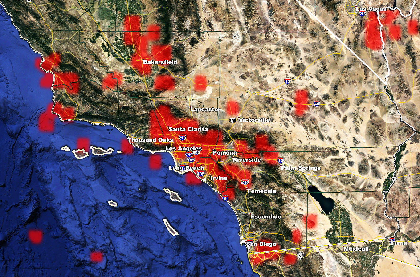
Lightning Strike Map as of 4 pm March 11, 2021 –