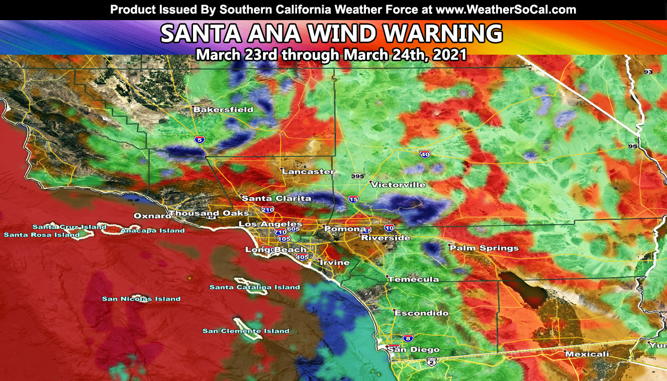
The forecast made for a Santa Ana Wind Pattern a week ago centering March 24th has been finalized and this event starts later on today and goes into Wednesday. Some areas will see some rain and snow as well as thunderstorms so read on for details and see the complete model suite …
A weak system that is giving a glancing blow to the forecast area will bring a strong Santa Ana Wind Event that will affect travel on the bottom of the Cajon Pass, which was forewarned a week ago (click here to see that article). It has been windy in the mountain and desert regions for the last day or so out ahead of the system, but those onshore winds will switch offshore over the day today, especially between the hours of 9pm tonight and noon tomorrow (Wednesday) – There are indications that some onshore flow today will work with a due north to south flow for precipitation in some areas – those are highlighted in the images below.
Given we do have some instability to work with since it is March, very similar to last Sunday we have a chance of thunderstorms surrounding the Riverside Mountain zones, east into some low desert zones along I-10 and I-8 to Imperial and CO River Valley. Some of these could also hit parts of the San Diego Mountain Range.
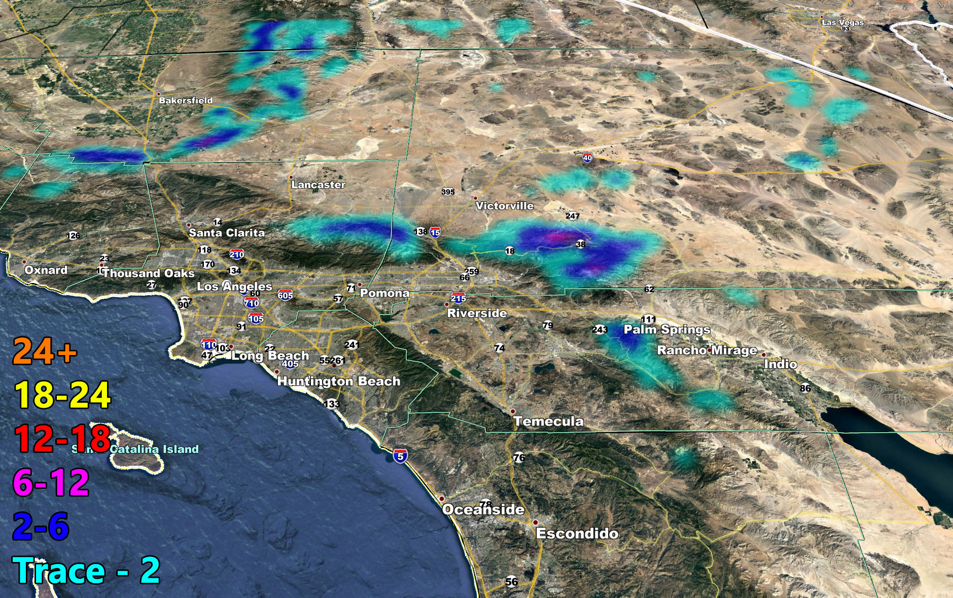
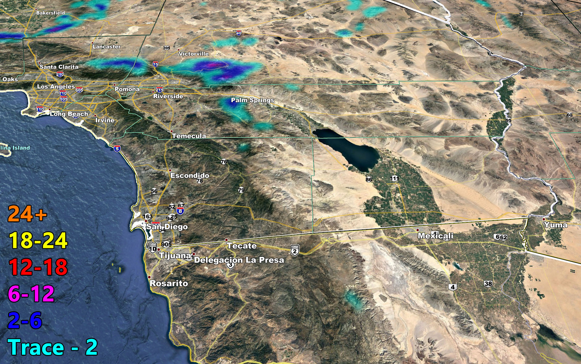
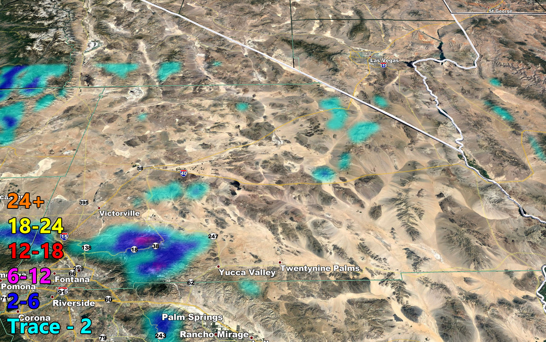
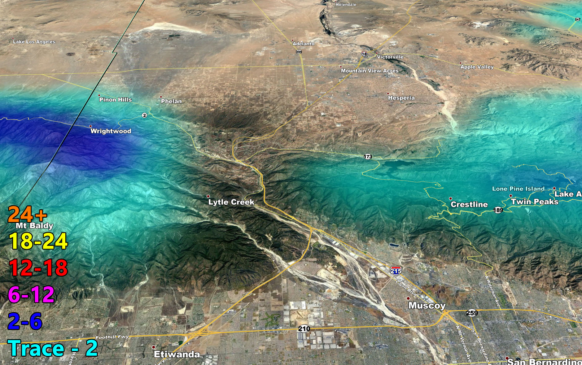
Use the images below for the rest of the forecast as there are too many micro-climate events happening today from snow in Big Bear to other areas seeing rain, gusty winds, and even thunderstorm activity.
Long Range indicates that we are not done with systems into Southern California and that we should hang onto a later ending season even through May.
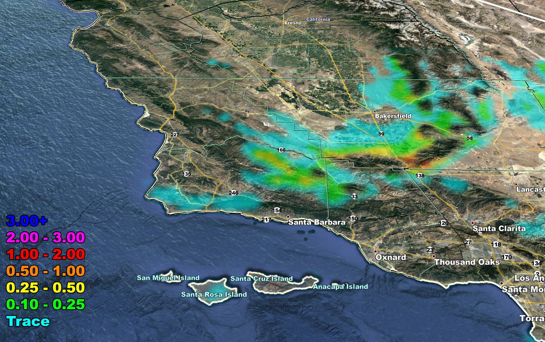
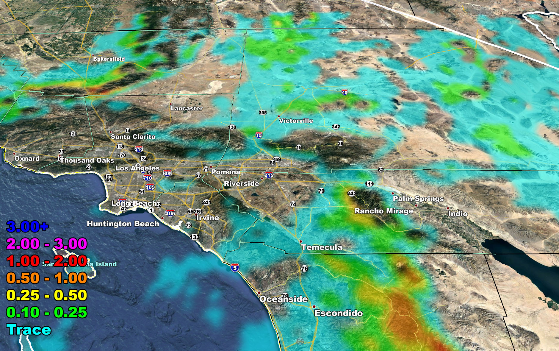
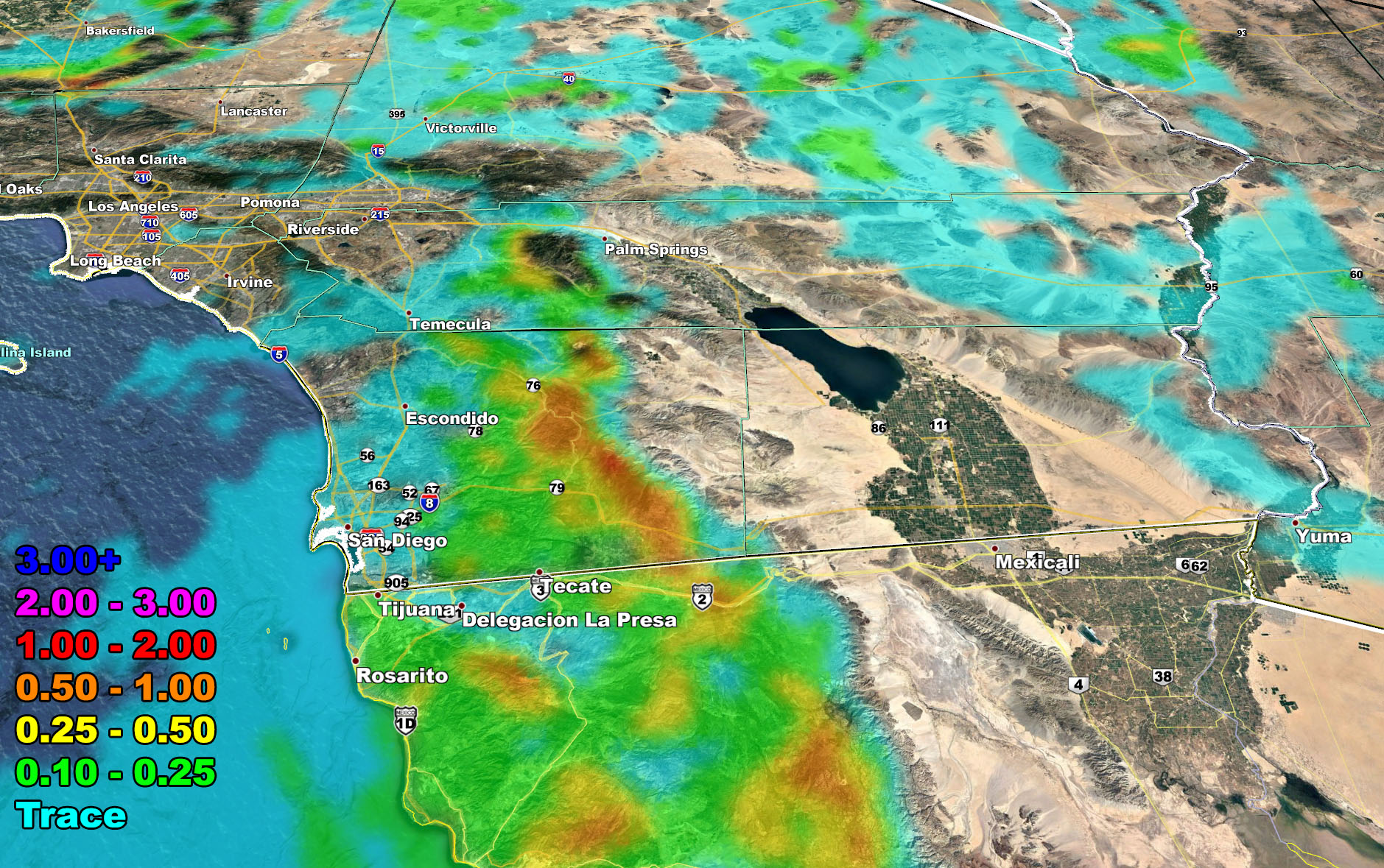
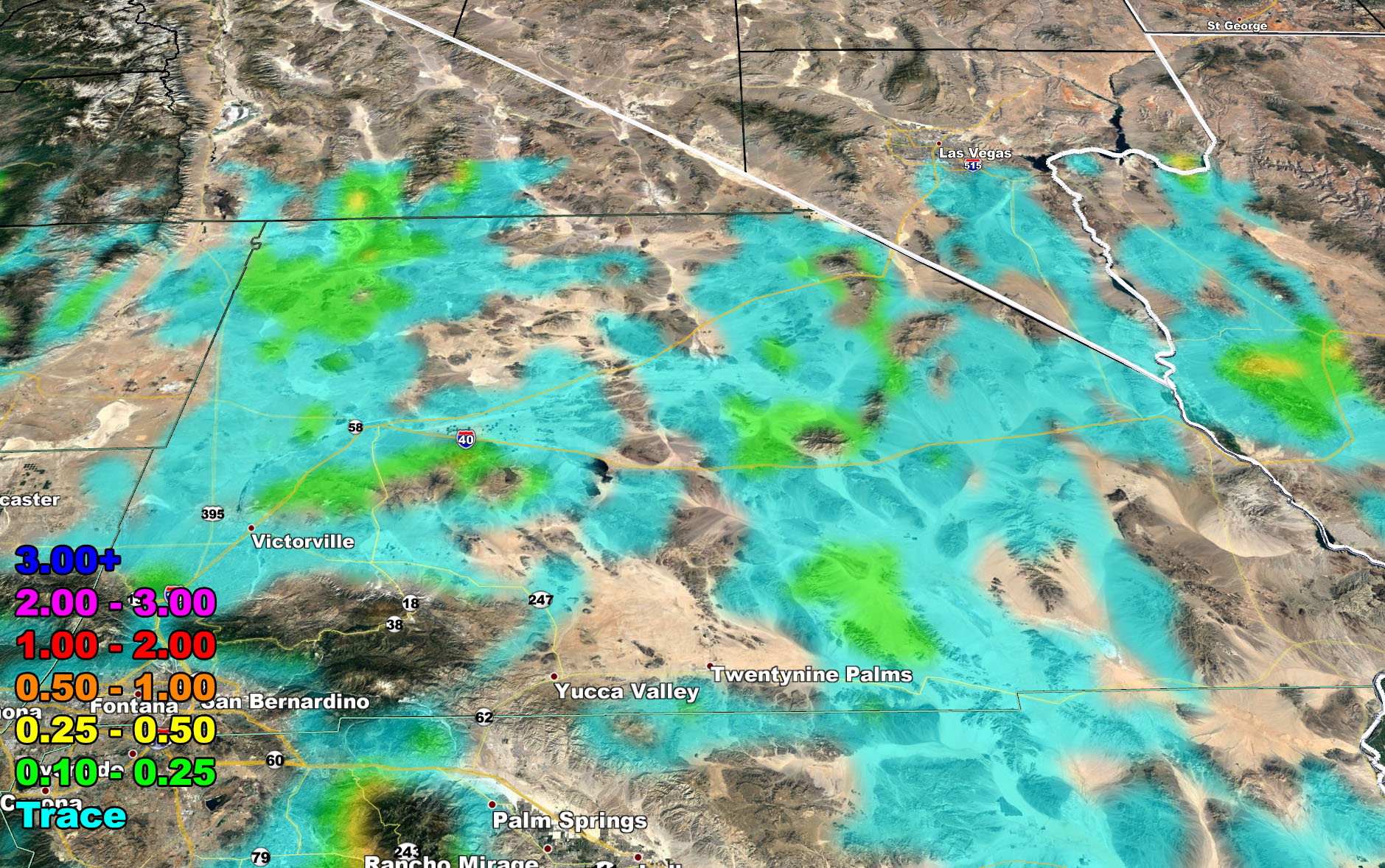
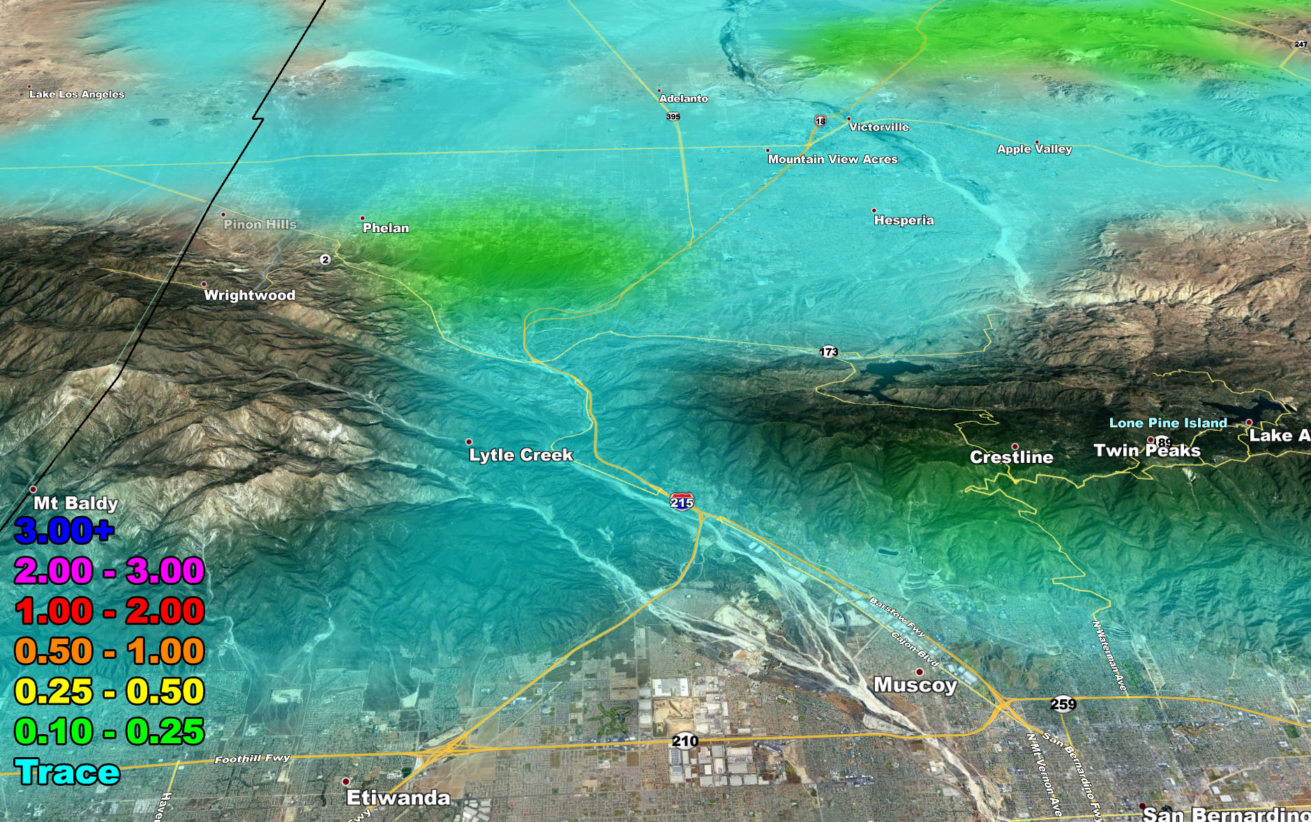
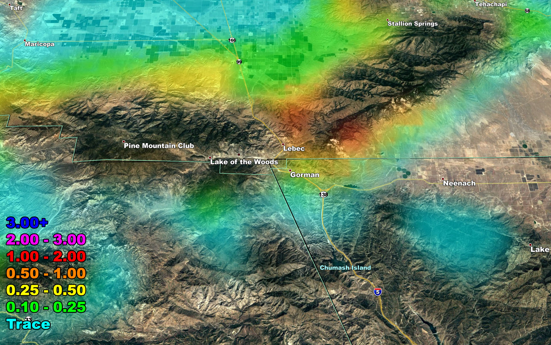
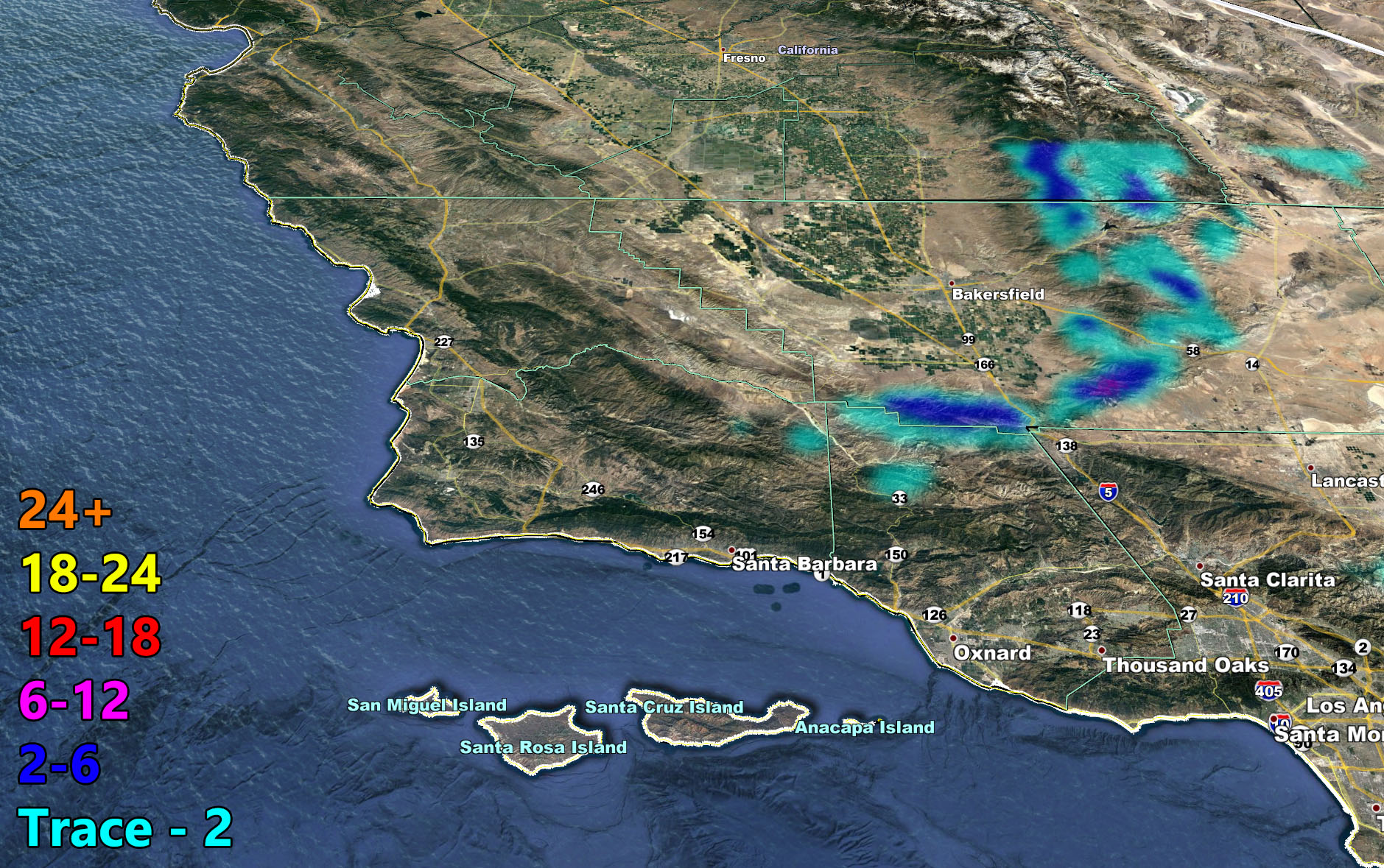
The SCWF model image suite below is so you can see your zone region covered. Keep in mind that these are the most comprehensive images around. They are touchy to the micro-climate and in the rain and flood risk model, you will only see the expected risk or amount. Those models actually cancel out the snow so before you saw flood risks covering the mountains. The new models remove that and make it easier to know what to expect.
The SCWF Member Section maps remain active for free through this system. You can click here to see them. Zoomable maps for rain, snow, and wind are available.
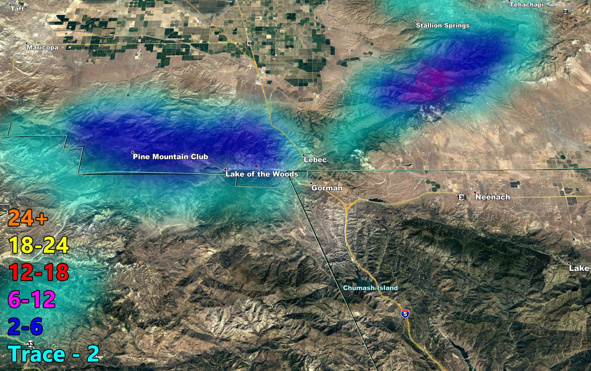
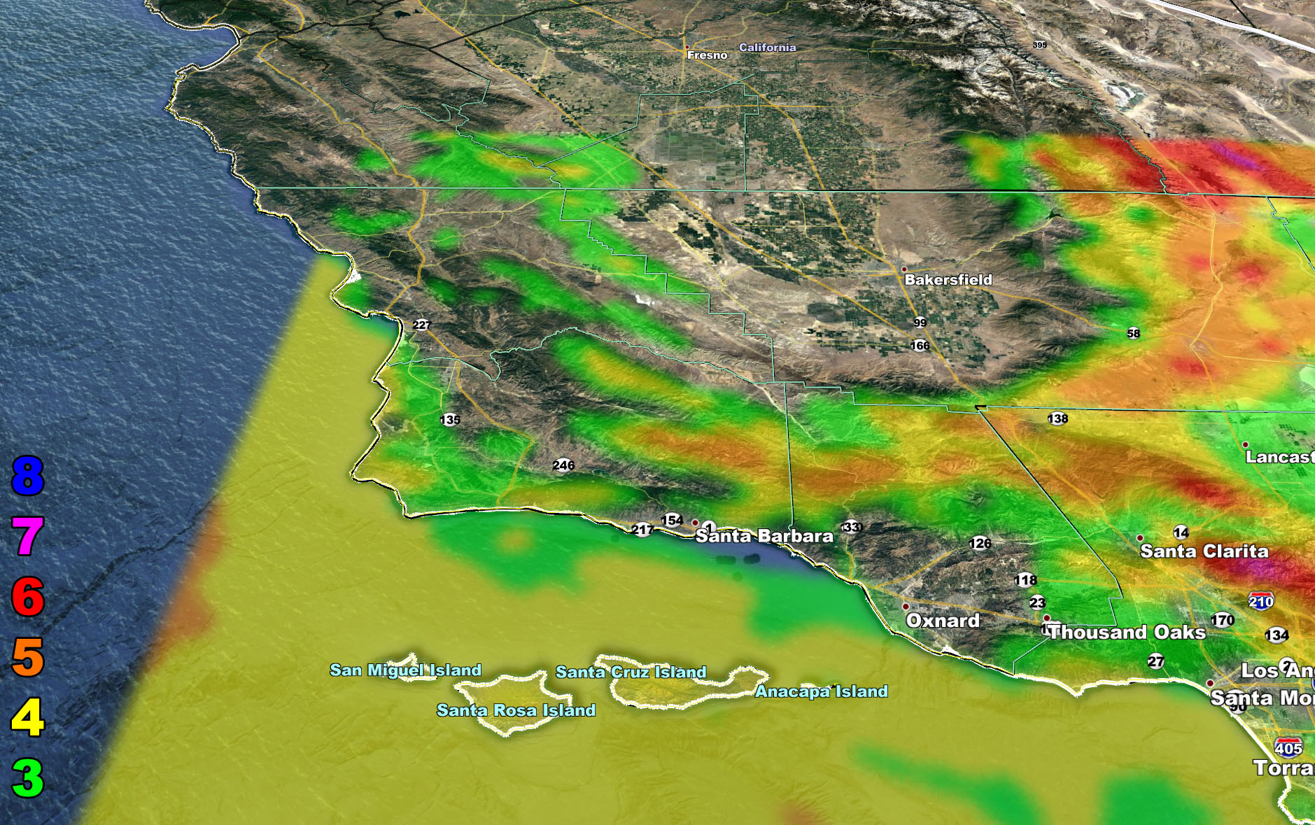
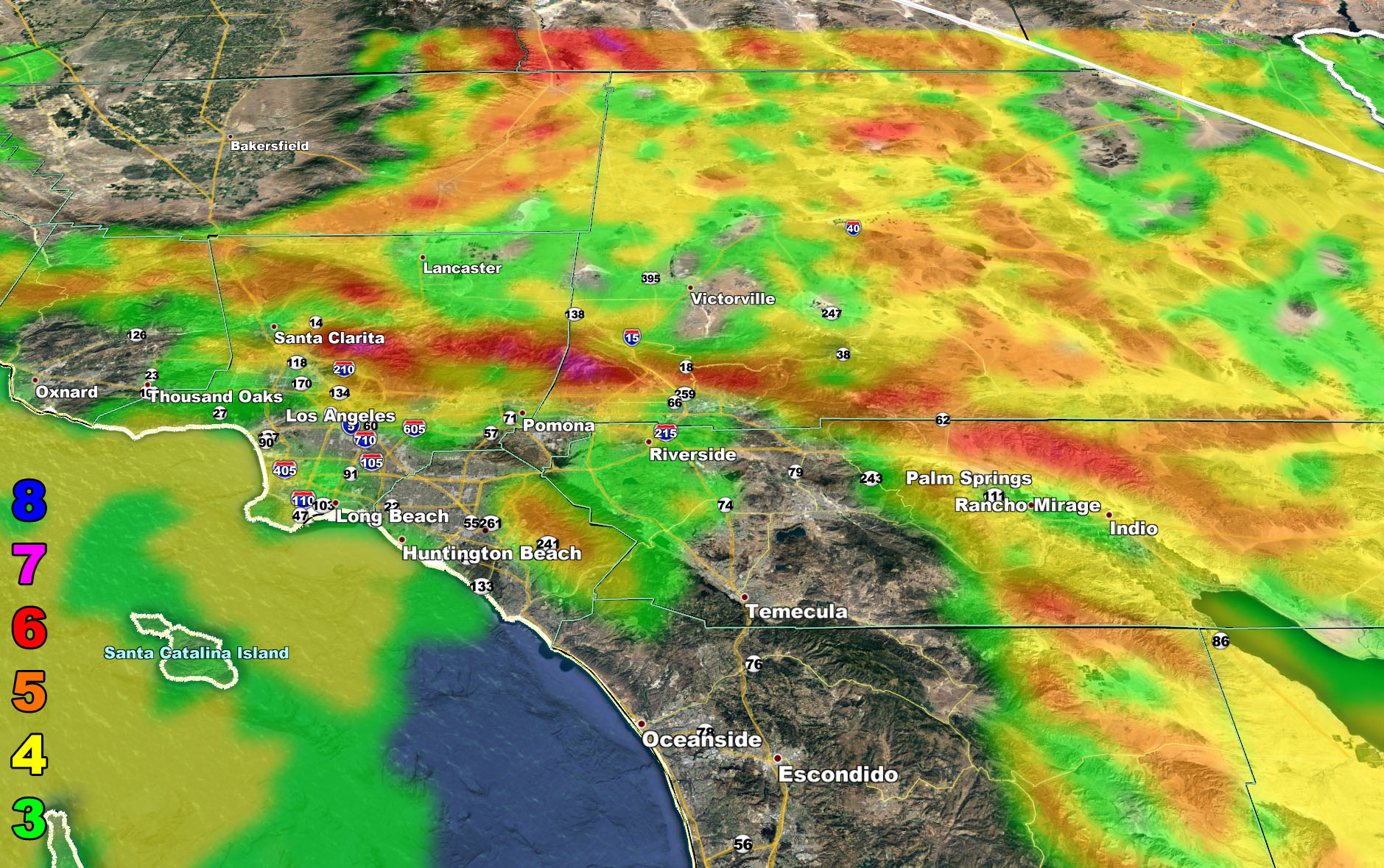
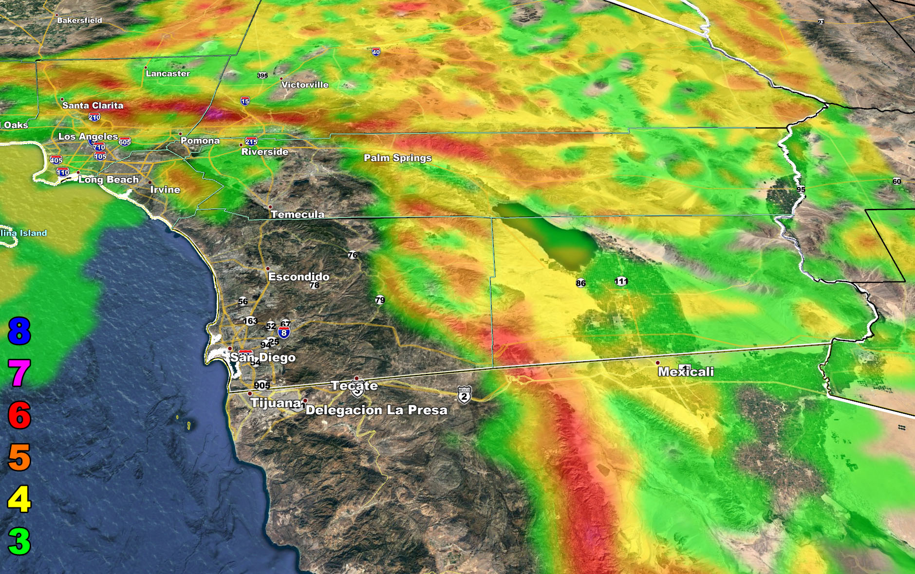
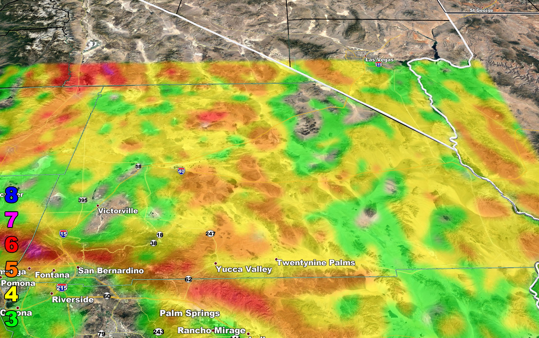
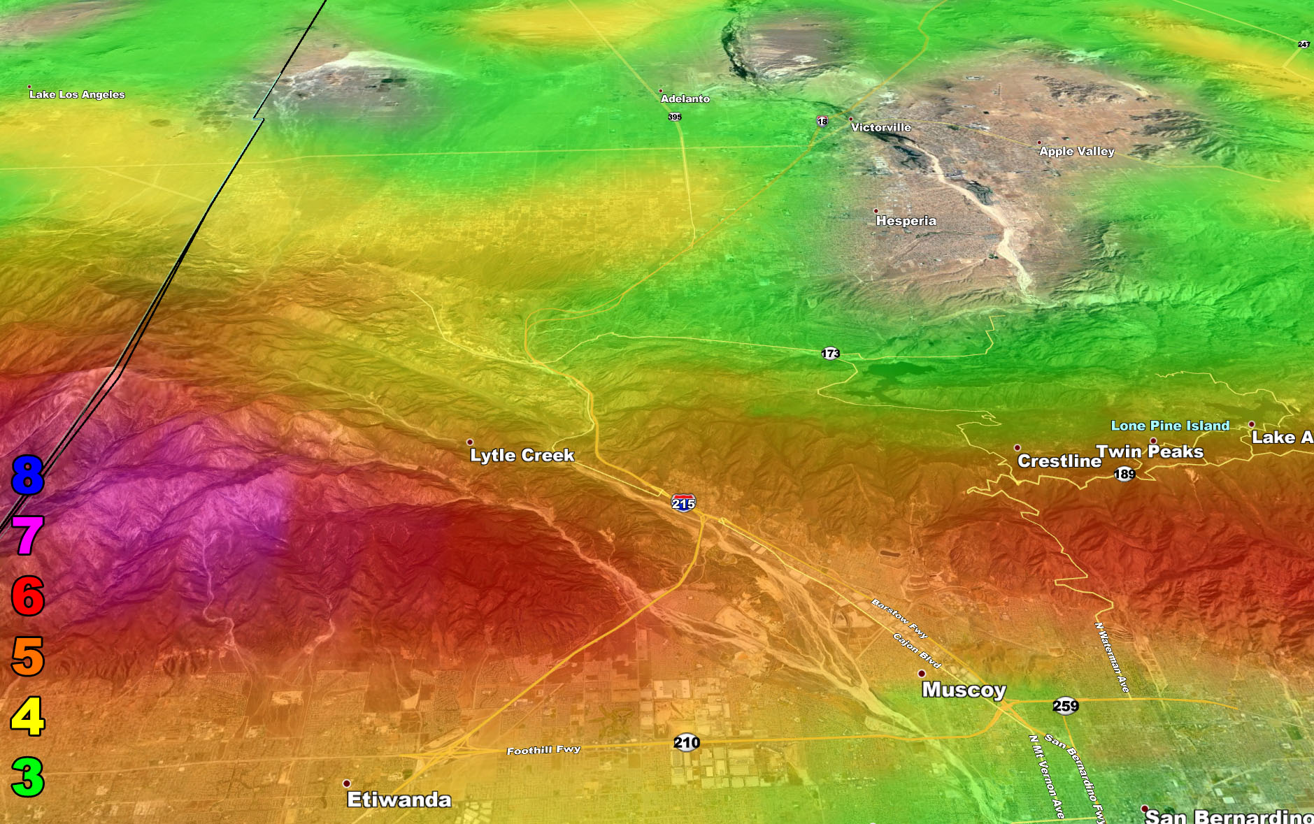
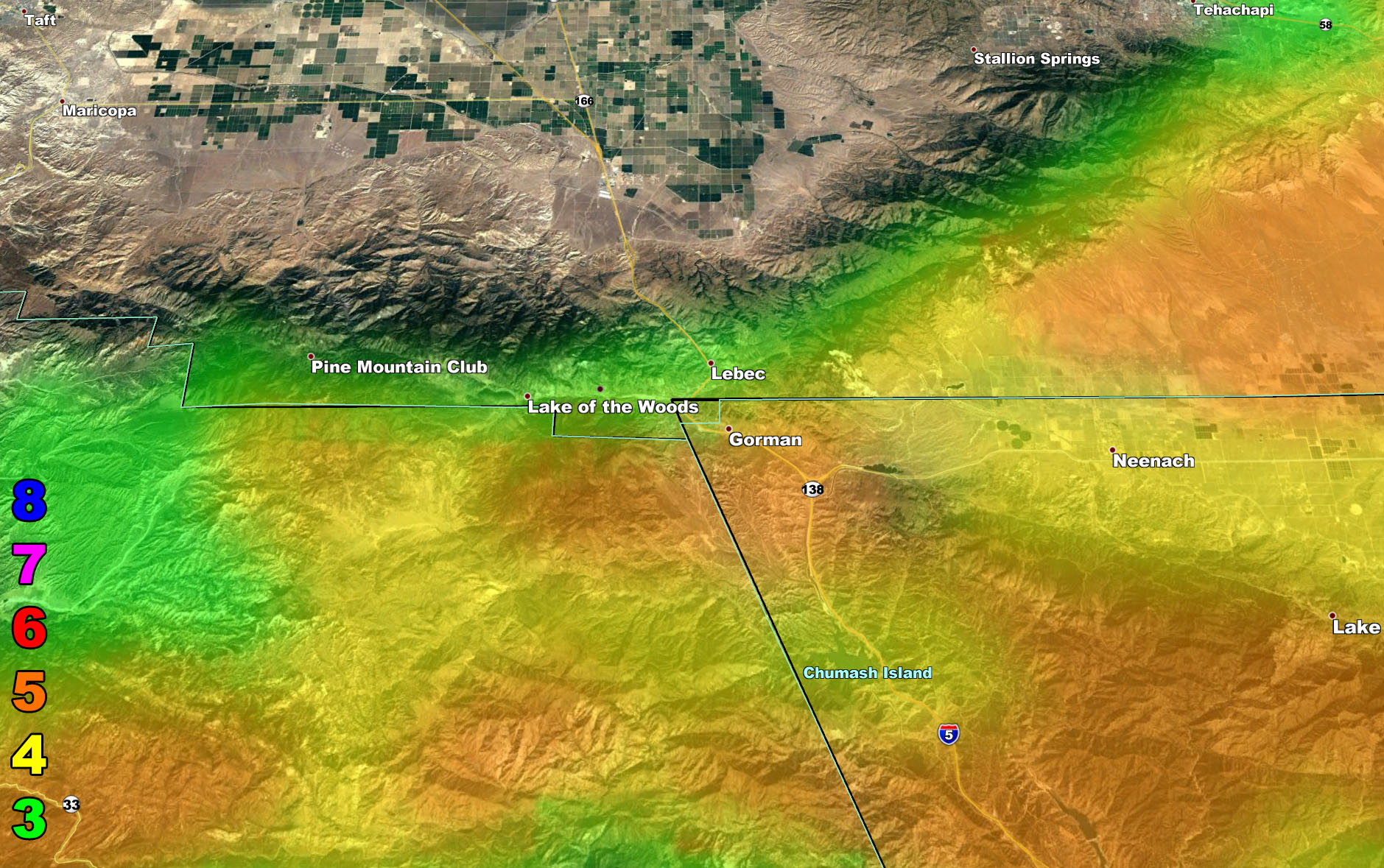
I control 10 counties in Southern California so there is a lot to say for various areas. The best I can do is let the images below speak for themselves. They are separated into five rows of six. Four zones that I control. If you are in Southern California, you are in one of these. Each is identical so zone 1 is the same on all the rows and so on. Image 5 is Cajon Pass, and Image 6 is Kern Mountains including Gorman for you travelers. Here is the key to the rows below. They are extremely detailed.
Row 1 – Rain Risk
Row 2 – Snow Risk
Row 3 – Wind Risk
NOTE: To control the maps, one must be a SCWF Facebook website member, which is like getting me a soda each month from you. You also get e-mailed alerts/articles because if you do not want to miss my social media posts, and/or I issue a product not on my social media accounts, being a supporting website member is the way to go. Click here if you are interested in reading more.
Row 1 – Rain Risk
Row 2 – Snow Risk
Row 3 – Wind Risk
Martin Wind Gust Intensity Scale –
8. Extensive widespread damage.
7. Trees are broken or uprooted, building damage is considerable. – High Profile Vehicle Roll-Over CERTAIN.
6. SOME Trees are broken or uprooted, building damage is possible. – High Profile Vehicle Roll-Over Likely, Do NOT recommend Traveling in this zone
5. Slight damage occurs to buildings, shingles are blown off of roofs. HIGH WIND WARNING CRITERIA – High Profile Vehicle Roll-Over Possible if weight is not corrected.
4. Twigs and small branches are broken from trees, walking is difficult.
3. Large trees sway, becoming difficult to walk. POWER SHUTDOWN THRESHOLD WIND ADVISORY CRITERIA
SCWF is on MeWe – https://mewe.com/p/southerncaliforniaweatherforce
MICRO-CLIMATE ALERTS DELIVERED BY EMAIL, FULL MEMBER SECTION WITH INTERACTION DURING EVENTS, ZOOM IN MODELS TO YOUR HOUSE/BUSINESS YOU CONTROL, AND MORE …
CLICK TO JOIN THIS WEBSITE AS A PREMIUM MEMBER
FACEBOOK PAGES TO JOIN!
SOUTHERN CALIFORNIA WEATHER FORCE MAIN: Southern California Weather Force Office Main Page
SOUTHERN CALIFORNIA WEATHER FORCE METEOROLOGIST: – Just my public figure page that isn’t as large so maybe you can reach me better at times.
INSTAGRAM, TWITTER, and NOW MEWE ACCOUNTS TO JOIN!
Instagram – https://www.instagram.com/socalweatherforce/
Twitter – https://twitter.com/SCweatherforce