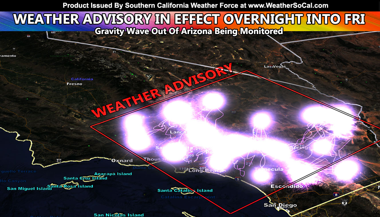
Southern California Weather Force has issued a weather advisory ahead of a gravity wave coming out of strong thunderstorms in Northern Arizona, which will reach our area around midnight and last through sunrise. This is a very tough forecast so I’ll try to get into the details so read on …
I’ve been waiting since yesterday to trigger this advisory. I’ve been wondering if I should go full thunderstorm watch or weather advisory. Such a call is extremely rare because of banking on a gravity wave that as of 3 pm is 300 miles east of Los Angeles near the Flagstaff, AZ area and moving westward towards Southern California. What I am going to go with is the arrival of this gravity wave plus the mid-level moisture present will act as an ocean wave and disturb the atmosphere between 14,000 and 30,000 Feet.
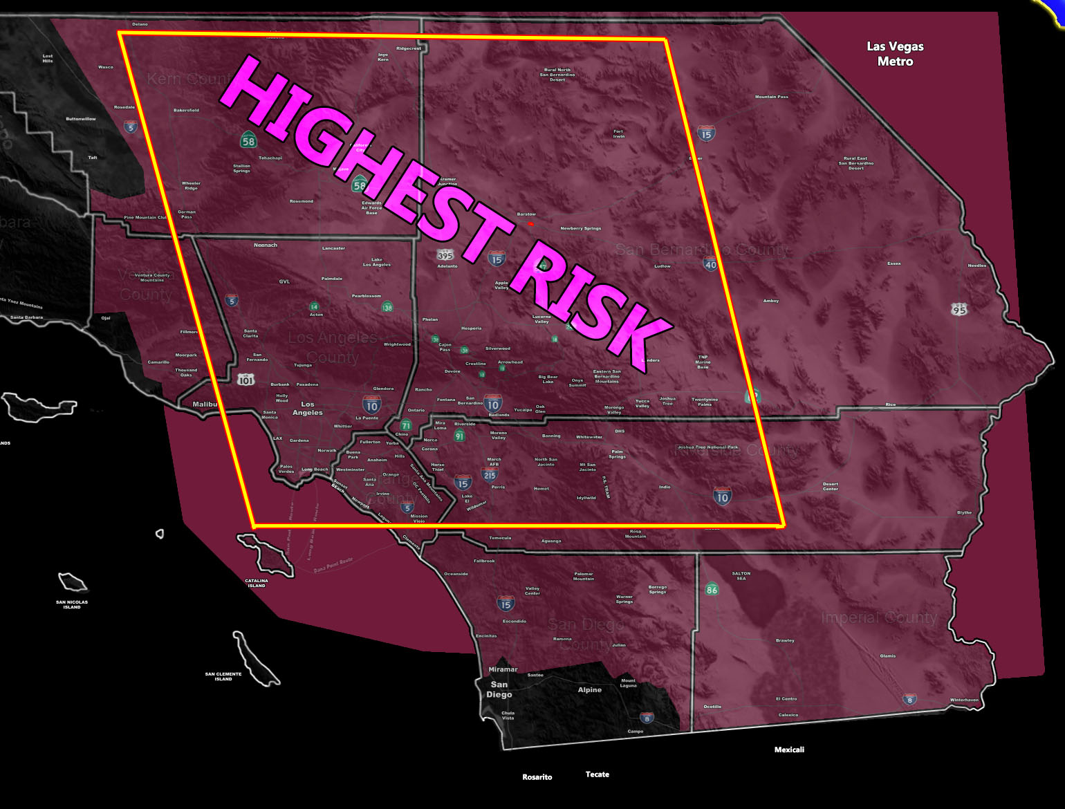
A freezing level at 16,000 feet would leave 14,000 feet of frozen particles, enough for lightning to be possible. Going to go with this moving in somewhere near midnight, noticeable on radar east into the deserts east of Banning. It will, with each passing hour, look to come in like a wave, unzipping scattered showers OR thunderstorms in the area. IF mid-level instability is enough, which it looks like it is a close call, we will see this happen within the advisory box I have issued in the image below this write-up.
So if all goes correctly, skies being super clear at 8-9 pm will rapidly become cloudy near midnight and we will see pop-up showers OR thunderstorms within the advisory zone, which is a large one. Higher moisture and upper divergence profiles do exist from Los Angeles/Ontario north through the LA/Kern Desert/Mountain/and Valley areas, including Bakersfield, which is within this advisory.
I did extend the advisory into parts of San Diego County and Imperial as well just in case, however, you are in the weaker section of retreating mid-level moisture northward. I had to add those areas just in case the timing was off by 2-3 hours – The focus is the Central and Northern boxed zones.
Keep in mind the bases (bottom) of these storms will be 14,000 FT up. That means that you can see lightning from them even over 50 miles away, sometimes 100 miles… If any of the cells have lightning and it is night, you will be able to see it from a very far distance… it does not have to pass over you. They will contain some rain, but this is not a flooding event … it actually can start fires …
Oh, and a side note, Palm Springs Airport reached 122F at 3 pm today. We also will be losing the monsoon moisture for a bit as dry southwest flow takes over through the weekend, taking the moisture with it to the east. Cooler temperatures are in store next week as a result.
NOTE: Go to the new SCWF FB Group and you can post photos and videos under admin approval on current events. You can view other’s posts as well and interact… just follow the simple 8 rules set and you’ll have a great time with everyone.
Click here to join the group
ADVISORY DEFINITION: A weather advisory is issued when conditions are favorable for convective showers OR thunderstorms, either or. It is one step below a full thunderstorm watch. It is often issued when dynamics borderline, yes or no for thunderstorms to form, so I throw it in there. You may or may not see an event if you are within the advisory area, but as with all alerts like a tornado watch, it happens in scattered form, hit, and miss. SCWF does not forecast for backyards, but it does forecast for regional zones.
GRAVITY WAVE: A gravity wave is when a strong thunderstorm punches through the stratosphere quickly, resulting in waves of pressure propagating outward from it. Think of it like a rock in a pond, but backward.
Here is the main map showing what city zones are within this advisory ( IMAGE IS CLICKABLE TO ZOOM )
THE OFFER EXPIRES FOR GOOD JUNE 22ND! – GET EMAIL ALERTS AND ENTER THE MEMBER SECTION ON THE SITE: Both Southern California Weather Force and Arizona Weather Force have a cheap Summer 2021 discount to supercharge this service you already get on social media for free. If you do not want to miss any articles this season because social media does not show you for hours or even days (common) and want to get custom email alerts such as thunderstorm, severe thunderstorm, flood, heat, or tornado alerts along with a controllable member section model for each during the events in YOUR area, sign-up for the premium member package, which is only $10 for the Summer. Read below for details on how to join this offer.
REMEMBER… your continued want for this service is what keeps the server running and paid for. A big bill is coming in the Fall and if I can get enough signed up this Summer, I can extend everyone’s Summer 2021 package through September. Thanks for your help!
SOUTHERN CALIFORNIA WEATHER FORCE – Click here to Join Southern California Weather Force‘s package
Southern California Weather Force Facebook Page is here
SCWF is on MeWe – https://mewe.com/p/southerncaliforniaweatherforce
FACEBOOK PAGES TO JOIN!
SOUTHERN CALIFORNIA WEATHER FORCE MAIN: Southern California Weather Force Office Main Page
SOUTHERN CALIFORNIA WEATHER FORCE METEOROLOGIST: – Just my public figure page that isn’t as large so maybe you can reach me better at times.
NATIONAL WEATHER FORCE – Join my NATIONAL page for higher-end events like flood, tornado, hurricanes, and more –
INSTAGRAM, TWITTER, and NOW MEWE ACCOUNTS TO JOIN!
Instagram – https://www.instagram.com/socalweatherforce/
Twitter – https://twitter.com/SCweatherforce