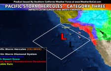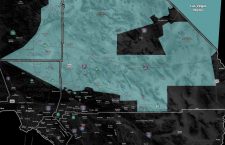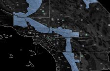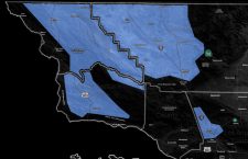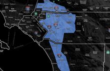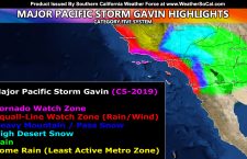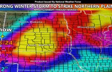
Snow and Ice Forecast For The Northern Plains From Now Through The Weekend
An ice storm is expected to develop tonight and go through Saturday for parts of the Northern Plains. The maps below will tell you what you will see with this event. The snow will start on Saturday night and go into Sunday… ending later on Monday. The maps below are for snow and ice and are for five states affected, […]
Read more ›