
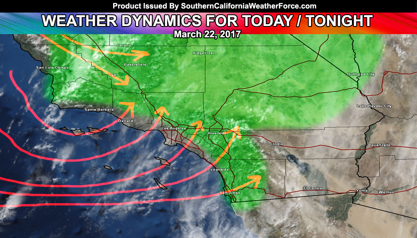
Kind of a mixed bag today where some will see heavy activity and others seeing nothing. What we have today is a onshore flow induced convective event meaning that areas near the foothills and in the mountains would have the best chance at activity, where most of the LA/OC/VT/SBA coast will not be favored.
This type of pattern also favors the High Desert areas, where I do believe the combo of upper dynamics and convergence with the low level flow will bring activity out there. The SCWF Wind Advisory does start for the deserts overnight tonight after the front has moved east, bringing in stronger west to east gradients.
Such a pattern would have a snow-level to 6k today and tonight so any activity moving across would drop a bit of snowfall to the resorts, but not much … and highly varied from location to location on the mountain.
The most concentrated spots today will be Kern County Valley/Mountain zones … the southern and western foothills and adjacent cities of the VT/LA/IE areas … and of course the entire San Diego Coast/Valley/Mountain areas as the San Diego Mountains to your east will be your lifting provider all the way to the coast through tonight …
Thunderstorms are possible today …
That’s about all I have for you … just a mixed bag day where some of you could be getting heavier activity while others will not …
Location … location … location …
As for the weekend … scattered light showers on Saturday, with dry weather on Sunday.
Still monitoring the pattern through the rest of the month as these systems have now become cutoff lows in the medium range so the forecast will flip-flop