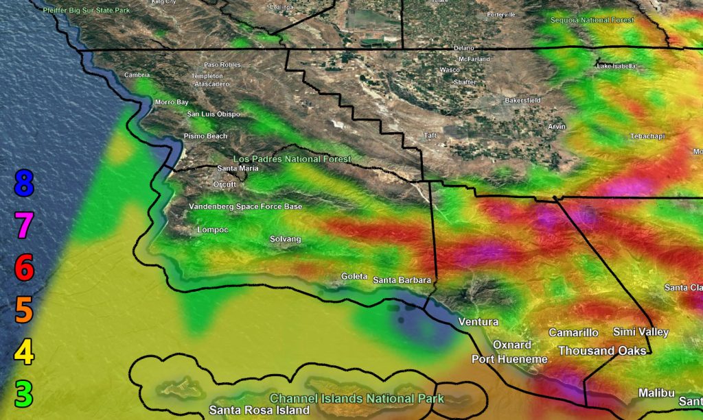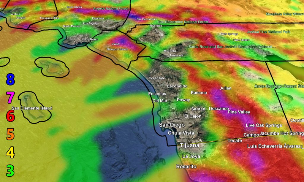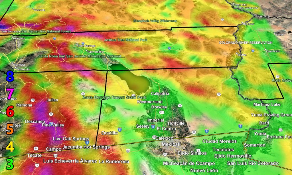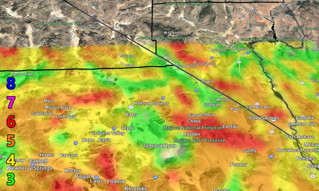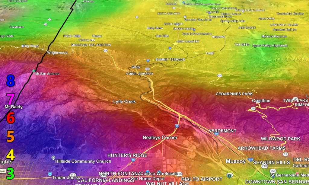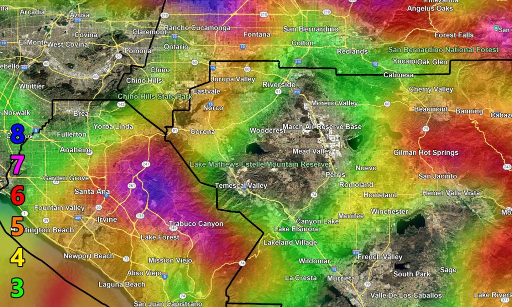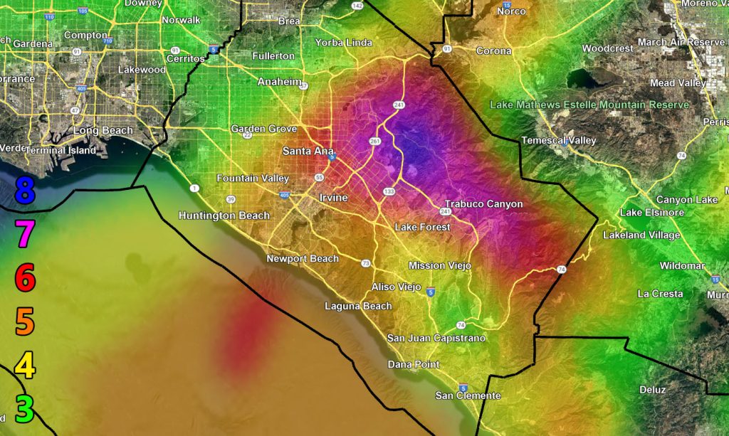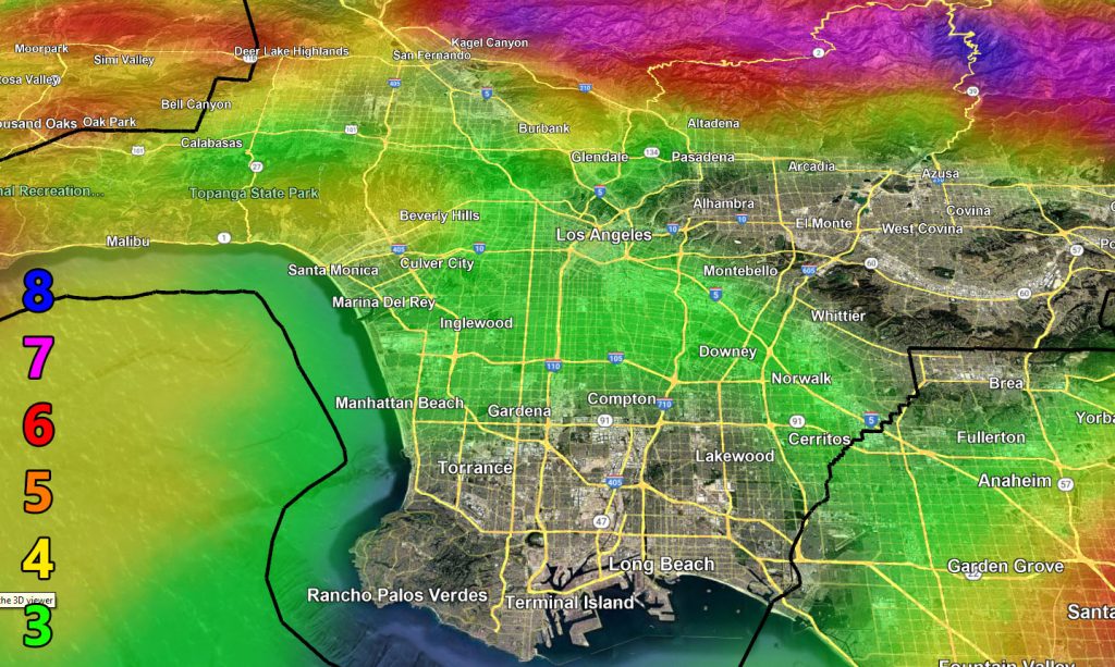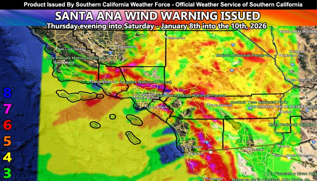
Southern California Weather Force has issued a Santa Ana Wind Warning effective now for this evening, and into Saturday.
Discussion: As this storm today passes to our north, drier air will be in place over the warning period. This will generate offshore gradients for strong Santa Ana Winds. Due to the saturation of the ground, the higher levels like 4 or 5 on the maps will have a chance of trees and powerlines coming down due to weakened roots.
LONG RANGE: It is possible we will enter a period of more stronger Santa Ana Wind Events in-between long period storm patterns, so expect more in the longer term.
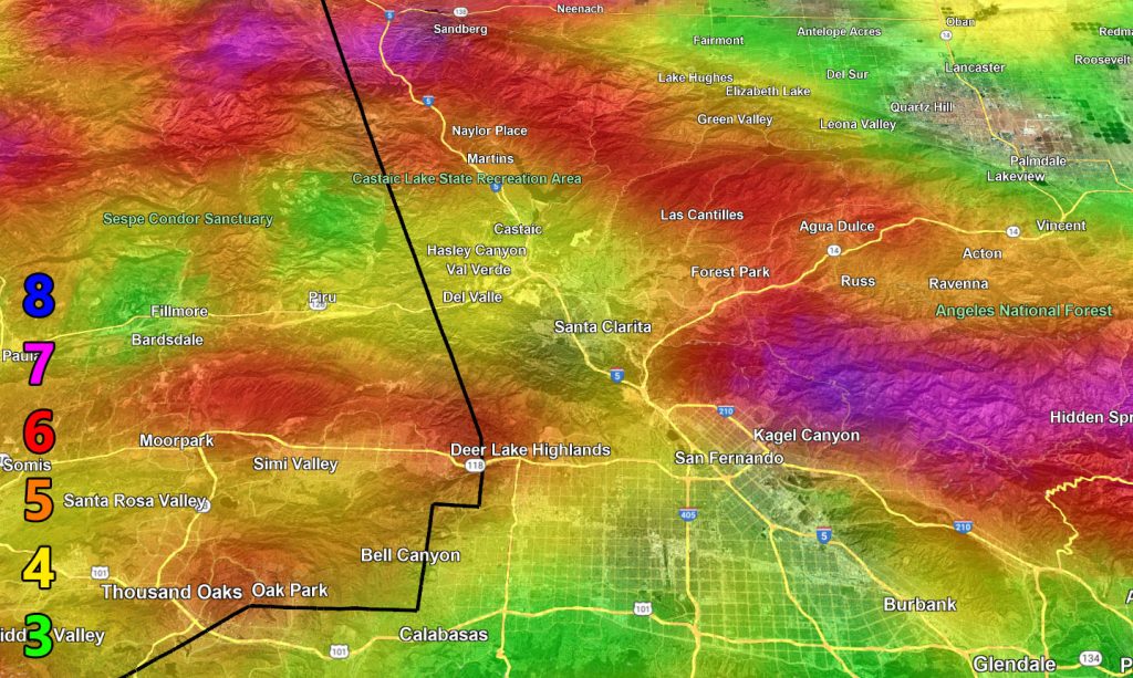
Use the zoom-in maps below for the alert period.
Raiden Storm Wind Gust Intensity Scale –
8. Extensive widespread damage.
7. Trees are broken or uprooted, building damage is considerable. – High Profile Vehicle Roll-Over CERTAIN.
6. SOME Trees are broken or uprooted, building damage is possible. – High Profile Vehicle Roll-Over Likely, Do NOT recommend Traveling in this zone. This zone also is the starting zone where trees and powerlines will fall and damage cars and even kill people near or in them!
5. Slight damage occurs to buildings; shingles are blown off of roofs. HIGH WIND WARNING CRITERIA – High Profile Vehicle Roll-Over Possible if weight is not corrected.
4. Twigs and small branches are broken from trees, walking is difficult.
3. Large trees sway, becoming difficult to walk. POWER SHUTDOWN THRESHOLD DURING FIRE WEATHER / WIND ADVISORY CRITERIA