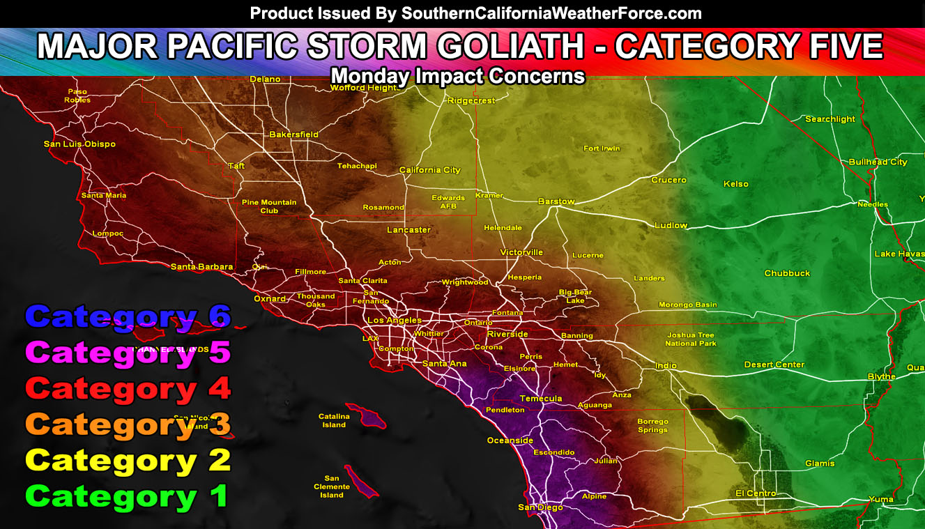
In what was initially named Gary will now take the original name from the start of the season, Goliath. Goliath will live up to the name as the category five upgrade was given from a four. Goliath has the potential to be the best lightning producer this season has seen thus far … all in part due to the time of year it is. Severe thunderstorms will accompany the system from the mountains south and westward. Read on for details.
Major Pacific Storm Goliath is a category five system and it will hit on Monday. He’ll produce strong winds with the front on Monday morning, first very early before sunrise for areas west of Ventura and just after sunrise for areas in the LA/OC/IE/SD metro and surrounding areas. The system has the potential to have tops of over 30,000 feet and this means the icing layer will be so thick that the storm front will contain incredible charges to produce frequent lightning.
Major Pacific Storm Frances back in January was a category five, however all storms can be different. She had some tornado potential, extreme front, and 70+ mph wind gusts. She however lacked the thunderstorm potential. Major Pacific Storm Goliath will have a marginal tornado potential, damaging severe storm winds, heavy front, and of course frequent lightning. The category is the same however the thunderstorm dynamics trump anything Frances brought.
Snow levels will be around 5,000 feet with levels as low as 4,000 FT in some areas. Sticking snow could be hard to get at 4,000 FT, however if a thunderstorm moves overhead, realistically it could force colder air down and stick snow at that level.
A decision on a Severe Thunderstorm or Tornado Watch will be given overnight and members can read those fine details in the morning … or when it’s issued. The cold air-mass through Monday could bring cold-core thunderstorms in hit and miss fashion for the forecast area … regardless everywhere will be windy after the front just like what is out there in most areas today after the weaker front that did hit.
So yes, Major Pacific Storm Goliath is on track to become the most powerful lightning producing front this year has seen, with hail, isolated tornado risk, and damaging winds … stay tuned to Southern California Weather Force.com