 The June 2016 forecast (released here) went perfect, calling for multiple heatwave events and an above average month for temperatures and a lack of precipitation in the forecast area … but how will July 2016 be? Read on for details!
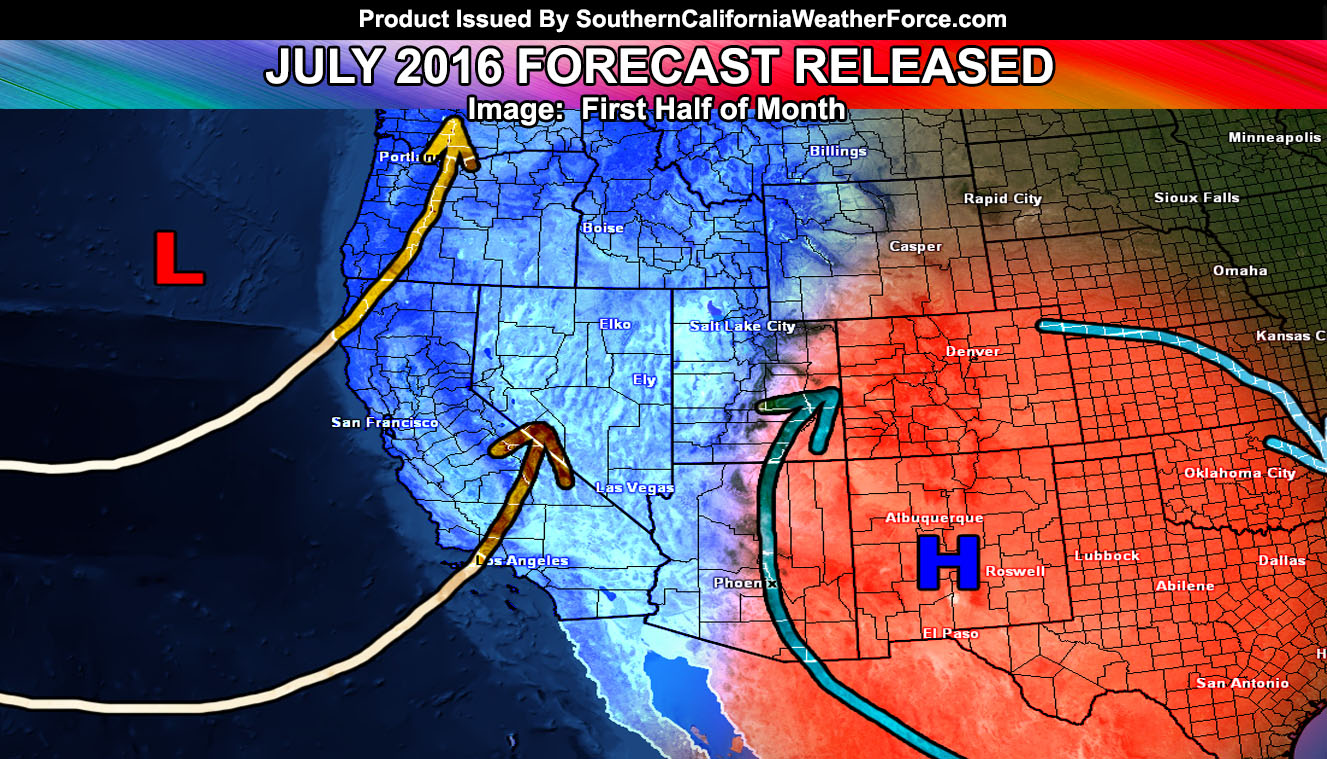
July 2016 is going to feature the ridge of high pressure backing further east and allowing for a trough to dominate the Western United States, which will bring in an onshore flow type pattern for the first 14 to 20 days of the month. This onshore flow type pattern means below average to average temperatures .. so at the moment I am not seeing a heatwave level event like we saw last month for that time period.
A trough breakdown will allow for the ridge to elongate a bit and the axis will reach Southern California sometime centering July 19th for an up in those temperatures and we could have heatwave level temperatures through the end of the month.
Because of the ridge placement … as previously expected for the heart of Summer … we will lack monsoonal moisture intrusions. Last year … Hurricane Dolores’ remnants hit the area on July 19th, causing thunderstorms and rainfall across the entire area in what was a rare event. That will not happen again as it will be very hot during that time-period.
So … July 2016 will be average in temperatures combined the cooler than average temperatures in the first half and hotter the last half … It’ll also be drier than average with limited monsoonal moisture intrusions .. although there could be a few.