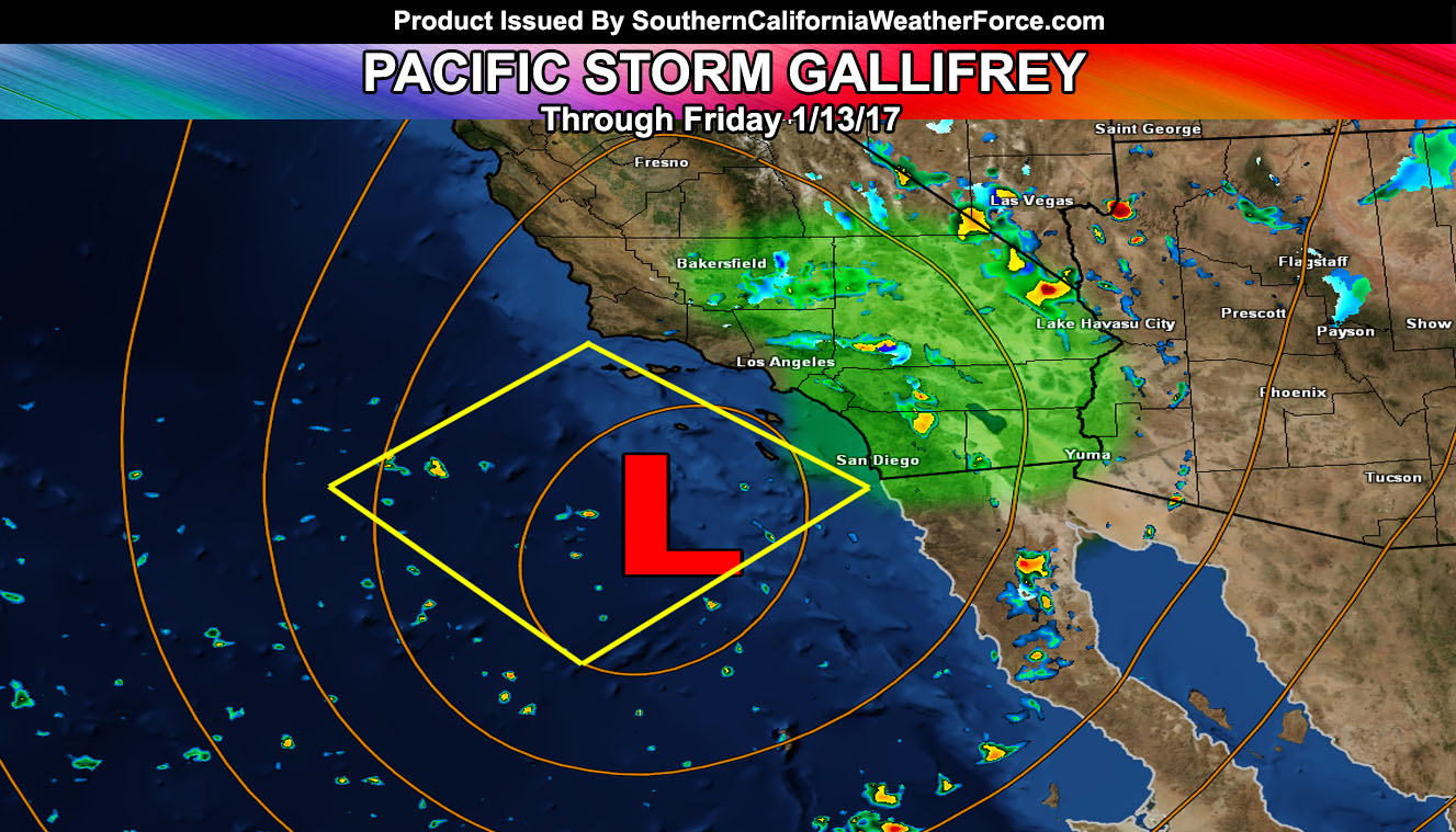
Pacific Storm Gallifrey is slowing moving into the forecast area and the first band of rain moving east will be replaced by yet another area of convection for areas east of Los Angeles overnight tonight and into Friday so read on for details …
Pacific Storm Gallifrey is a cutoff system and has brought flooding rains to the LA/OC/IE/San Diego forecast regions today. However … as the first band of rain moves off … another will move in overnight tonight as Gallifrey swings southwest of the forecast area and causing a fine line of dry conditions in LAX and heavy rain in Whittier south and eastward …Upper divergence profiles along with low level lifting and some instability in the region may make it also possible for some lightning strikes through tonight and early Friday morning.
Once again … flooding rains are expected to return after a brief break and there are indications that a prolonged even overnight will happen …San Diego seeing heavy rainfall as well .. perhaps holding onto it longer than other areas as the system slowly drifts south of the area even into Friday and Friday night …
Further detailing the system, the infrared satellite prediction model shows cooling cloud tops overnight tonight and into early Friday morning from some of Orange County, The Inland Empire, and the San Diego forecast regions … a reason we could very well see lightning strikes out there.
As Pacific Storm Gallifrey moves south of our forecast area … an easterly reversed flow will hit the region and wrap around moisture through the Kern Mountains will finally drop the snow-level to the Gorman pass on Friday as well as Tehachapi … and possibly even the top of the Cajon Pass.
The wrap-around moisture will also favor the Los Angeles and San Bernardino County Mountains on Friday through Friday night so again, Big Bear you are far from over and totals will rake upwards as Gallifrey slowly moves past us.
Not expecting much for the San Luis Obispo and Santa Barbara forecast areas as a drier north flow will only produce widely scattered showers for you through tonight and Friday .
For Imperial County through the Eastern Deserts along I-40 and I-10 expecting divergence tonight and through you Friday to provide you with the risk of heavy rainfall … and maybe even some thunderstorms …
So there you have it … Pacific Storm Gallifrey is not done with us yet and will stick around through Friday … stay tuned to Southern California Weather Force.com
Not on our Facebook Page? Join thousands for updates.
Click Here To Join
Everyone else is going to have to click the link and go to your micro-climate section and await the alerts that come. Some are out now … and others will be issued.
Click Here To Go To Your Micro-Climate Section –
Full Members can see the snow level, snow amount, flood risk, rainfall maps and much more before events hit … Don’t miss out! … Click Here To Enter the Member Section
See ALL the alerts I issue here – https://www.southerncaliforniaweatherforce.com/