[vc_row][vc_column][vc_column_text]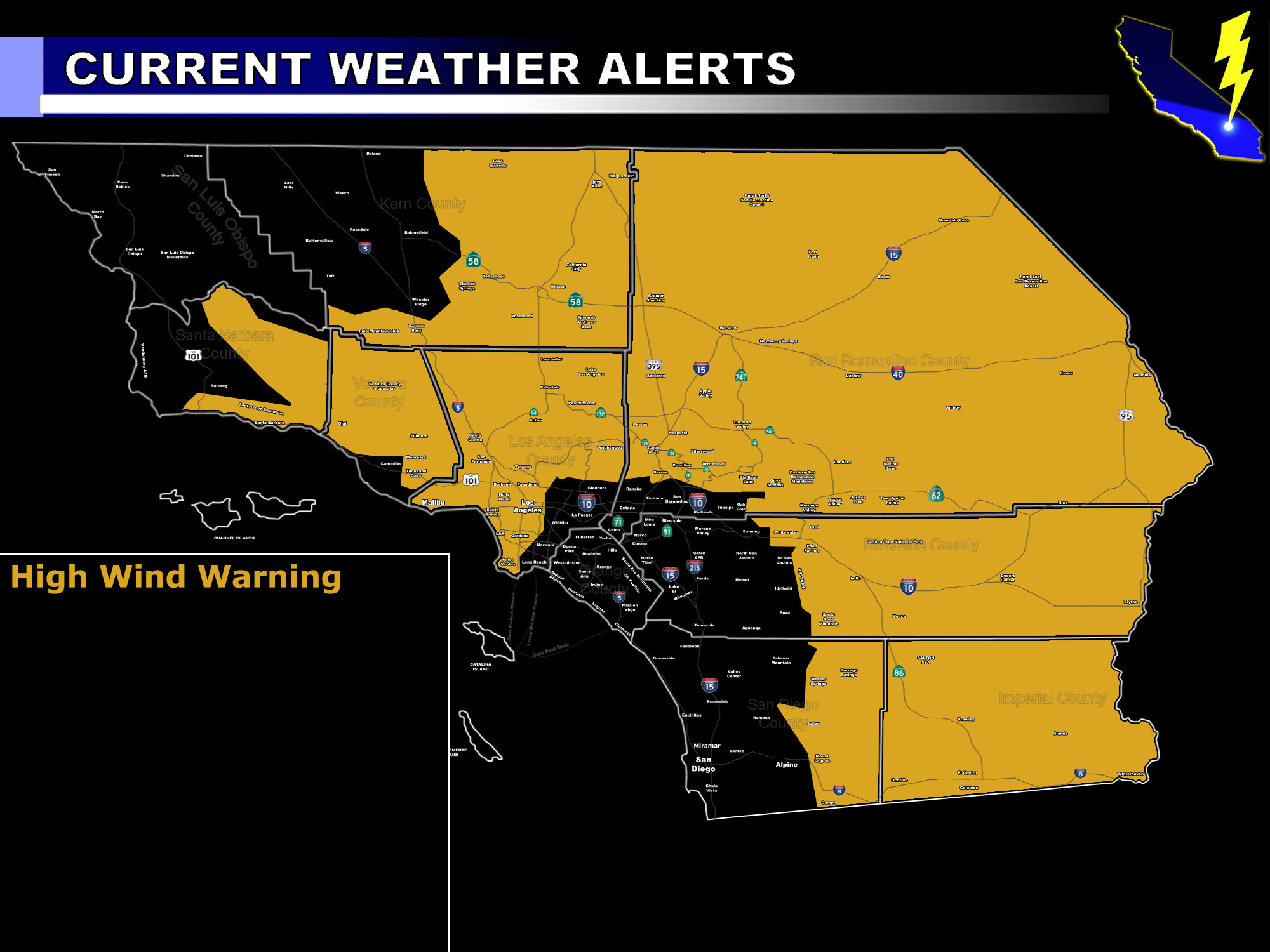 [/vc_column_text][vc_column_text]Issued Zones: Los Angeles Mountain, Coast, Basin, and Northern Valley areas (SFV/SCV) … Gorman Pass … All Desert areas … Ventura Upper Valleys .. .Santa Barbara Mountains and Southern Coast … San Bernardino, Riverside, San Diego Mountains …
Site: SouthernCaliforniaWeatherForce.com has issued a High Wind Warning effective now for Thursday …
Date: 3/29/17 at 4:55pm PT
Forecast: A storm system missing to our north will yet again bring back those strong damaging Northwest winds through the area on your Thursday. Wind gusts will be particularly strong on the southeast and eastern sides of the mountain and adjacent valley sloping zones to the foothills. Just as it was a few days ago, these winds will also be strong in the LA Coast, Basin, and SCV/SFV areas …
The winds will turn northeasterly for Santa Ana Wind prone zones to open up on Thursday night into Friday. Gusts on Thursday will range from 40 to 60+ mph … and damage is expected again, such as falling trees, power-lines, and vegetation fires as a result will be likely. Blowing Sand and Dust will also be likely so visibility will be way low and dangerous.
10 mile rule: These alerts issued on this site means that within your zone and 10 miles from you will see the event forecast for. You may or may not see the event but it means you are in the zone or 10 miles from where someone will.
Forecaster: KM[/vc_column_text][/vc_column][/vc_row][vc_row][vc_column][vc_column_text]
If this doesn\’t say “you like this” below then click the LIKE button if you thought this was good information! This helps spread the word by just ONE LIKE … Do it every time if you enjoy these … Thanks for helping!
[/vc_column_text][vc_facebook type=”button_count”][/vc_column][/vc_row][vc_row][vc_column][/vc_column][/vc_row]