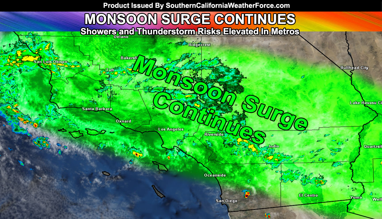
The moisture surge continues across the southland, making it feel like the Midwest, and it will increase today and especially overnight in a large part of the forecast region. Read on for details.
In the previous article there was mention of severe weather IF debris clouds did not get in the way. Convective temperatures over the Elsinore Convergence Zone will be 94 over Hemet and 99 for March AFB.
LIKE ME ON FACEBOOK for updates! Click Here and join thousands …
Because of the debris clouds, convective temperatures will not be met over March AFB today … but will over Hemet between 3pm and 6pm.. This window would allow storms to form on the Elsinore Convergence Zone WITHOUT outflow from the mountains. Being it is so late in the day, these would be the only ones in the region unless the mid-level cloud deck breaks or storms form in the mountains and set off the convergence zone between 1pm and 3pm
All products will remain the same with thunderstorm watches spanning the affected regions. Now what about overnight? Overnight is a bit more interesting for the Low/High Deserts, Inland Empire, Los Angeles, Ventura, Santa Barbara County areas because an impulse over Arizona is moving very quickly into the area, upping the PVA profiles. PVA is Positive Vorticy Advection. Think of it like the waves on the beach. The people out there move up over the swell and then sink on the back-side of it. Well.. that is PVA in a sense. The moisture waits for the ‘wave’ in the atmosphere to come in and it rises, thus creating building clouds … thus shower and thunderstorm activity is born. This will be an overnight event.
Click Here To Find Your Zone On Facebook For Updates Now and In The Future
Click Here To Find Me On TWITTER.
Some areas will be in an strong surface instability overnight, namely areas along I-40 and I-10 in the deserts. This, with upper divergence and high low level moisture content will make it possible for damaging winds, large hail, and isolated tornadoes in those areas …
Other areas across the Inland Empire, LA/VT/SBA County zones will remain in the shower/thunderstorm risk into the night …
Flow turns north on Thursday and it the usual mountain and desert zones will see the storms. Depending again on debris clouds will depend on how powerful they will be. There are indications that with the north flow, drier air in the upper levels would be happening, thus the available instability should be there for severe thunderstorms … storms off Mt. San Jacinto will push into the Coachella Valley areas and/or flood the washes…