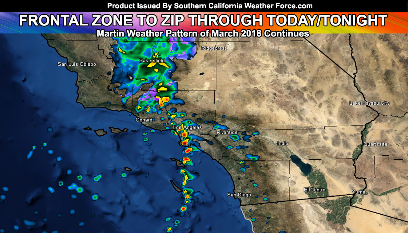
The next frontal zone in line in the Martin Weather Pattern of March 2018 will hit the area today and surge into Los Angeles south and eastward overnight. This will deliver some good snow amounts to mountain communities along with a sharp cold-front through the metros. Find out the details by reading on.
I’m weighing heavily on whether to give the front a name because it does fit the criteria in having a frontal zone move from SLO/Vandenberg to San Diego. It does also have thunderstorm producing dynamics for some. This would be a category 1 or so for San Diego with a category 2 north to Los Angeles. However, given the low and scattered values I am at the moment deciding against a name because most will be like (why name just this?).
If it does not say “Liked” LIKE The Page Below and join thousands of informed weather forecast viewers in our region for more of the updates!
Time-frame suggests cells will pop out ahead of the front in the Kern/SLO/Santa Barbara County areas by noon today with some upslope activity in the Los Angeles Basin, Inland Empire, and San Diego Valley/Foothill areas. The main timing of the cold-front however is the focus. This timing shows Vandenberg by 5pm, Ventura by 8pm, Los Angeles by 10-11pm, Orange County by 11pm-12am, Inland Empire between 12am and 2am with a solid break-up after the Riverside/San Diego Mountains so very minimal if anything in the eastern deserts.
Thunderstorms are possible along the front, which will be broken in nature. Broken fronts tend to look like mini-supercells on radar and they produce hit or miss rain and as such will be the case with this frontal zone. The best chances of thunderstorms according to my model I’m developing in the member section shows up for Ventura County east to Los Angeles and South into some of Orange County, east to the I-15 zones of the Inland Empire from Ontario to Corona tonight. Premium members can see those maps along with the precipitation, snow, wind, etc in the SCWF Member Section. The area is being monitored this afternoon for later on.
Snow charts in the member section are available, however briefly I’ll say the snow level does get to the Gorman Pass to Tehachapi, but fails to hit the Cajon Pass. So what that means is the snow-level north and west of Los Angeles will be 4,000 Ft while the snow-level east of there into the LA/SBD/RIV Mountains will be hovering just above 5,000 FT. A good chance at southwest flow producing good amounts of snow along Highway 18 from Running Springs to Big Bear Lake’s Dam, with less, but noticeable amounts at the lake areas east. Snow will also fall in Idyllwild, possibly a dusting near Anza but nothing more.
Nominal winds in the desert areas will resume.
Another front hits on FRIDAY …
Will post another update this evening, but for now if you are a premium member go to the member section for further map details. Keys for the values are on the right for some of them.
Click Here To Find Your Zone On Facebook For Updates Now and In The Future