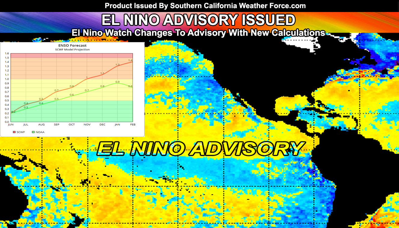
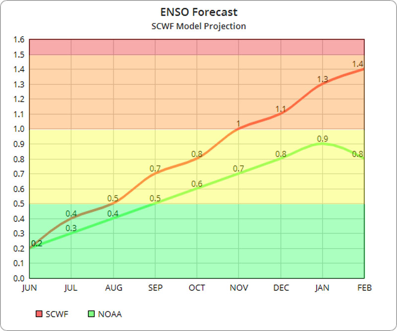
The Southern California Weather Force El Nino Watch that was in place has just been upgraded to El Nino Advisory, meaning El Nino is expected to form within the next couple of months and gain strength through Fall. The model algorithms have been crunched with SCWF vs NOAA so keep reading for that graphic and what it could mean …
Atmospheric profiles thus far on average are starting to look like the 1968-1969 El Nino at the current time. I know I said El Nino doesn’t mean more or less rainfall for the area, but in moderation (moderate) it does show some promise of more seasons with better rainfall here in Southern California than not. The season started similar with a neutral condition changing to El Nino around this time as it is doing so now.
Ongoing Text Ad: Furthermore we parted with our main summer-time advertiser and will need help from viewers/readers this Summer. So if you are interested in helping you can donate to SCWF in just a couple clicks by CLICKING HERE. I do appreciate all the help to make it through this Summer Monsoon Season. We are now over 3/4 of the goal and on the way to full to keep operations this Summer without an advertiser. Thank you everyone who has helped thus far. If the monsoon kicks up in July and August you’ll want to have this service operational.
The model forecast at NOAA is weaker than my algorithm at the moment. In just a week we jumped from 0.0 to +0.2 and that is a pretty big jump in a week. While not looking like the jumps of the 2015-2016 Super El Nino trends, we are seeing a steady incline toward El Nino by End July or August with moderate hitting by November and December. Given I’m going for a moderate El Nino over the winter months the following is true;
If we get a Moderate El Nino the following percentages are in play;
42% chance way above average
29% chance slightly above average
29% chance slightly drier than average
SOUTHERN CALIFORNIA ONLY: if it does not say “Liked” LIKE The Page Below and join thousands of informed weather forecast viewers in our region for more of the updates! noticeable
As you can see the percentages over the recorded moderate El Ninos greatly favor above average precipitation. Moderation seems to always be key.
Weak El Nino seasons tend to have warmer July days here in Southern California. They also tend to have some monsoonal activity move through, but not anything worth mentioning at the moment. The ridges tend to form too far east and the monsoons mainly affect the Colorado River Valley and our neighboring mountains. We would need the ridge north of Las Vegas to push storms to the west in what is called an easterly wave once it does move through. Preliminary for July I’m above average in temperatures with average monsoon intrusions here. For Arizona I’m with above average precipitation from Phoenix/Tucson and of course the Western half of New Mexico as the monsoon ramps up there.
We would also have less Atlantic Hurricanes as a result of El Nino’s wind shear this Summer. The Eastern Pacific (our basin) would have more than average Hurricanes as will the Western Pacific for the Philippines and Japan. Following this should continue to have confidence in the SCWF model vs NOAA because NOAA says more hurricanes in the Atlantic this year, which even in July on my numbers it looks very weak in terms of development in that basin. Everything is lining up to the SCWF model projection and overall atmospheric response to 1968.
In 1968 we even had a significant tornado in Oregon. Significantly rural it was, it still was a historic event. Given we have the troughs offshore and ridge trying to build in over Arizona and New Mexico, it is entirely possible that the blocking over Oregon could make the needed upper divergence for tornadoes and severe thunderstorms this Summer in that state.
So enjoy what we have now because after the beginning of July we may be entering a long term month of above normal temperatures. That is.. unless Hawaii wants to belch off another So2 plume to head this way. We have exhausted the plume of May and the effects of that will no longer be available to us. We now are working on a developing El Nino and temperatures in July are typically above average for such.
BEHIND THE SCENES FORECASTS/UPDATE PAGE: if it does not say “Liked” LIKE The Page Below and join thousands of informed weather forecast viewers in our region for more of the updates! noticeable
Things to note are as followed;
- Monsoon Season starts June 15th, however this year will be a mid-start, likely toward or in July.
- To remain active this Summer we are keeping the member section open to the public but as a ‘donation’ for help, by Clicking Here you’ll help this service remain into Summer.