Hurricane Sergio will hit parts of Arizona by the end of the week and a cutoff low moving into our region will provide warm offshore flow on the backside of it. Read more, including more into this month by reading on.
Hurricane Sergio is a category one system about 1,200 miles to the south-southwest of Southern California and starting to make the turn like Rosa did not too long ago. The system is much weaker than Rosa was at that point and should weaken to a tropical storm by at least Wednesday before zooming into Southeast Arizona by Friday.
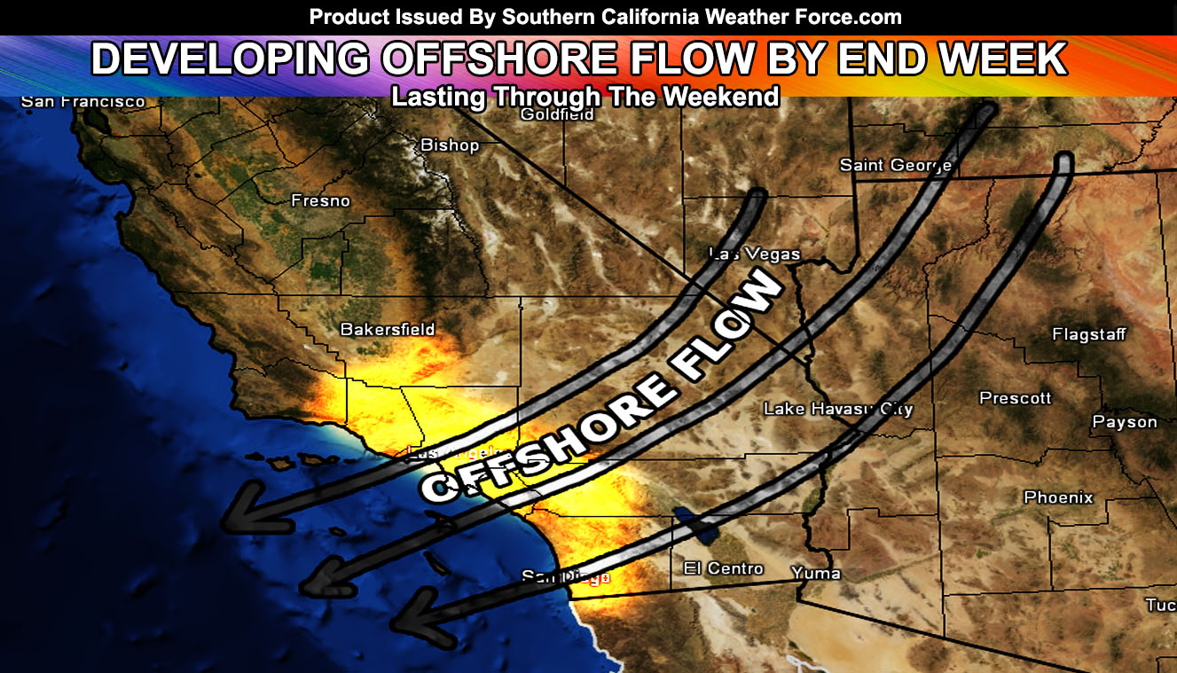
Offshore flow generated by a cutoff low moving through the area may bring a mild ‘Santa Ana Wind’ pattern below passes and canyons. This also will up the temperatures through the 90 mark. Coincidentally this is falling around the time I stated we should flip from colder than normal to warmer than normal conditions for this time of year by mid-October in the October 2018 forecast released at the beginning of the month (link here).
Averaging the numbers of the cutoff track however moves it directly over us so more of an offshore flow event than anything so going with offshore flow at the moment. Residents should continue to monitor the latest forecasts here at Southern California Weather Force for the risk of offshore flow, warm conditions, and elevated fire risks toward this weekend.
Long range numbers of mine continue to show mostly a warmer than average last half of October. There are indications of troughs toward the end of the month that’ll be watched.
As for Hurricane Michael: My landfall for it has always been Wednesday morning in Panama City Florida as a category 2 or 3 storm. All residents of the Florida Panhandle should be taking precautions by now.
End article
NOTE: Premium members. If you are signed up, your login is your e-mail address and the username and password as the password. You can change the password
Ongoing Ad – The Southern California Weather Force has a member section with LIVE UPDATES FOR EVENTS and rain, wind, thunder, tornado etc models that are personally updated by me with each Santa Ana Wind or storm event. You also can get e-mailed alerts via a slew of micro-climates. Check the member section for details on how you can support this service.. along with getting service in return… Click Here To Join or Upgrade Via The Member Section
Please remember if upgrading to CANCEL YOUR PAYPAL PAYMENTS. Login and cancel the reoccurring payments.
The Southern California Weather Force has different Facebook groups that you can ask for notifications from in order to get the latest posts affecting those regions. If that area is talked about in an article, alert, and such .. it’ll be posted there and you can be notified.
Comments are usually DISABLED as we do like to keep this as an information giving group and replies from others in the notification may annoy some.
Find your micro-climate group here – https://www.southerncaliforniaweatherforce.com/scwf-weather-alert-facebook-groups-by-region/
EMAIL ALERTS? Many micro-climate zones to choose from to get custom alerts from thunderstorm, wind, flood, surf, heat, cold, storm, and much more with the premium e-mail alert system, the most advanced zone alert system in Southern California – Click Here To Join!
SOUTHERN CALIFORNIA ONLY: if it does not say “Liked” LIKE The Page Below and join thousands of informed weather forecast viewers in our region for more of the updates! noticeable
BEHIND THE SCENES FORECASTS/UPDATE PAGE: if it does not say “Liked” LIKE The Page Below and join thousands of informed weather forecast viewers in our region for more of the updates! noticeable