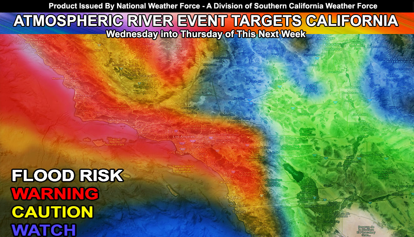
An atmospheric river, or what is commonly known as a ‘Pineapple Express’ will impact Southern California mid-next week. This is an official statement of major flooding in ALL burn areas in what will be the Martin Storm Pattern of February v2.0 and Major Pacific Storm XAVIER. You have your warning. Read on for details…
On Saturday, a frontal zone will affect the forecast area, moving through Vandenberg and San Luis Obispo on Friday evening and night, moving through the Metro Los Angeles zones by Saturday morning on a weakening trend down into San Diego County. The mountains could get a dusting from this one, San Bernardino Mountains weaker amounts than Los Angeles and Ventura due to the weakening of the front on Saturday morning. If heading to the NHRA races in Pomona the ‘main-front’ will be out by mid-morning with residual shower chances up near that area and the foothills all day, especially the evening.
The real story hits by mid-next week. It what is now official Major Pacific Storm XAVIER is showing up as a major flood risk by Wednesday. The February 2019 forecast released late-January stated; “Based on what I am seeing in my numbers, the beginning of the month is still projected to bring nearly half that rainfall forecast. We have breaks in-between and I want to say we will get yet another pattern by mid-month so watch those Valentine’s Day forecasts.” Being it was before other forecasts reflected it again, it is a Martin Storm Pattern.
Expected timing of the heaviest precipitation is certainly Wednesday into Thursday (Valentine’s Day). ALL burn areas need to be on alert and if you need to book a place to stay, do so now. This is a true Pineapple Express with snow-levels over 10,000 FT so say goodbye to what snow you have when it hits. Even Mammoth Mountain’s snow levels will be at 10,000 FT. This will create rushing down the rivers of the Sierra Nevada into the desert and valley below.
All basin/coast drainage and the LA River will be raging, possibly even the Santa Ana River itself along with DAMAGING WINDS for downed poles and trees again.
As always, stay tuned to Southern California Weather Force for further details. You have your warning.
For Main Facebook Page Click Here
End Article
NOTE: Premium members. If you are signed up, your login is your e-mail address and the username and password as the password. You can change the password
The Southern California Weather Force has different Facebook pages that you can join for a better in-depth analysis of storm and wind events …
Click here to find your area today!
EMAIL ALERTS? Many micro-climate zones to choose from to get custom alerts from thunderstorm, wind, flood, surf, heat, cold, storm, and much more with the premium e-mail alert system, the most advanced zone alert system in Southern California – Click Here To Join!
SOUTHERN CALIFORNIA ONLY: if it does not say “Liked” LIKE The Page Below and join thousands of informed weather forecast viewers in our region for more of the updates! noticeable
BEHIND THE SCENES FORECASTS/UPDATE PAGE: if it does not say “Liked” LIKE The Page Below and join thousands of informed weather forecast viewers in our region for more of the updates! noticeable