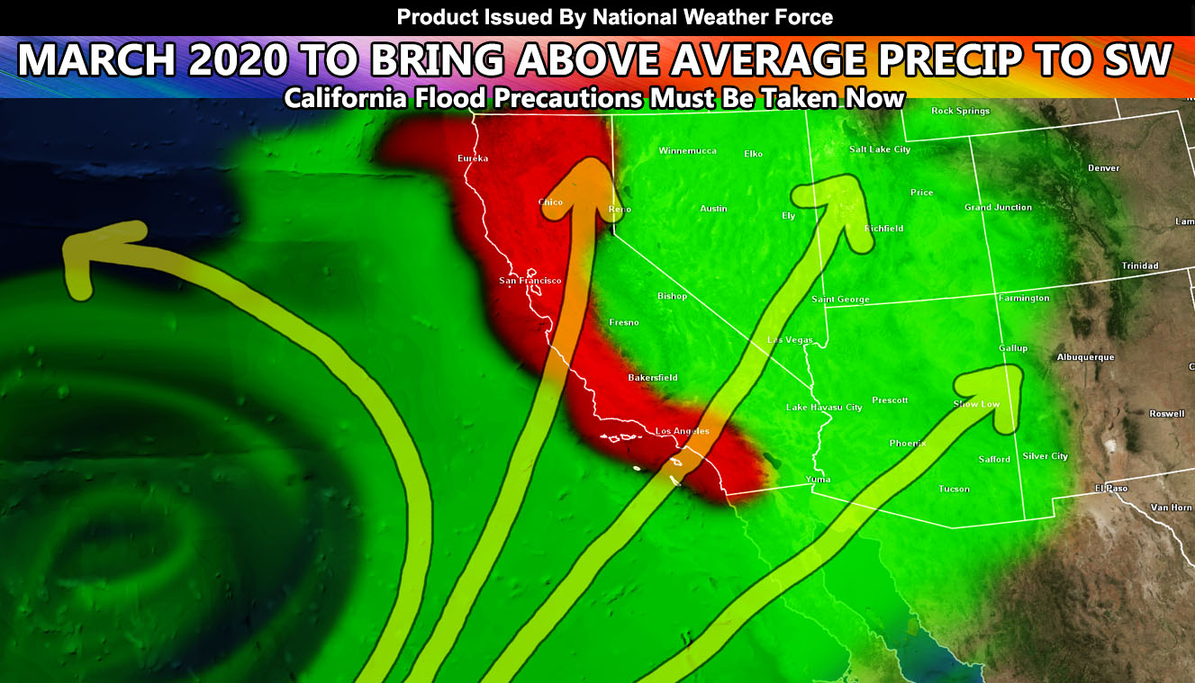
Well here we are, as projected a month back, we are looking at a pattern change for the Spring months and March 2020 will bring a good amount of rainfall and those in California need to take their Flood Precautions now, likely above average for the month, to the entire Southwestern United States so read on for details whether you are in the California or Arizona areas.
I’ll merge this article with Arizona Weather Force and Southern California Weather Force so I do not have to have two articles mentioning the same thing. So let me get Southern California Weather Force out of the way first.
SOUTHERN CALIFORNIA WEATHER FORCE
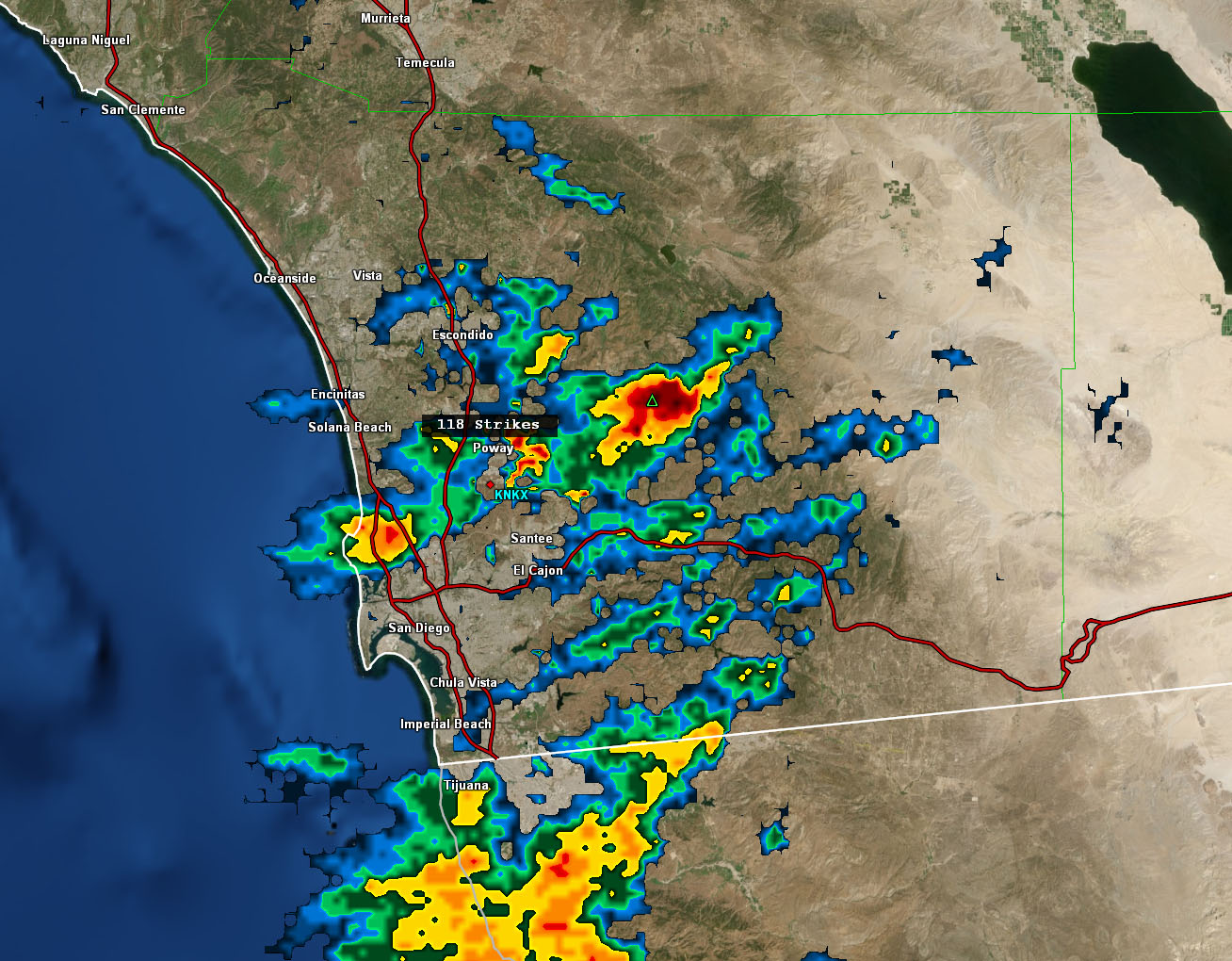
I issued two alerts this morning. One was a Weather Advisory for the San Diego County foothill/mountain areas. It read; The upper level low that moves south of the area yesterday and last night will have a northeast back-end flow to it today. The flow out of that direction will work with surface convergence in the San Diego County Foothill/Mountain areas. There is the risk of thunderstorms in spots this afternoon and evening with instability developing. Some storms will contain gusty winds and small hail …
Outcome: Thunderstorms formed in the afternoon over the San Diego County Mountains near the San Diego County Estates area, near Julian and Ramona. The images are below for archived purposes.

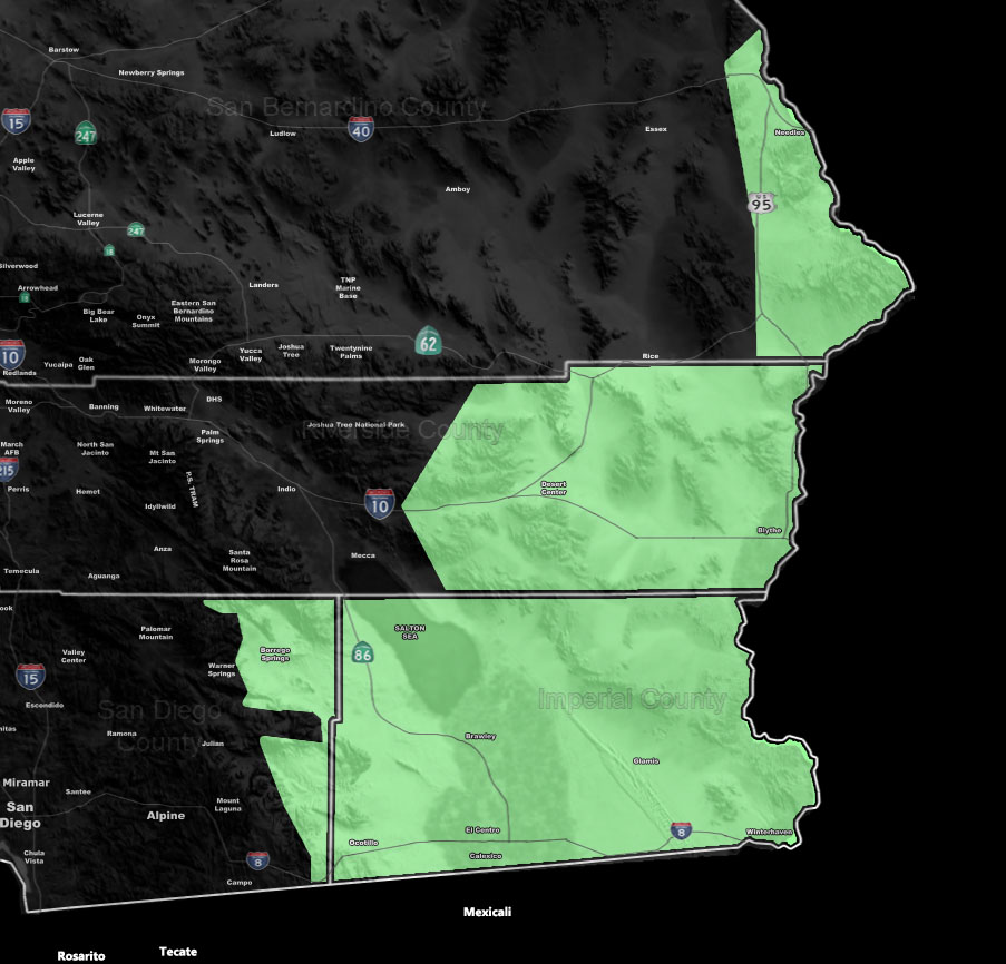
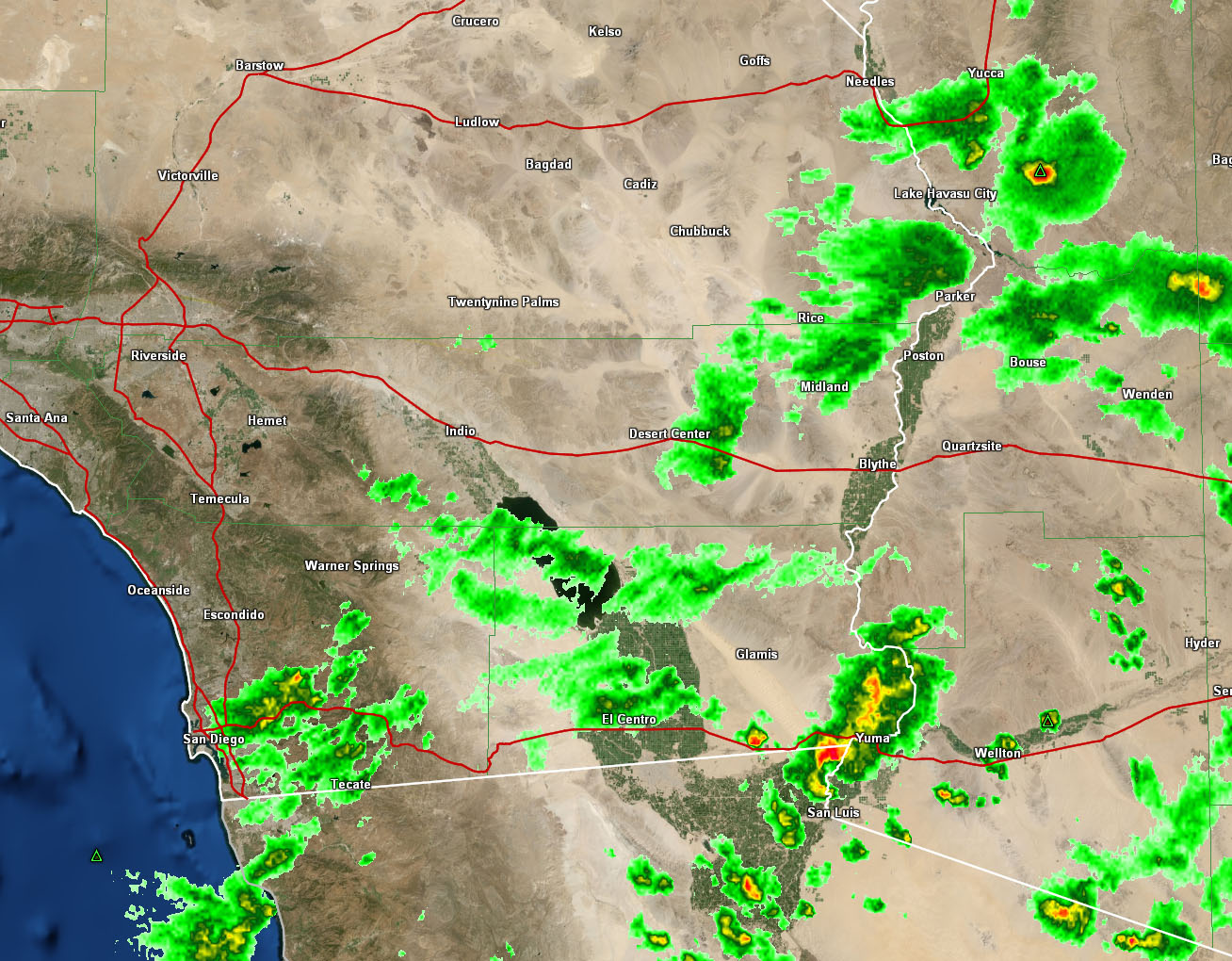
The second issued micro-climate alert was the Short Term Forecast for showers and isolated thunderstorms for Imperial County, Desert Center, Blythe, and up to Needles. It read; The storm system will bring a northeast flow on the backside of it and with upper divergence in the area all day today, passing on and off showers and even isolated thunderstorms are possible. They will end early tonight …
Outcome: Showers and isolated thunderstorms move through this zone. The images are below for archived purposes.
ARIZONA WEATHER FORCE
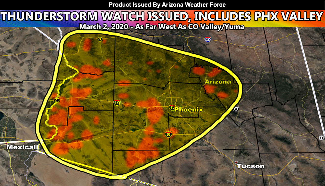
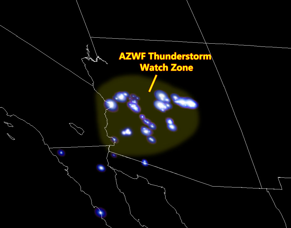
Two days ago I issued an outline for thunderstorms being possible in Central/Western Arizona for your Monday. I finalized this with the official Arizona Weather Force Thunderstorm Watch showing the AZWF Lightning Prediction Model having storms peppered across the area. That forecast was for hit and miss scattered thunderstorms so with you get it or the next city over will. We have seen that today with thunderstorms in Payson, Prescott, the Colorado River Valley, Yuma, and parts of the Phoenix Valley, where Mesa and Scottsdale up to Cave Creek got in on the action. People are commenting on the main Facebook Page (Click here to join or view it) on “where are the storms”. Radar doesn’t lie and as I stated, hit and miss today so you either get it or you do not. There were numerous cells within the AZWF Thunderstorm Watch today including the far West Valley of Tonopah, and Wintersburg and the chances remain till sunset where they will die off.
On your Tuesday, am expecting the backside of the system like today to target the Clifton, Arizona forecast zones. Very likely a thunderstorm watch will be issued in a very small area so if you are there, you have your forecast.
As you know, just as Southern California Weather Force has a service for members with micro-climate alerts, Arizona Weather Force does as well and we do have some people already signed up getting those so it is seeming like it is helping. The service helps businesses and persons, especially with ranches. Click Here to read about it and even join.
NOTE: This is the SCWF Website but it is being used for national updates until ad placement is ready on the AZWF site.
Your Facebook Page to join for this update is linked here – https://www.facebook.com/ArizonaWeatherForce
MARCH 2020 FORECAST
March can come dry or be full of surprises. Given March is traditionally the start of the tornado season in Tornado Alley, it is no surprise that large areas of low pressure can hit the Western United States at that time. There will be the chance of storms across the Southwestern United States from March 8th through the 20th with the strongest between march 10th and the 13th or so. These systems will be of tropical origin and this means that the snow level will be higher and it is not the Alaskan track we are having now at the beginning of the month. The storms will cause flooding in California. The snow level for the region will be above 7,000 FT so while most resorts will be below it, we will have a healthy snow-pack developing for the Sierra Nevada Mountain Range.
The month’s temperatures will be average. I do believe that with the Pineapple Express’ storm flow that we will run some warmer temperatures out ahead and within the storm systems. After this, toward the last 10 days or so of the month… we will have a cooler mid/low levels so with that being said, I’ll go with average temperatures for the region.
That’s it … I’ll leave you to this and I will update National Weather Force, Southern California Weather Force, and Arizona Weather Force as events unfold.