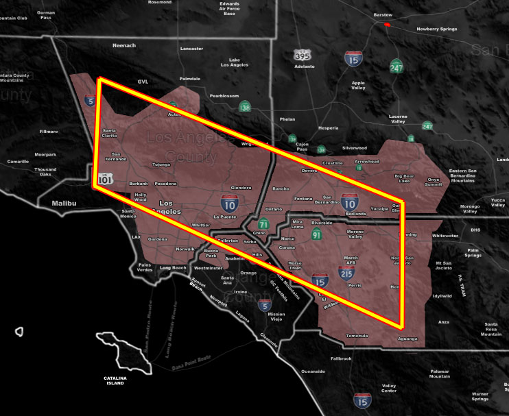
Issued Zones: SCV/SFV, LA Basin and Valleys … Northern OC … The Inland Empire … Los Angeles Mountains … San Bernardino Mountains …
Site: Southern California Weather Force has issued a High Surf Advisory effective now for Tuesday …
Date: 3/12/21 at 4:50am PT
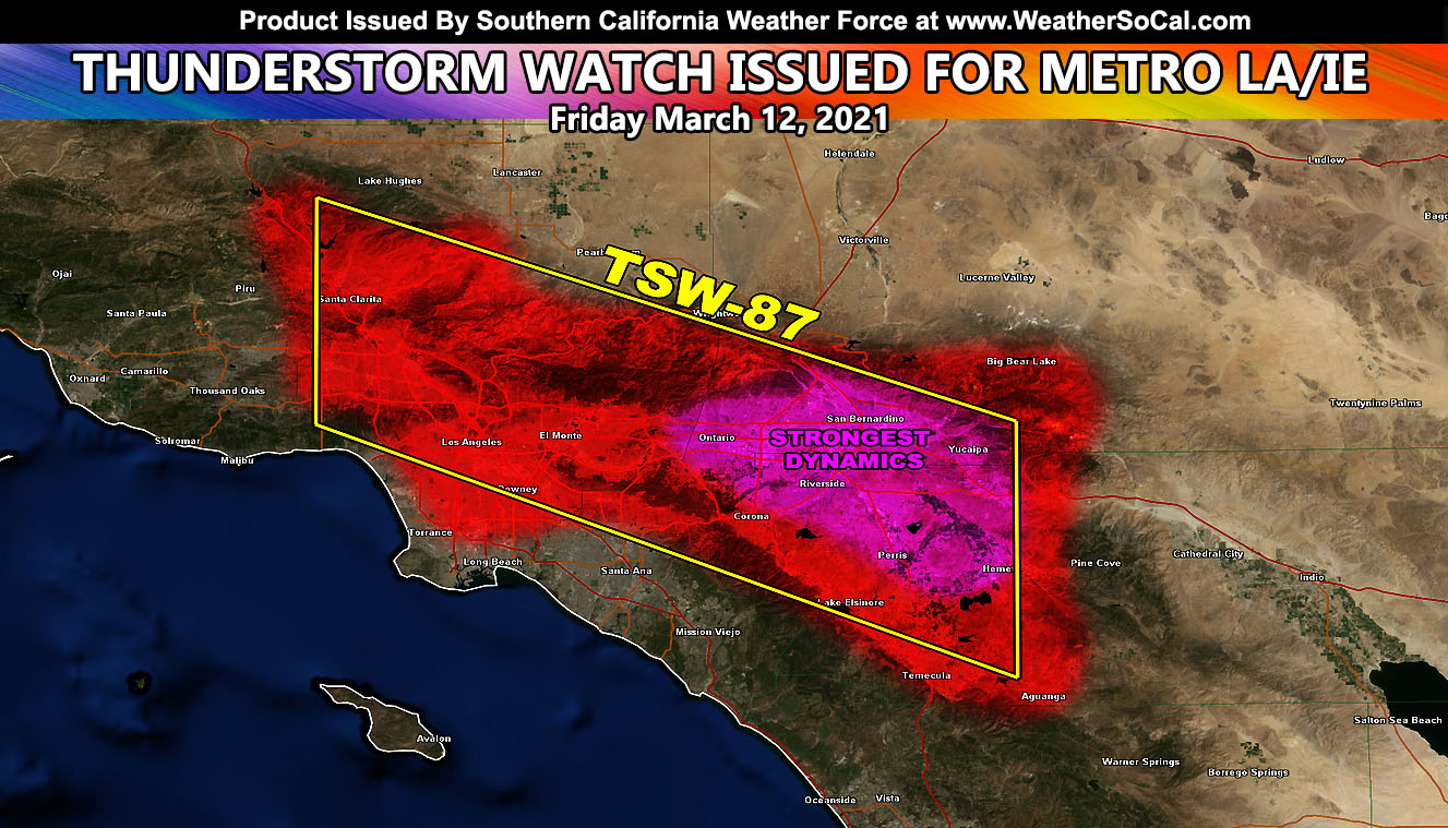
Forecast: A north to south flow above clear skies will work with a convergence zone stretching from the SCV to Banning, along the entire length of the 210 and 10 freeways west to east. This convergence zone in the mountain areas will work with the north to south flow and push off over the later afternoon and evening hours. The strongest dynamics look to exist from Ontario to Redlands in a strong thunderstorm line that will push southeast through the area.
Outskirt activity is likely in the SCV/SFV,, LA Basin and even as far south as Northern Orange County, but the main dynamics will be from Ontario to Redlands southward into the entire Inland Empire.
Snow-levels will afford the chance that Yucaipa, Cherry Valley, and Beaumont will see snowfall with it and that means thundersnow for the mountains …
NOTE: If you read this from a SCWF micro-climate Facebook Group, keep in mind that forecast ARTICLES are NOT posted there unless it directly affects you. You will want to go to the MAIN SCWF Facebook Page and to go there you CLICK HERE.
10 mile rule: These alerts issued on this site means that within your zone and 10 miles from you will see the event forecast for. You may or may not see the event but it means you are in the zone or 10 miles from where someone will.
Forecaster: KM