The storm system has weakened for Los Angeles, Orange, San Diego, Inland Empire, surrounding mountain and desert regions, but has maintained original forecast strength for San Luis Obispo and Santa Barbara County. Read on for details …
First and foremost I will always call out NOAA if I have to. This is a trait I am known for and confrontational if I have to be. The Flood Watch you are hearing on the news is fine for the Santa Barbara and San Luis Obispo areas, however it is not for the Ventura and Los Angeles County zones. I am unable to issue my flood watch outline as I am not in the office till later Saturday and the people watching my animals in the house cannot forecast for me.
However I will say that if you are in the Santa Clarita Valley or LA Basin that a Flood Watch is NOT needed with this system.
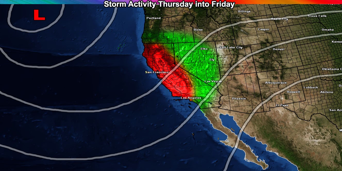
This system is a classic tail-end charlie system where the front moves east-northeast and impacts the SLO/SBA areas and weakens as it moves into the LA/OC/IE/HD/SD metro and surrounding mountain/desert areas.
Although less than four days ago, it maintained that the SLO/SBA areas would be the hardest hit from this system. I could have said this a couple days ago, however I was still grieving from the loss of Callie, my one year old cat.
Because this system weakens as it moves from there to LA/SD, this will NOT be a named system.
So what about timing? Well the lighter type virga and/or light precipitation within the warm front would hit the VT/LA/OC/IE zones as early as this evening and this would tell me that it will be hit and miss to who sees what. Given that we do have elevated instability out there in those zones. .. I will give a chance of thunderstorms out there for areas surrounding the Los Angeles Basin this evening (Thursday).
However, the main front will be the focus for the flooding and that will be hitting the SBA/SLO areas this evening, with the main front hitting overnight into Friday morning there with Ventura getting it by around sunrise on Friday give or take 2 hours. There will be a chance of thunderstorms in these areas with the front.
It’ll slide eastward across LA/IE/OC/SD during the day on Friday. The deeper layer moisture is enough to produce rainfall into all High Desert areas, with much less to none for the Coachella Valley.
Snow level is too high for any resort level snow with this system
Winds will be gusty in the mountain and desert regions .. as always … and also along the front for Vandenberg AFB …
SATURDAY TO SUNDAY MORNING – A risk of activity for the LA/OC/IE/SD areas as another impulse comes in … This will miss areas west of Ventura … so another tropical connection with another risk of shower/thunderstorm activity.
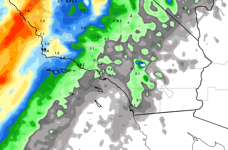
My updated weather forecast model for precipitation clearly shows what I said in this article. Less rain for the metros, more for the SBA/SLO County areas … marginal in Kern County … and even rain in the High Desert with the deeper-layer moisture. The rain in the LA and NW OC Basin is partly because of the chance of thunderstorms in the area of PVA moving through this evening (Thursday) …