
[vc_row][vc_column][vc_column_text]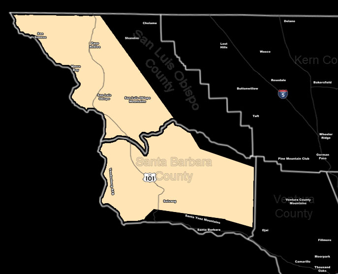 [/vc_column_text][vc_column_text]Issued Zones: Western half of San Luis Obispo and Santa Barbara County …
Site: SouthernCaliforniaWeatherForce.com has issued a Special Weather Statement effective now for this weekend on a series of storm fronts …
Date: 11/23/16 at 9:00pm PT
Forecast: A series of fronts will impact the San Luis Obispo and Western Santa Barbara County forecast areas this weekend. The frontal zone dynamics do call for heavy rain through a short period of time … and thus this could lead to flooding.
In addition to the flooding … the system has strong low-level winds and thus over the weekend it’ll lead to strong gusty winds at the surface in the forecast area. Additional forecast updates will be made as they are issued by this office …
First Frontal Zone Arrival Estimation Countdown Timer to Saturday Morning …
10 mile rule: These alerts issued on this site means that within your zone and 10 miles from you will see the event forecast for. You may or may not see the event but it means you are in the zone or 10 miles from where someone will.
Forecaster: KM[/vc_column_text][/vc_column][/vc_row][vc_row][vc_column][vc_column_text]
If this doesn\’t say “you like this” below then click the LIKE button if you thought this was good information! This helps spread the word by just ONE LIKE … Do it every time if you enjoy these … Thanks for helping!
[/vc_column_text][vc_facebook type=”button_count”][/vc_column][/vc_row][vc_row][vc_column][/vc_column][/vc_row]