
Well it is that time again… time for the long range monthly forecast and it is the new year. So how did December go? 2-4″ of rain was the forecast and we did get into that margin for Los Angeles, the station used at all times. January will be around the same with the first system hitting soon so read on for details.
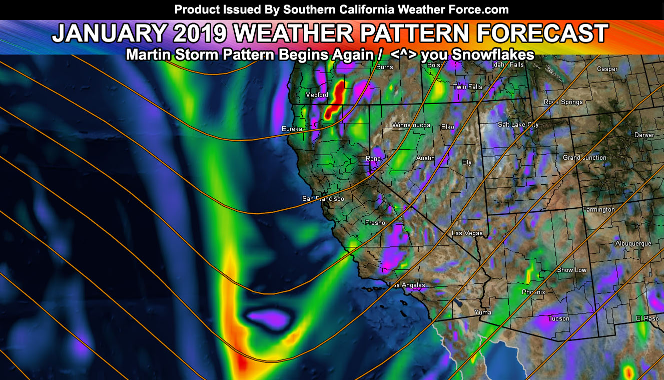
The next Martin Storm Pattern was in previous articles well over 7-10 days ago. Between January 4th and 12th would be the next round of cold-fronts hitting the Southern California area. These should be on the cooler variety being the cold air is remaining in place. It will not be cold enough for valley snowfall so get that out of your heads. Snow levels over the weekend system, which could be Pacific Storm Simon; will be between 4,000 and 5,000 FT along the initial front, with ice as far down as 3,000 Feet so some high desert locations and the top of both Gorman and Cajon Pass will be a travel danger.
For now I do have the system coming in on Saturday, earlier for west of Los Angeles and for Los Angeles south and eastward through OC/SD/IE. Snow level is low enough to warrant the chance of some Santa Ana Mountain locations above that 4,000 FT level to receive some, making Santiago Peak at over 5,000 FT photogenic by sunrise on Sunday morning into the day.
Winds will not be terribly strong or damaging in areas around Ventura, Los Angeles, south and eastward. However.. Vandenberg Air Force Base to San Luis Obispo you will have very strong frontal zone winds so your category is higher there. Category to be determined due to uncertainty on thunderstorm dynamics.
Another system will come in several days after Pacific Storm Simon, the T name.. Trump. That system is still being watched as it could be worse than Simon.. depending on track. It still is well over a week away.
We warm up some for January standards through mid-month and then cool back down again like we did last month after the 20th-21st or so. This month does look identical to December 2018 in temperature aspects. Snow levels along the fronts however will be lower than they were in December during those major cold-fronts.
We have the chance of another storm window end month or early February after the brief break we will have between systems as a ridge takes hold.
Based off our cool start now and the cold end month with only mild temperature swings in the mid-month.. I’ll go with a final of below average temperatures and average precipitation with a couple real good storms. 2-4″ rainfall margin in Los Angeles once again.
NOTE: I am in FB jail again on my main profile and can only post due to a back-up. IF I EVER find the snowflake that keeps doing this you better run … and run far… Premium members… this is why you signed up to the website.. so you can get notifications and updates in the event FB ever removes me COMPLETELY …Thanks …
End
NOTE: Premium members. If you are signed up, your login is your e-mail address and the username and password as the password. You can change the password
Ongoing Ad – The Southern California Weather Force has a member section with LIVE UPDATES FOR EVENTS and rain, wind, thunder, tornado etc models that are personally updated by me with each Santa Ana Wind or storm event. You also can get e-mailed alerts via a slew of micro-climates. Check the member section for details on how you can support this service.. along with getting service in return… Click Here To Join or Upgrade Via The Member Section
Please remember if upgrading to CANCEL YOUR PAYPAL PAYMENTS. Login and cancel the reoccurring payments.
The Southern California Weather Force has different Facebook groups that you can ask for notifications from in order to get the latest posts affecting those regions. If that area is talked about in an article, alert, and such .. it’ll be posted there and you can be notified.
Comments are usually DISABLED as we do like to keep this as an information giving group and replies from others in the notification may annoy some.
Find your micro-climate group here – https://www.southerncaliforniaweatherforce.com/scwf-weather-alert-facebook-groups-by-region/
EMAIL ALERTS? Many micro-climate zones to choose from to get custom alerts from thunderstorm, wind, flood, surf, heat, cold, storm, and much more with the premium e-mail alert system, the most advanced zone alert system in Southern California – Click Here To Join!
SOUTHERN CALIFORNIA ONLY: if it does not say “Liked” LIKE The Page Below and join thousands of informed weather forecast viewers in our region for more of the updates! noticeable
BEHIND THE SCENES FORECASTS/UPDATE PAGE: if it does not say “Liked” LIKE The Page Below and join thousands of informed weather forecast viewers in our region for more of the updates! noticeable