
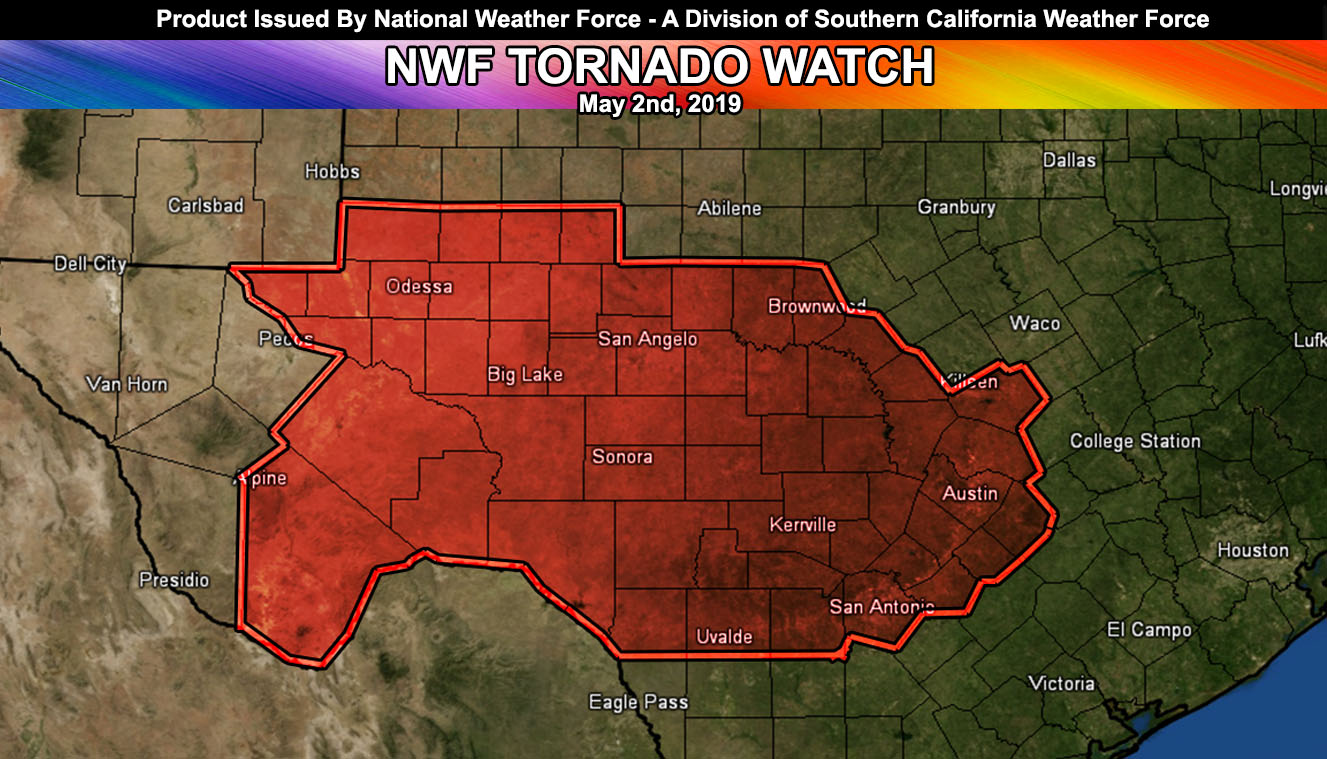
National Weather Force has issued a Tornado Watch for West to Central Texas, including the Bend to San Antonio and Austin effective May 2nd, 2019. Read on for details.
At 11:30 am Central storms were trying to get going in Central Texas. These storms will be forming along an outflow boundary that moved through Northern Texas yesterday. As the afternoon moves on, scattered thunderstorms will form in the region. There will be some weak, but enough shear for supercell development in this region and this would bring a weak tornado scenario, peppered across the watch area. Storms will move through the metro areas of San Antonio and Austin later in the period.
There are some indications that a convergence boundary that will be lagging will be in the Odessa forecast zones surrounding Big Spring, TX. If some storms can get going in that region of Texas, shear is adequate for weak tornadoes. Today does not seem like a strong or violent tornado scenario so we’ll keep it at large hail, damaging winds, and weak tornado probabilities within the watch zone in the image of this article.
FACEBOOK PAGES TO JOIN!
NATIONAL WEATHER FORCE MAIN PAGE: The National Weather Force is the national forecast alert project in development in what you just read in the articles. It will cover national weather during events only and it will be able to target your newsfeed so you will only get the updates that pertain to your state. Join today!