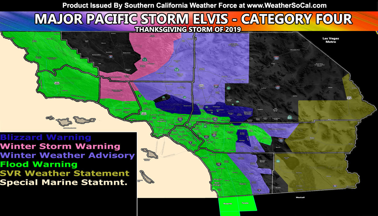
Major Pacific Storm ELVIS has been upgraded here at Southern California Weather Force to a Category Four storm and he’ll bring that mountain snow, flooding metro rains, thunderstorms in spots, and some tornado dynamics for some. I’ve custom done exclusive flood and snow-level maps in this update so read on for details and look at my maps …
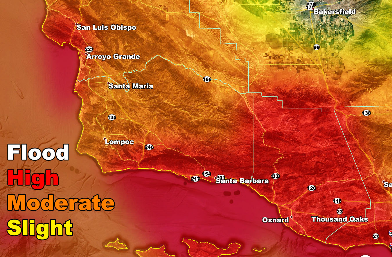
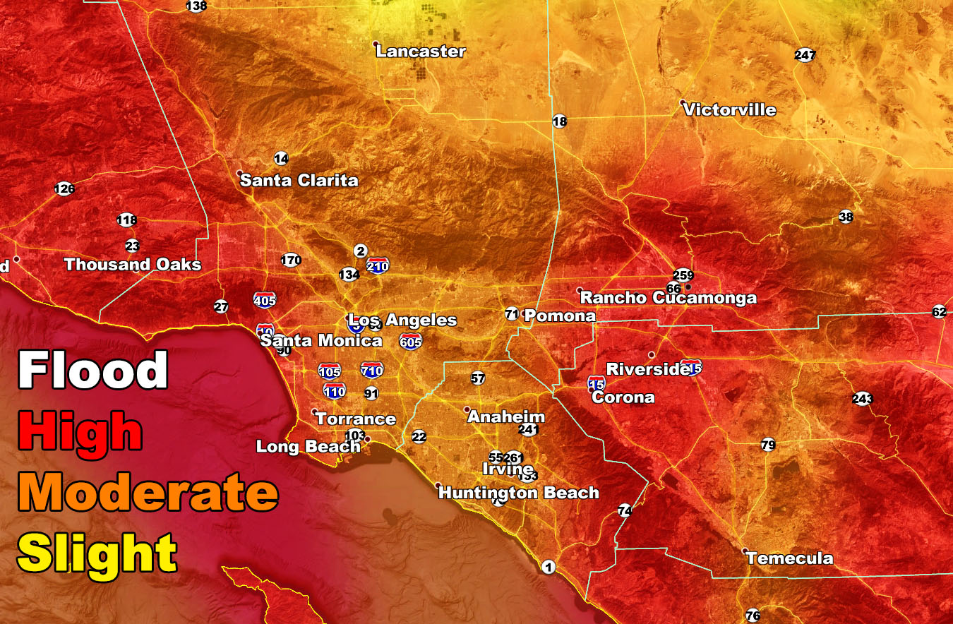
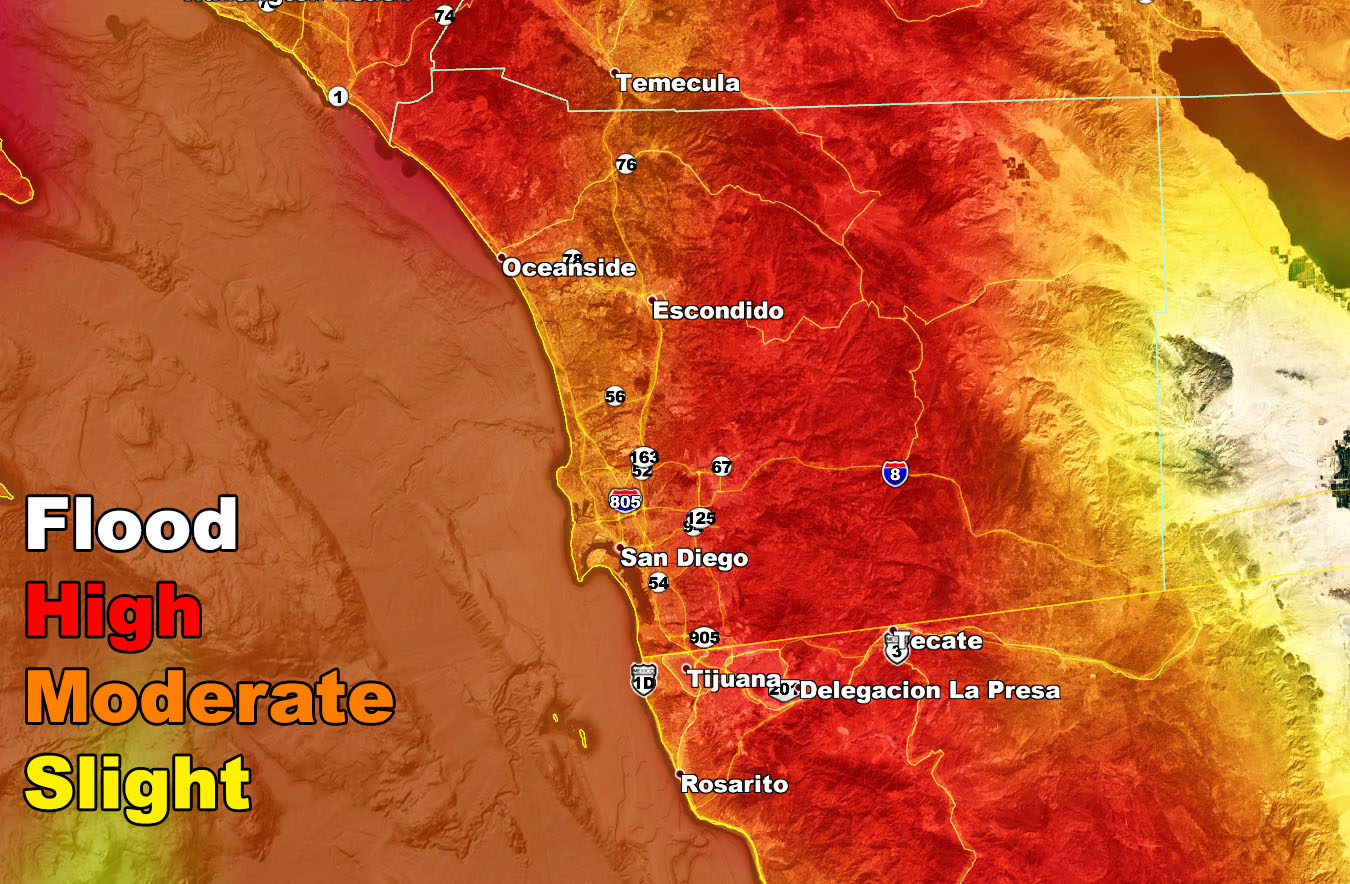
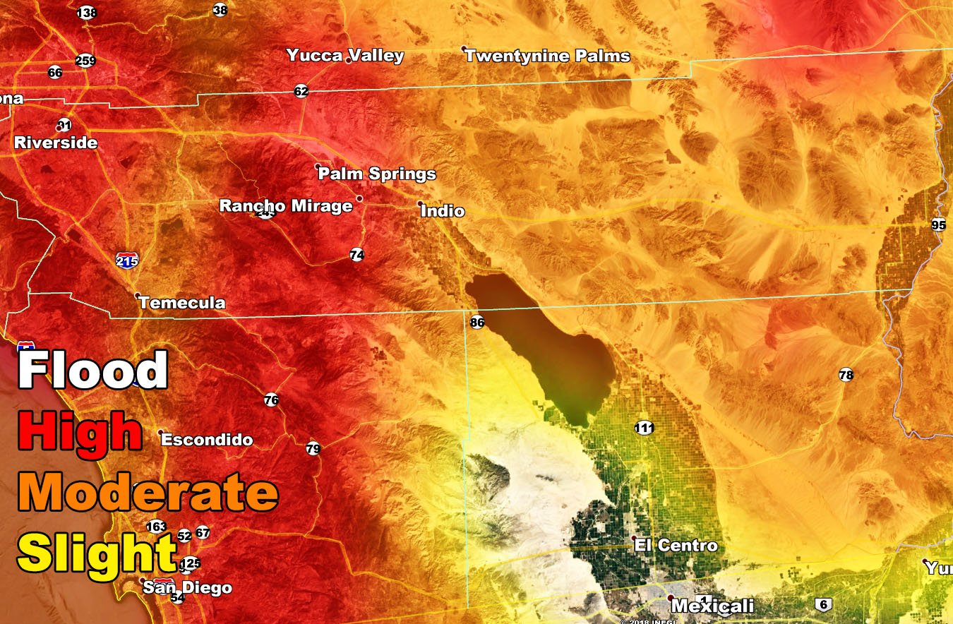
I’ve issued a large affecting Flood Warning for the following zones; San Luis Obispo … Santa Barbara … Ventura … Los Angeles … Orange … San Diego Coast/Metros … The Inland Empire … The Coachella Valley … Baja Metros … The first front is moving across the region today and the second more powerful one is the one that will bring the most rainfall that will prompt this warning. The timing of the Thanksgiving storm front will be around the same as today’s with SLO / Santa Barbara around sunrise and pushing into Los Angeles over the morning hours. There is a difference with the Thanksgiving front compared to today’s and that is how much deep-layer moisture will be available. This will make it to the Coachella Valley with flooding concerns on Thanksgiving.
Join Southern California Weather Force main Facebook Page for future updates!
Rainfall totals in the warning area will range from 1-2″ in the SLO/SBA/VT/LA areas with 2-3″ for the Inland Empire, Orange, and San Diego areas and near 2″ for Palm Springs!
Convective activity on Thanksgiving in the warning area will yield the risk of thunderstorms and some of these could contain waterspouts and/or small tornadoes. Will upgrade this to a thunderstorm watch in the zones needed Wednesday evening …
The areal flood risk zones are below for this event based on the SCWF Flood Risk Model
A Severe Weather Statement is in effect for Thanksgiving for the Imperial, Riverside, and San Bernardino Desert zones. Quiet day expected with no deep-layer moisture to get rain out into the low desert for your Wednesday, but that will change on Thanksgiving …
The deep-layer moisture is expected to impact the Los Angeles zones on Thanksgiving morning and the surface boundary will move into the Low Deserts in the afternoon/evening hours. This boundary will be the focus of storm development and some of these storms with added instability ahead of the advancing upper low will bring the risk of severe thunderstorms with hail, damaging winds, and even that chance of tornado dynamics added in.
This will quickly develop and move east into Arizona on Thursday night. An assessment will be made on Thursday morning for an upgraded alert if needed.
This is a Glamis impact …
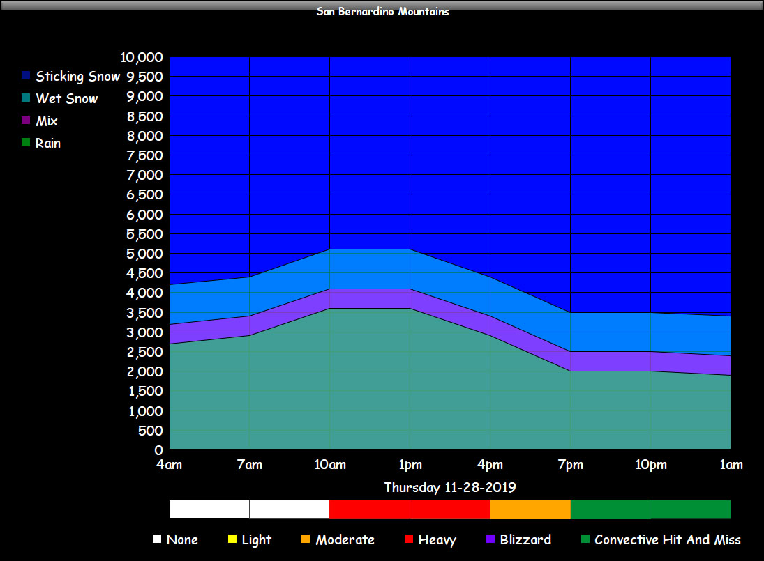
As for the High Desert Metro and Cajon Pass travels –
The colder part of the storm system will reach the region by Thursday morning and last into the evening hours.
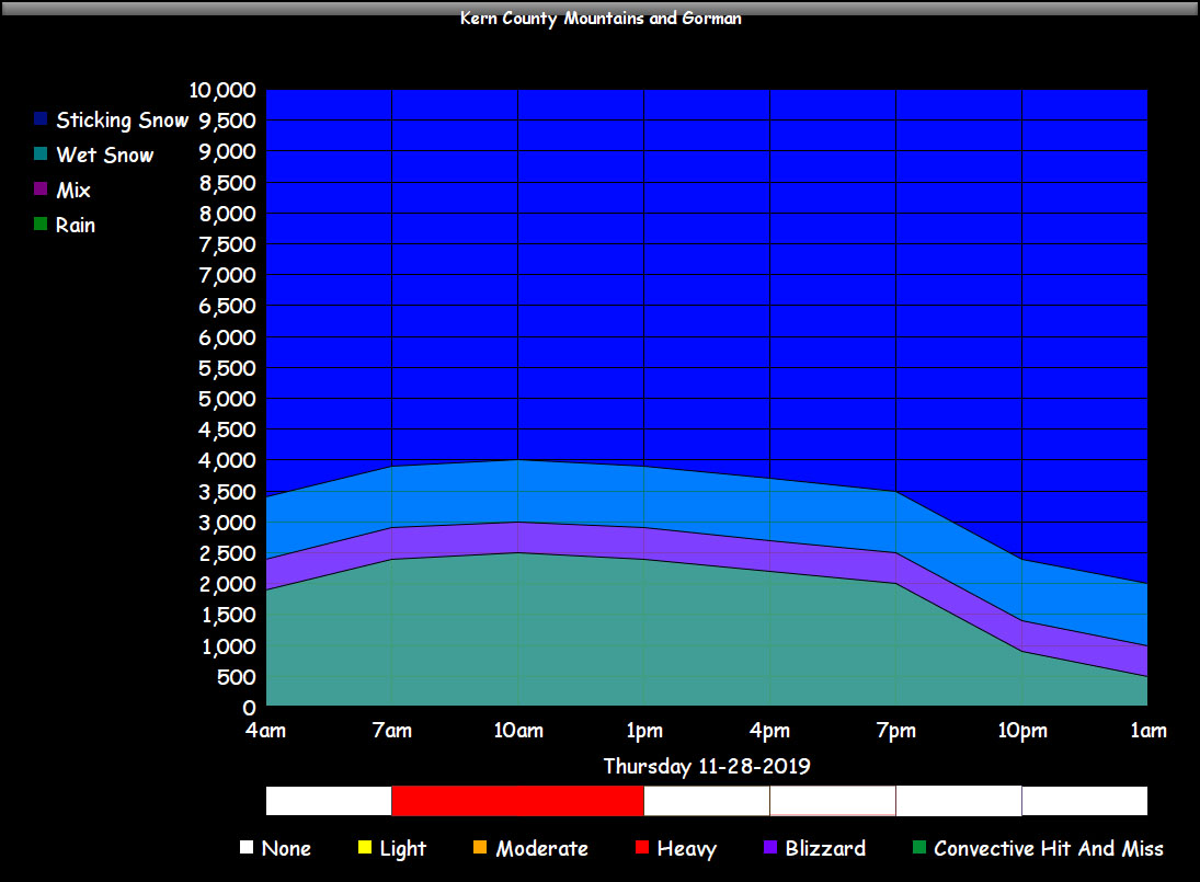
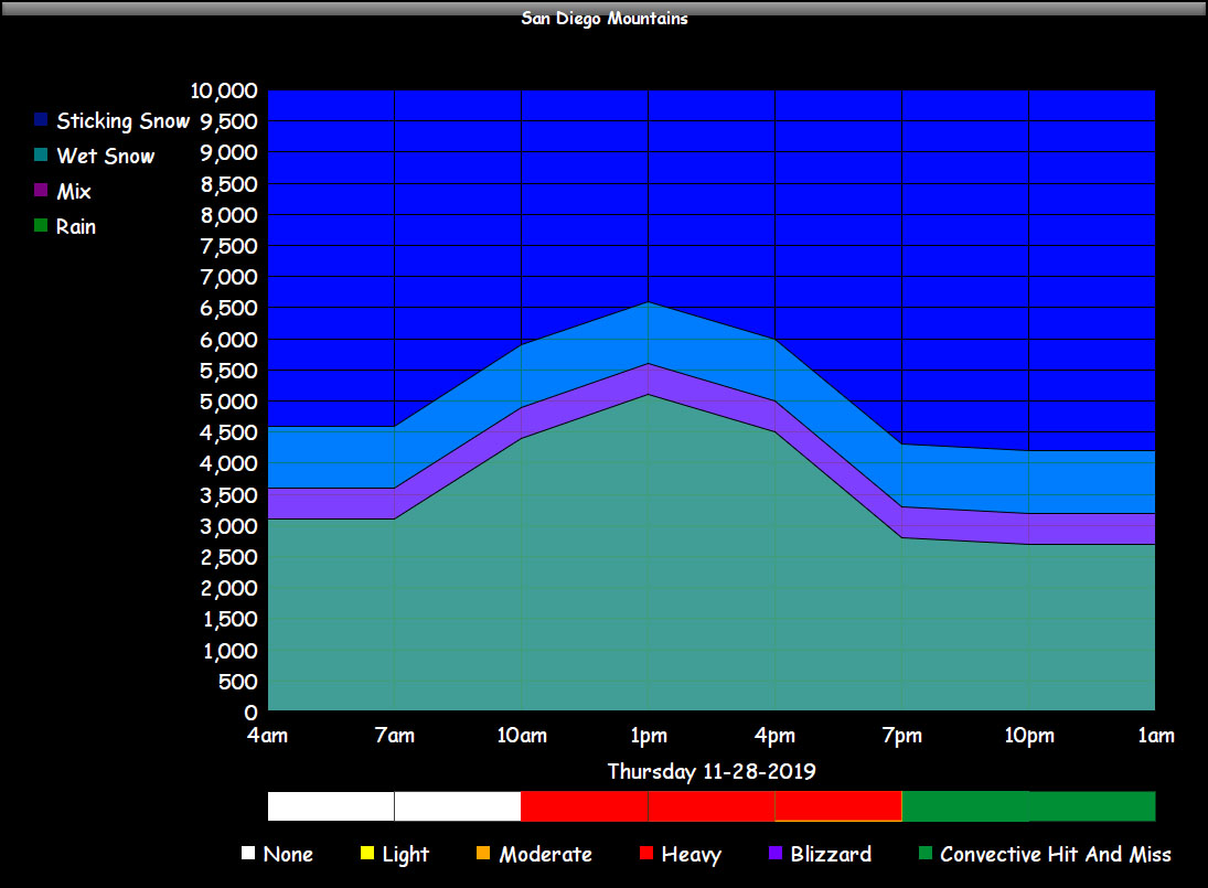
The snow-level chart in the Kern/LA Desert clearly shows heavier snowfall above 4,000 FT and this means that the High Desert / AV / Kern Floor will be in the zone for a dusting of snowfall with cold-air advection out of the mid-levels as Thunderstorms will be the issue in the LA Metro areas.
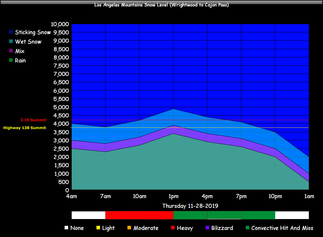
Usually this could give up to an inch of snowfall in the LA/KERN Deserts and a couple inches at the top of the Cajon Pass … with a dusting in the Victor Valley metro areas. This is not a major snowfall producer in the High Desert Metros, but the Cajon will see the 2″ snow amounts on Thanksgiving.
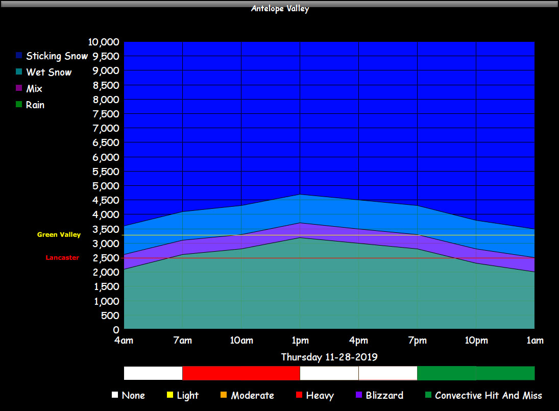
In addition to that, Highway 14 through Acton will be clear of snow and 2-4″ of snow will be possible in higher elevations of Green Valley.
SNOW AMOUNT FORECASTS UNCHANGED FROM YESTERDAY’S UPDATE CLICK HERE
As for the weekend, some spots north and west of Los Angeles will have precipitation and the micro-climate alert system will take care of those zones and we remain in a storm window right on through the first week of December so stay tuned.