
Atmospheric River Storms System For Northern half of California To Prompt Tornado Watch Probabilities On Saturday
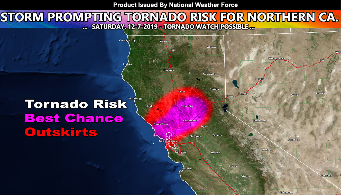
The atmospheric river is hitting the Bay area through most of the weekend, with areas across all of Northern California seeing high amounts of rainfall. Rainfall amounts are 1-3″ but mostly the metros will see 2-3″ of rainfall and some flooding will certainly be an issue out there. NWF articles for this region are for more rare events and this is one of those higher impact events.
On Saturday morning I will look into my tornado forecast model numbers for areas around the SF Bay area to Santa Rosa, northeast to the Sacramento Valley areas. Preliminary estimations bring tornado dynamics through on Saturday afternoon and evening and these dynamics would promote the chance of tornadoes, including the issuance of the NWF Tornado Watch product. So if you are in those metros areas within the red/magenta colors in the article image outlined zone then continue to follow for updates.
NOTE: This is the SCWF Website but it is being used for national updates until a suitable national website can be developed for you.
Your Facebook Page to join for this update is linked here – https://www.facebook.com/WesternWeatherForce/
Reading for another state? Find your region I serve here – https://www.facebook.com/…/a.6435502791214…/1544547759021716