
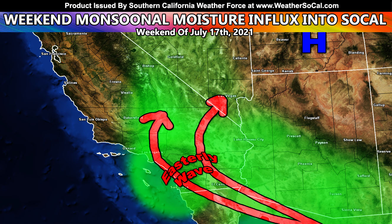
The ridge of high pressure that has brought hot temperatures over the last week will move to Utah over the weekend, which opens up the southeast flow for monsoon moisture into Southern California with mountain/desert thunderstorms being likely, with some chances of storms over parts of the coast/valley regions so read on for details …
It’s been a while since any weather event has allowed me to post, but we have a brief intrusion of monsoonal moisture for the Southland over the weekend. The ridge will finally migrate eastward into Utah, opening the southeast flow out of Mexico and Arizona. Monsoonal moisture causing thunderstorms across Arizona will be allowed to spread into Southern California starting Saturday, probably peaking on Sunday. An embedded easterly wave may make it possible for pop-up shower or thunderstorm activity as far west as Ventura and Kern County through the weekend and into early Monday as well. The peak again is Sunday into Monday. There are some indications that Monday’s pattern could bring the moisture further west into San Luis Obispo County.
I Will update as I crunch more numbers and the time-frame gets a bit closer. Elsewhere areas that do not get the showers or storms, it’ll be humid and miserable.
Get these alerts via your own e-mail control panel for your zone, or the closest to you as a full supporting member of this service that saves lives and property – here – https://www.southerncaliforniaweatherforce.com/scwf-discount-member-sign-up-page
Join the Southern California Weather Force group for photos and pictures, and sometimes updates not posted on the main FB Page – here – https://www.facebook.com/groups/socalweatherforce/
See ALL Active articles and alerts for Arizona here – https://www.southerncaliforniaweatherforce.com
Southern California Weather Force is a custom weather alert service that began in September 1999 off and is regarded as the most accurate weather service in the region, offering custom alerts, maps, and models to help save life and property. The work done here is never 100% accurate, but it comes pretty close. Southern California Weather Force runs on zones, so if an event happens in a zone that is 10 miles from the border of your zone, the forecast is still valid to activate your zone’s alert system. A company quote to the public is that of “The Joker” and tells other agencies in weather this all the time… “This world deserves a better class of meteorologist… and I’m gonna give it to them”… out-forecasting even the National Weather Service with lead-time and precision, which makes this service a focus of ridicule and envy in the weather community due to having such accuracy. Alerts issued here are issued custom from this office and this office alone. You may not even hear it elsewhere, but if one is issued near or in your area, listen up because “if you do not wish to die in weather, follow, it’ll save your life one day.”