
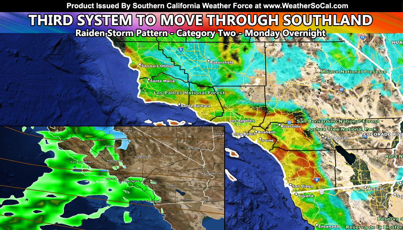
A system that of which is called a southern slider here at Southern California Weather Force will move into the region later this evening, the main forecast area overnight tonight, and out of here through Tuesday morning. The system has been given a category of two out of six. A stronger system is expected on Thursday. So, for your forecast, read on for details and see the rain, snow, wind forecast maps …
WANT THESE DELIVERED WITH ALL THOSE PERKS INCLUDING BEING ON THE MICRO-CLIMATE ALERT SYSTEM AND MODELS DURING EVENTS BECAUSE NOT EVERY ALERT IS POSTED ON SOCIAL MEDIA FROM THIS WEATHER OFFICE – JOIN TODAY BY CLICKING HERE – Southern California Weather Force Subscriber System – Southern California Weather Force
Join the Facebook Page for Further Updates If You Have Not Yet!
SOUTHERN CALIFORNIA WEATHER FORCE MAIN:
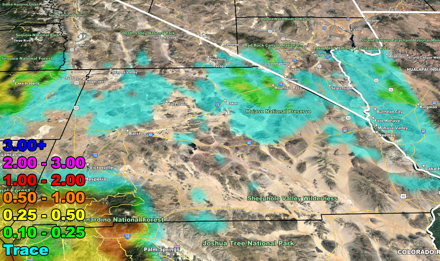
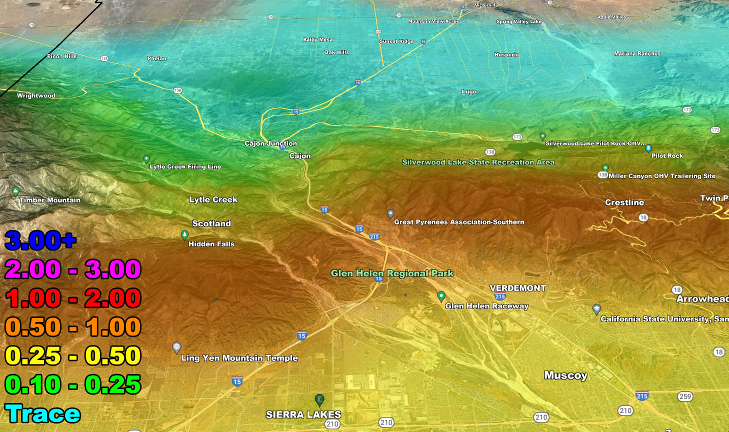
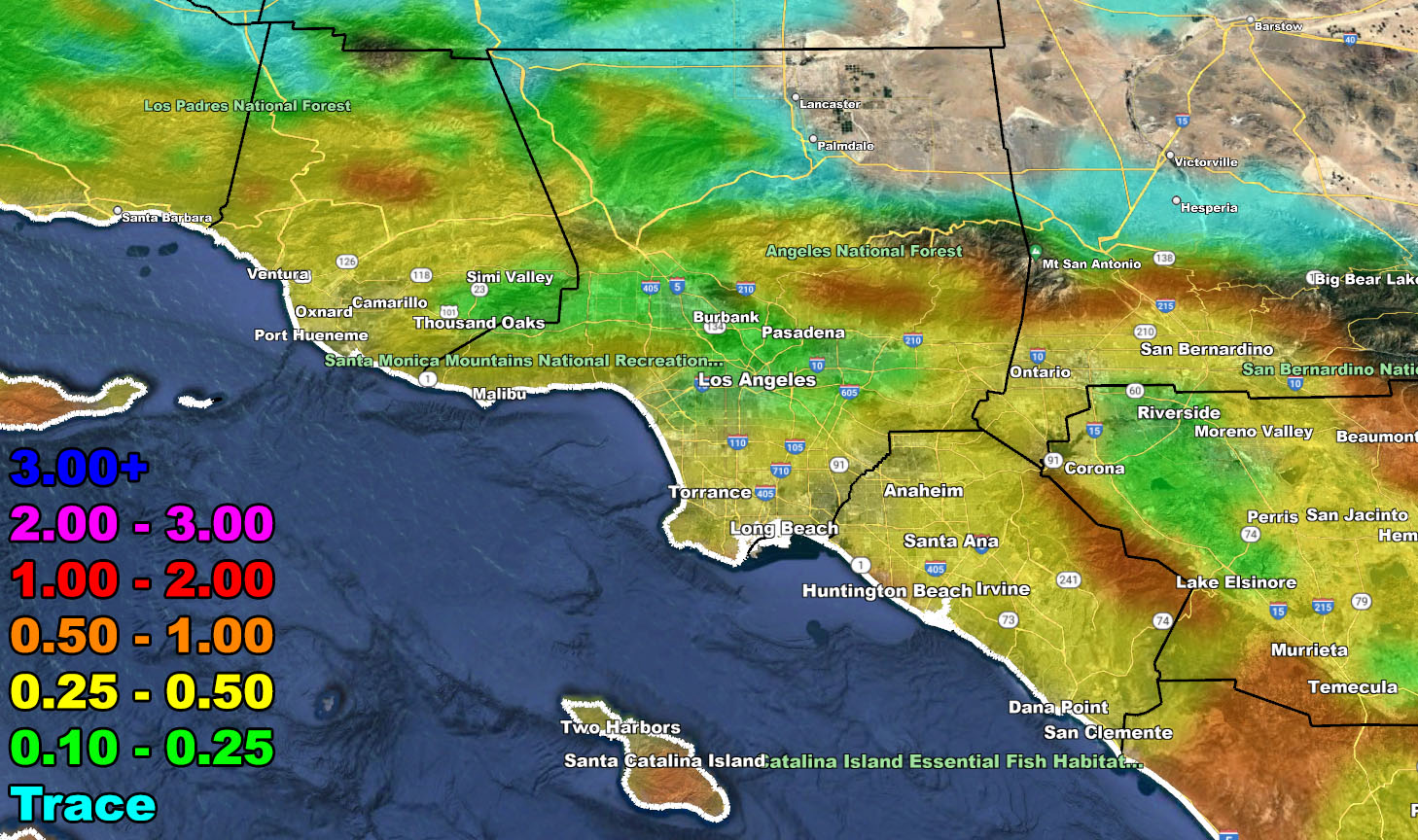
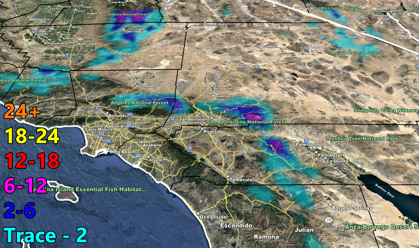
The third system within the Raiden Storm Pattern we currently are in will be the weakest of the series thus far. This system will bring precipitation through San Luis Obispo and Vandenberg this evening, including up through the Kern County areas as well. At the same time, later this evening, upslope showers will develop ahead of the main front for Ventura, Los Angeles, Orange, San Diego, and the Inland Empire locations with all areas increasing in intensity overnight.
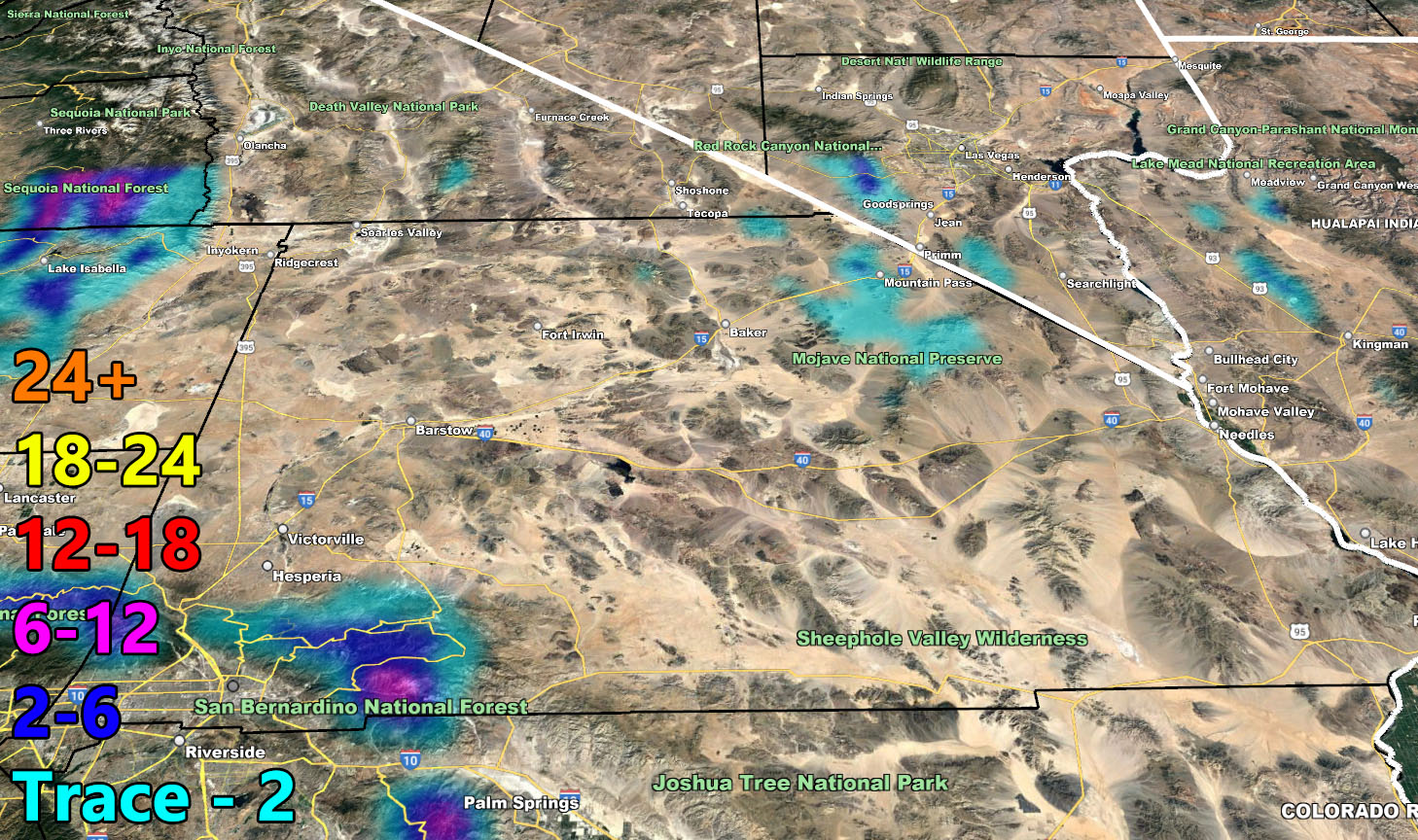
As I stated, this is a southern slider system. An inside slider slides to the north of us. A southern slider slides to the south, which puts a lot of the High and Low Desert out of the chances for precipitation and gives you the nominal high winds instead.
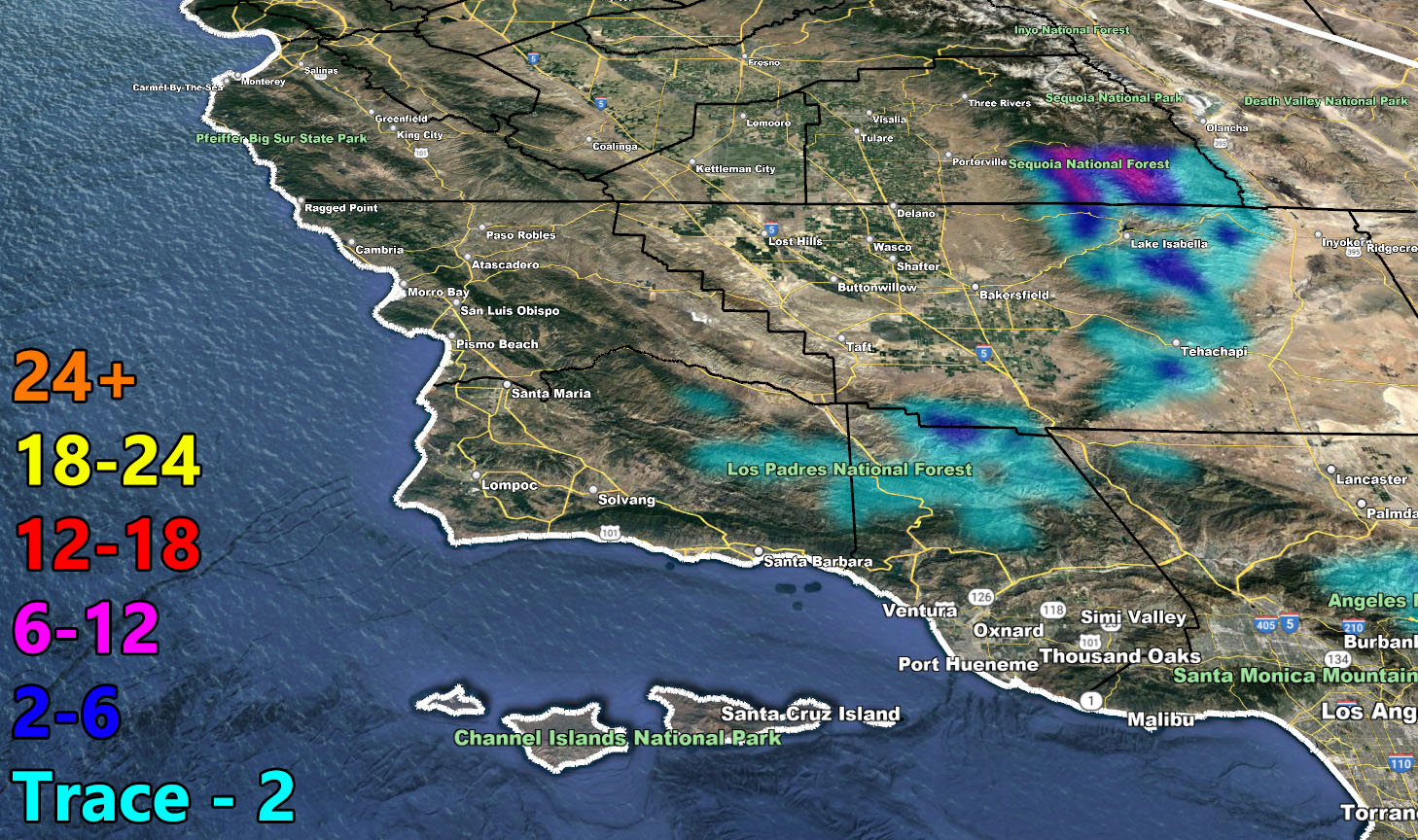
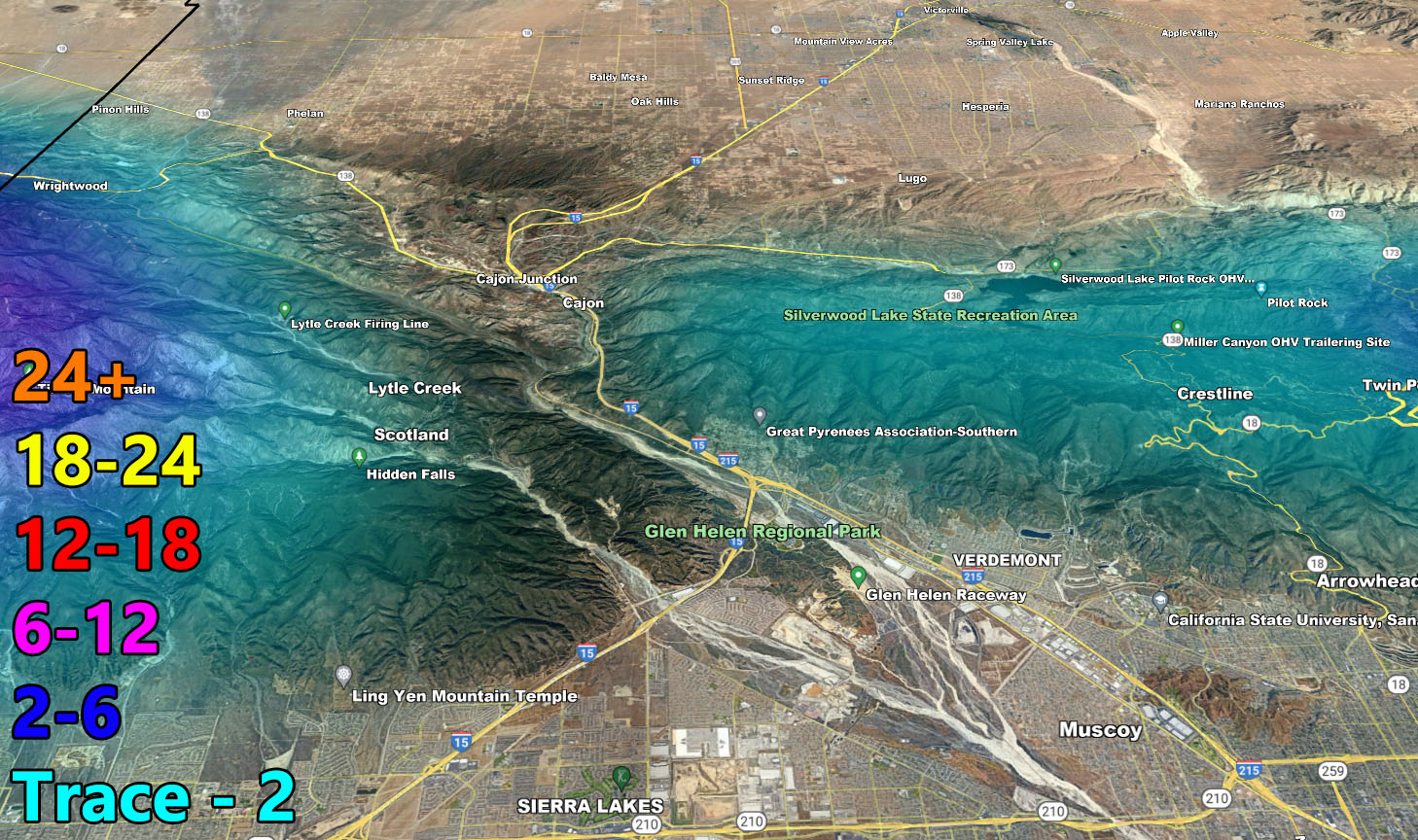
A southern slider also brings less snowfall for the mountain community areas. Because of the southern slide pattern, I’ll only put Big Bear as per the models here at Southern California Weather Force say and put you at the 1-2″ mark. Sure, can you get higher amounts in areas like Upper Moonridge, yes, but at the city level it will not do much. Your best timing for this will start around 8pm tonight with the upslope and increase only a bit from there, giving an inch by midnight and a bit more through the early morning hours before sunrise on your Tuesday.
Tehachapi you’re the same. A dusting at the airport tonight, possibly more a bit higher up. Use the maps below for this forecast, as is always the case.
This will clear on Tuesday, but not before residual showers behind the front hit and miss areas of LA, OC, SD, and IE.
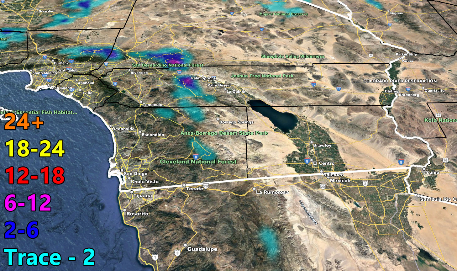
AHEAD IN WEATHER: A warm front will bring more showers through OC/LA/VT/IE on Wednesday for a brief moment before a stronger system moves in on Thursday, starting early morning west of Ventura through to SLO/Vandenberg and hitting the metros of LA/OC/SD/IE over the day. Yes, for once this will hit during the day and it will also produce more Flood Watch products from me, which will go out on Tuesday in the areas that are needed of it. The strongest risk for a higher-class flood watch for the stronger system will be Santa Barbara.
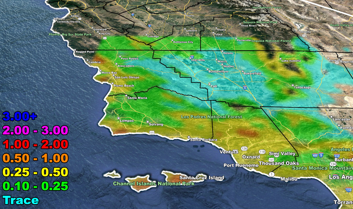
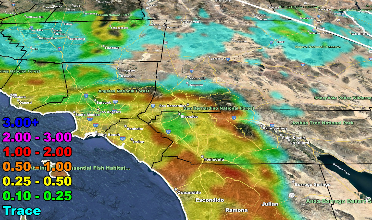
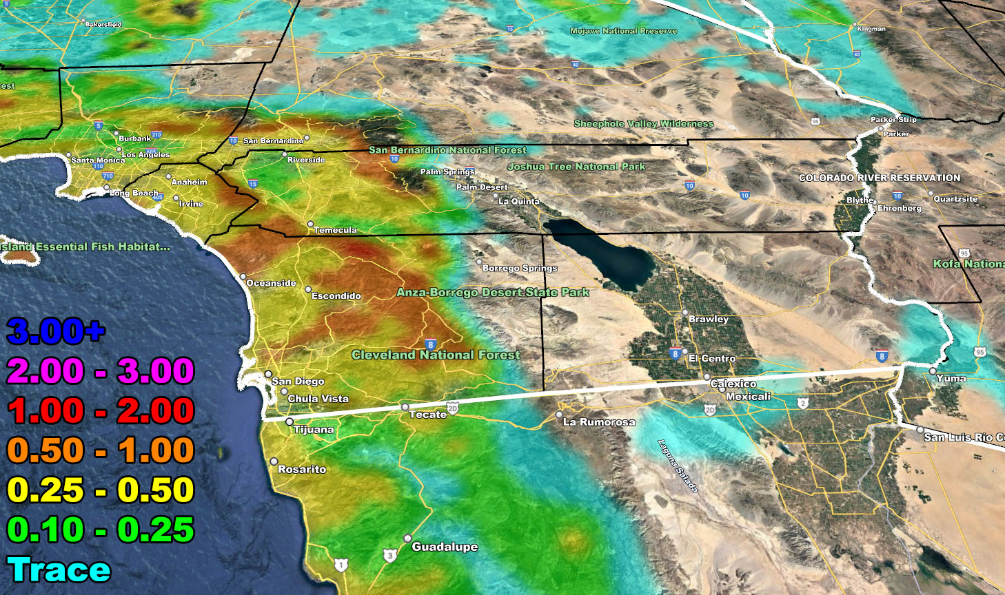
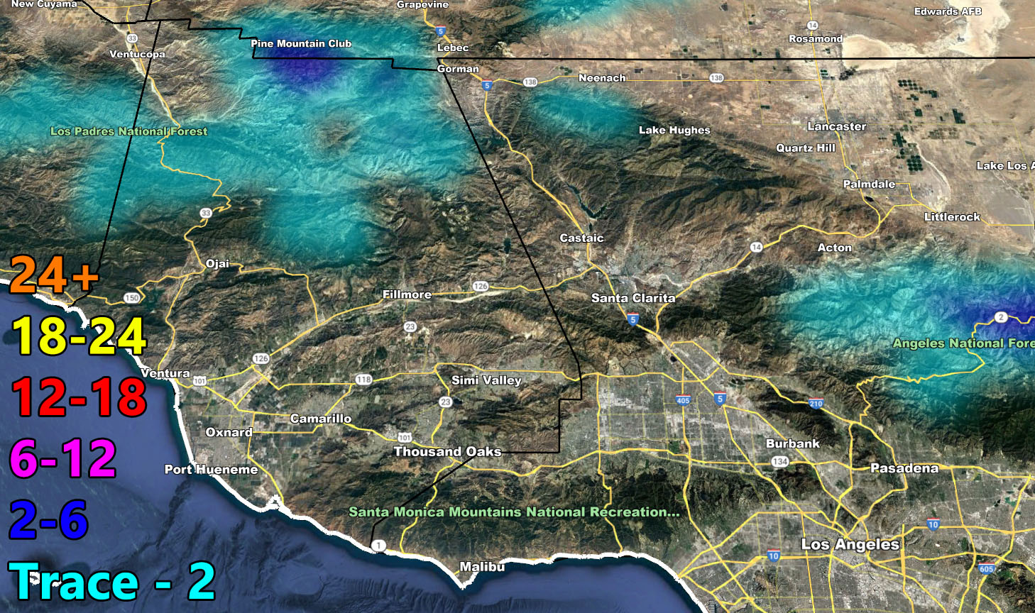
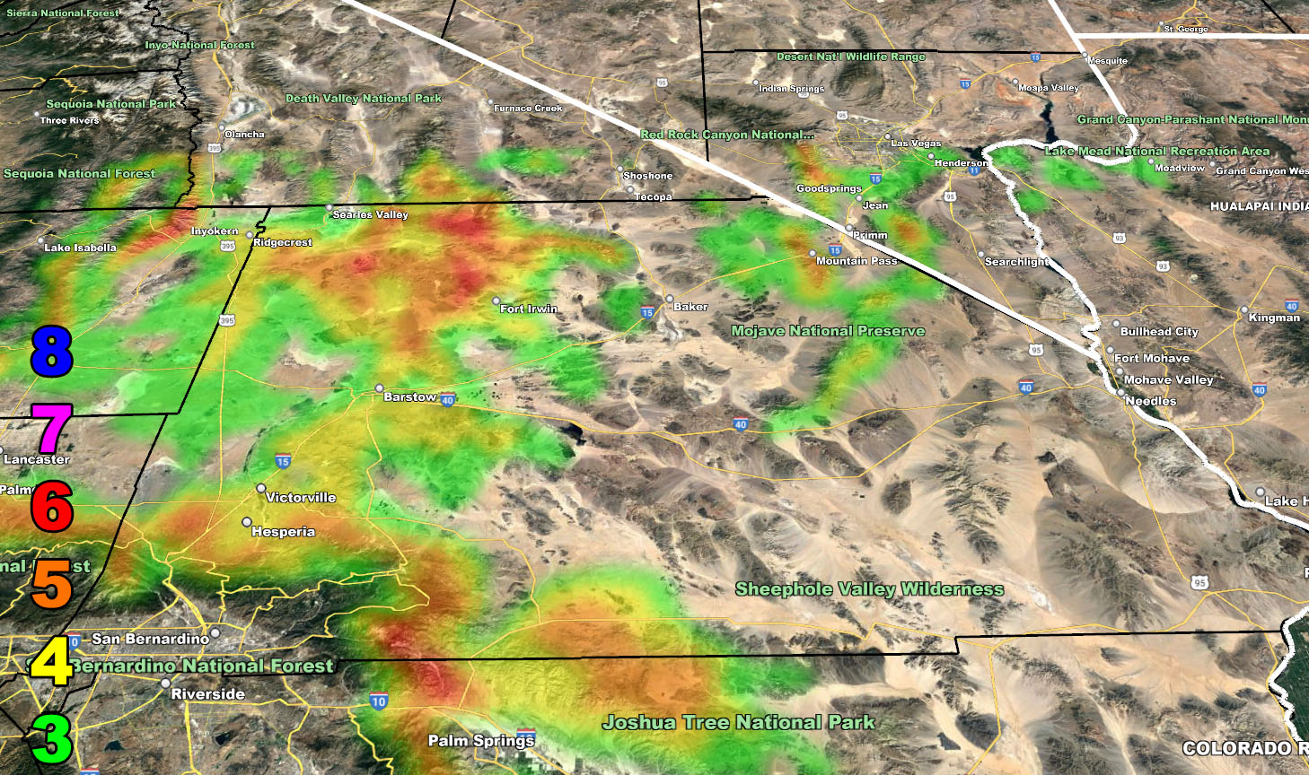
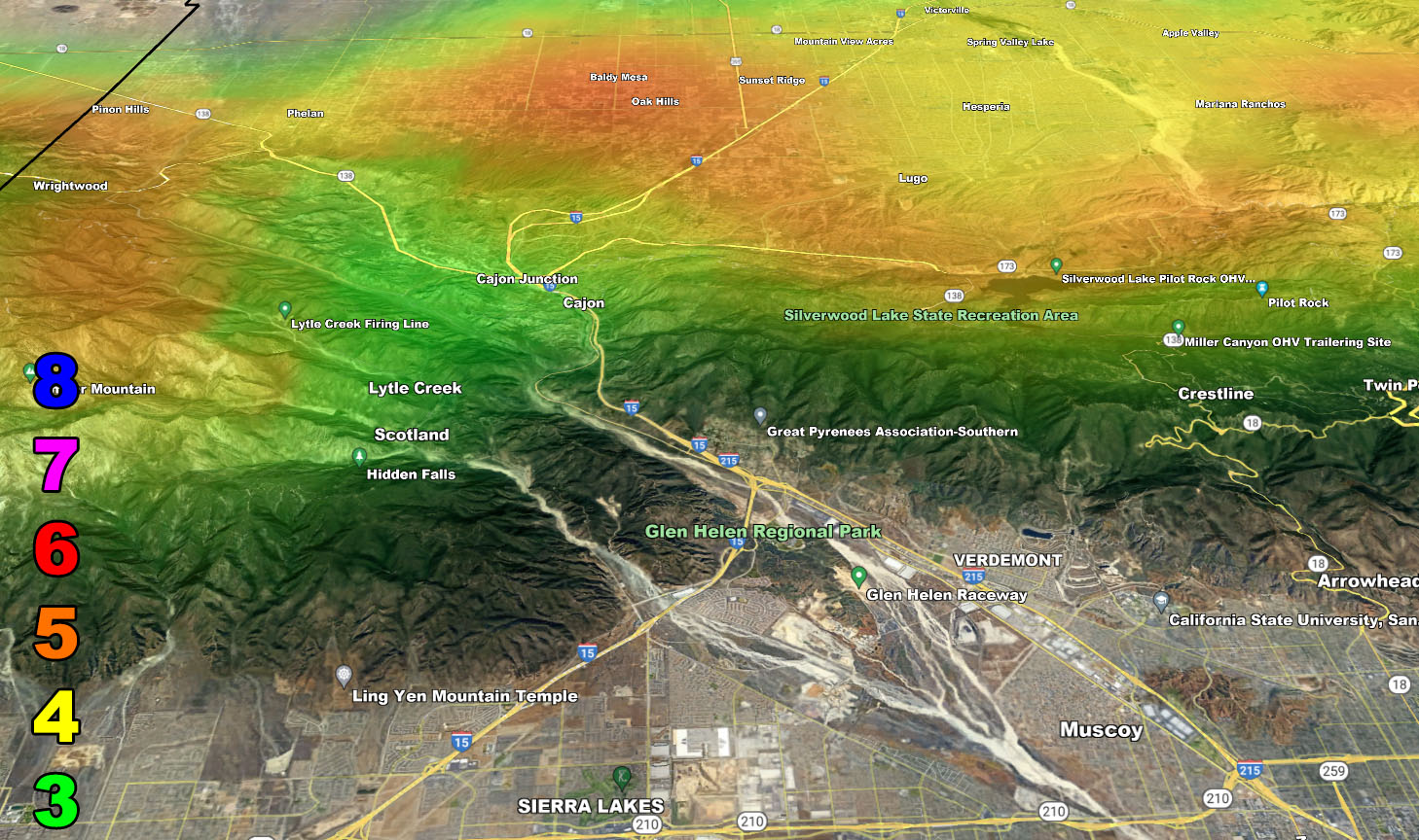
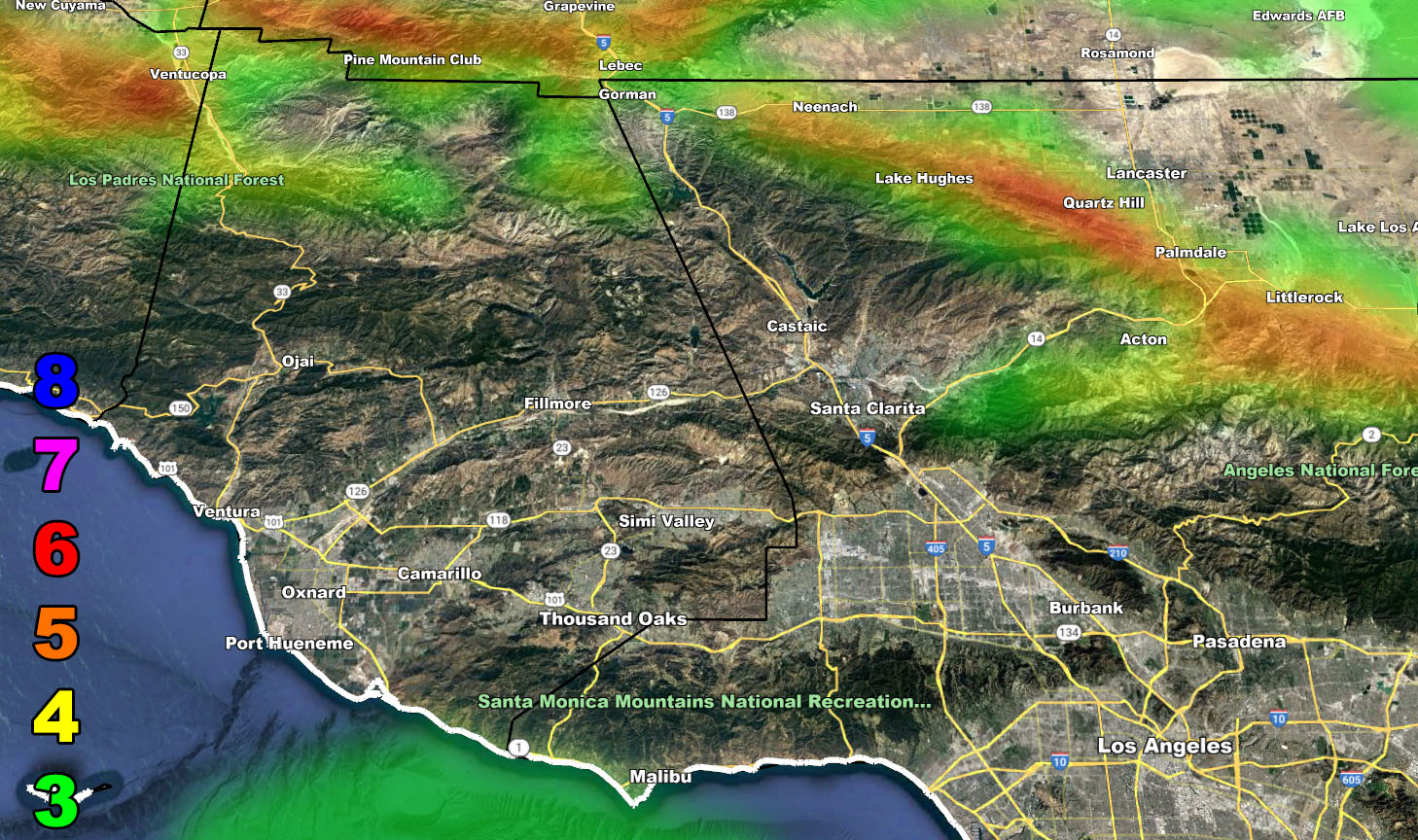
Rain Model – VALID TODAY INTO TUESDAY MORNING
SUPPORTING MEMBERS: Click Here To See The GPS Version Of This Model In Your Member Section Tab.
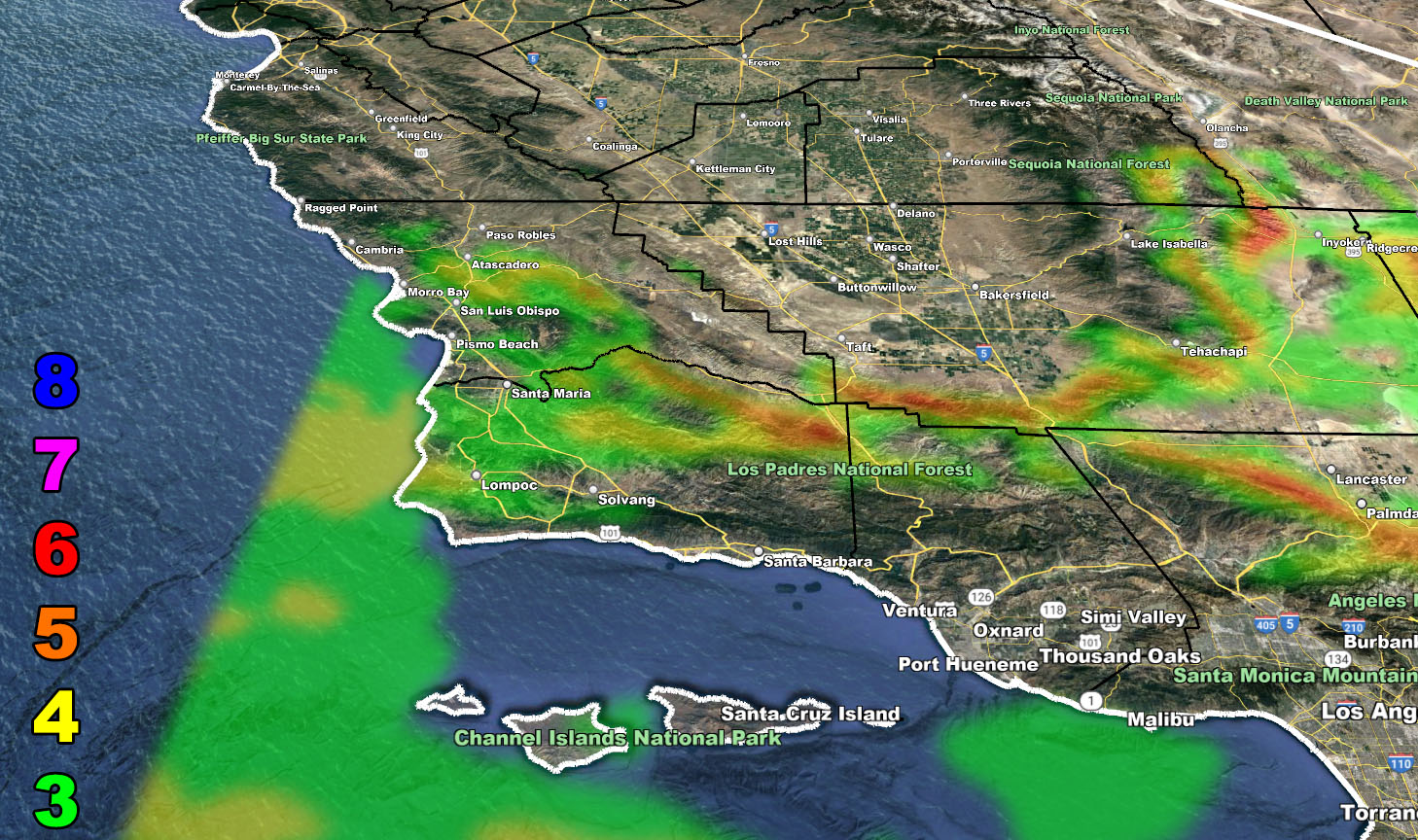
Snow Model – VALID TODAY INTO TUESDAY MORNING
SUPPORTING MEMBERS: Click Here To See The GPS Version Of This Model In Your Member Section Tab.
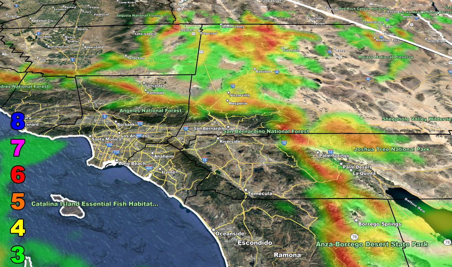
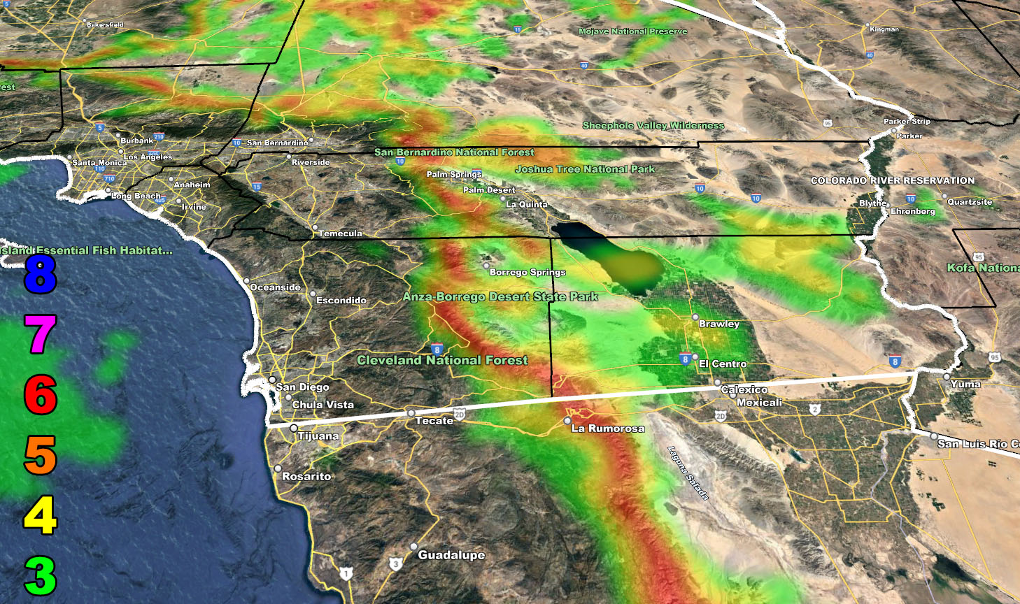
Wind Model – VALID TODAY INTO TUESDAY MORNING
SUPPORTING MEMBERS: Click Here To See The GPS Version Of This Model In Your Member Section Tab.
Raiden Storm Wind Gust Intensity Scale –
8. Extensive widespread damage.
7. Trees are broken or uprooted, building damage is considerable. – High Profile Vehicle Roll-Over CERTAIN.
6. SOME Trees are broken or uprooted, building damage is possible. – High Profile Vehicle Roll-Over Likely, Do NOT recommend Traveling in this zone. This zone also is the starting zone where trees and powerlines will fall and damage cars and even kill people near or in them!
5. Slight damage occurs to buildings, shingles are blown off of roofs. HIGH WIND WARNING CRITERIA – High Profile Vehicle Roll-Over Possible if weight is not corrected.
4. Twigs and small branches are broken from trees, walking is difficult.
3. Large trees sway, becoming difficult to walk. POWER SHUTDOWN THRESHOLD DURING FIRE WEATHER / WIND ADVISORY CRITERIA
WANT THESE DELIVERED WITH ALL THOSE PERKS INCLUDING BEING ON THE MICRO-CLIMATE ALERT SYSTEM AND MODELS DURING EVENTS BECAUSE NOT EVERY ALERT IS POSTED ON SOCIAL MEDIA FROM THIS WEATHER OFFICE – JOIN TODAY BY CLICKING HERE – Southern California Weather Force Subscriber System – Southern California Weather Force
Join The Main Southern California Weather Force Facebook Group (50 percent delivery time) – You can join the main SCWF page as well through that group.
Click Here To Join The Page Today