
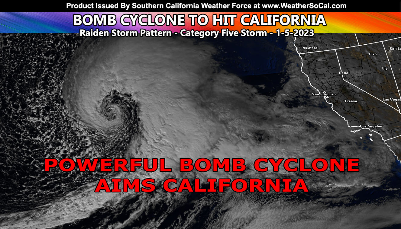
Southern California Weather Force has issued a Flood Watch effective overnight on Wednesday and into Thursday for all areas south and west of the mountains, including all local mountain areas and parts of the High Desert as well, including assigning this system a category five out of six on the Southern California Weather Force intensity scale. 100 MPH wind gusts are expected on the Gorman Pass on Wednesday into Thursday as the bomb cyclone intensifies off the California Coast, and as such Southern California Weather Force has also issued the rare Hurricane Wind Speed Warning so read on for the details and see the rain and wind models for Wednesday’s rain passage and the flood risk model for Thursday …
WANT THESE DELIVERED WITH ALL THOSE PERKS INCLUDING BEING ON THE MICRO-CLIMATE ALERT SYSTEM AND MODELS DURING EVENTS BECAUSE NOT EVERY ALERT IS POSTED ON SOCIAL MEDIA FROM THIS WEATHER OFFICE – JOIN TODAY BY CLICKING HERE – Southern California Weather Force Subscriber System – Southern California Weather Force
Join the Facebook Page for Further Updates If You Have Not Yet!
SOUTHERN CALIFORNIA WEATHER FORCE MAIN:
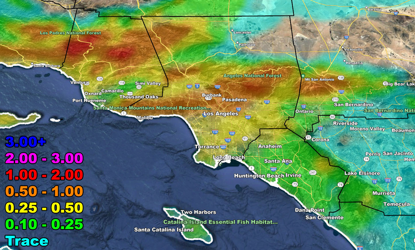
At the current time, satellite images continue to see a deepening low-pressure center about 1000 miles off the California Coast, moving fast to the east toward the forecast area. Pre-frontal rainfall will move over the Santa Barbara, Ventura, Los Angeles, Orange County, and parts of San Diego County north to the Inland Empire on Wednesday, starting in the morning. Some of the rainfall will be heavy at times, especially from Santa Barbara County to about Downtown Los Angeles. Areas between there will be the target zone for this first round along the cold front.
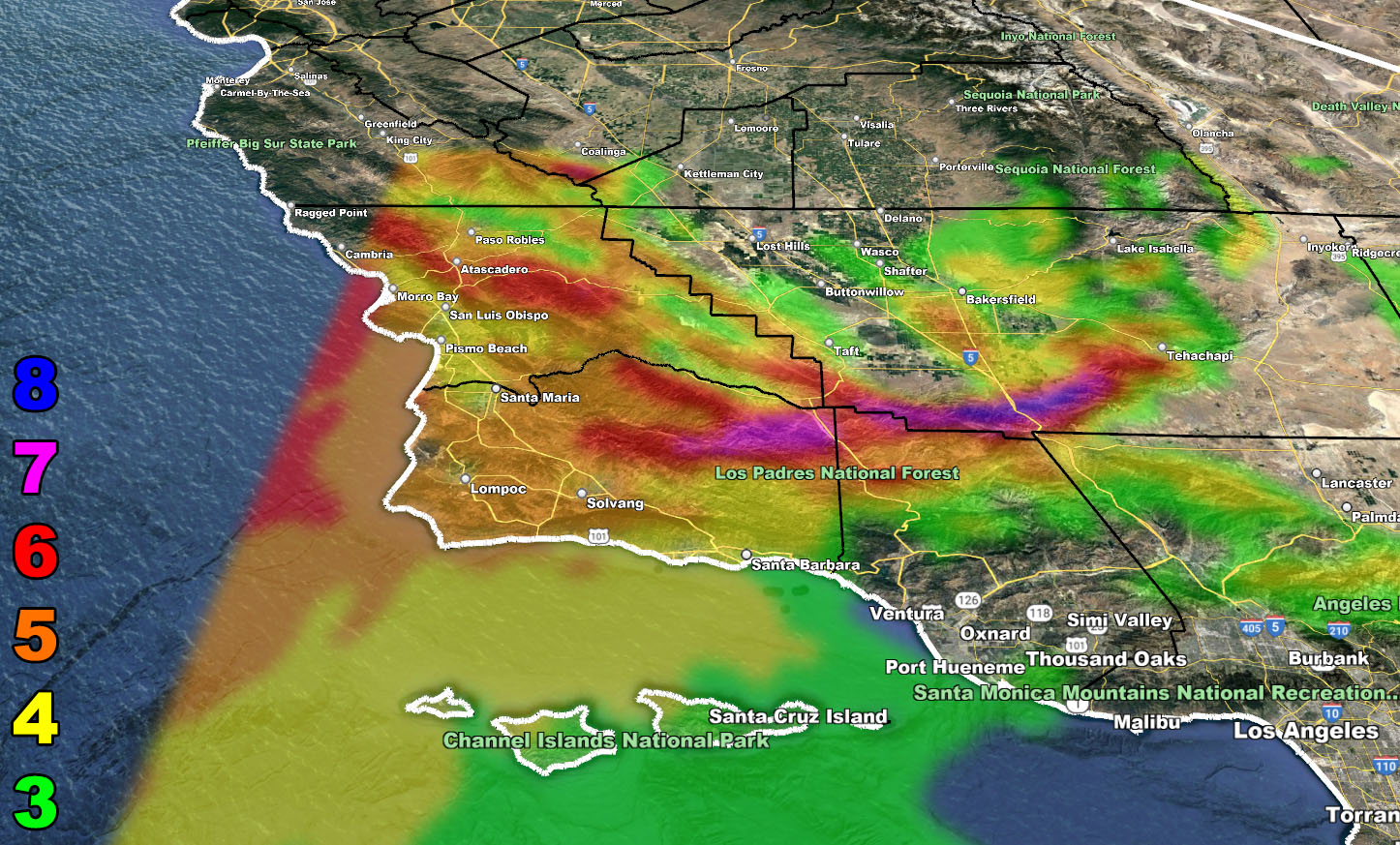
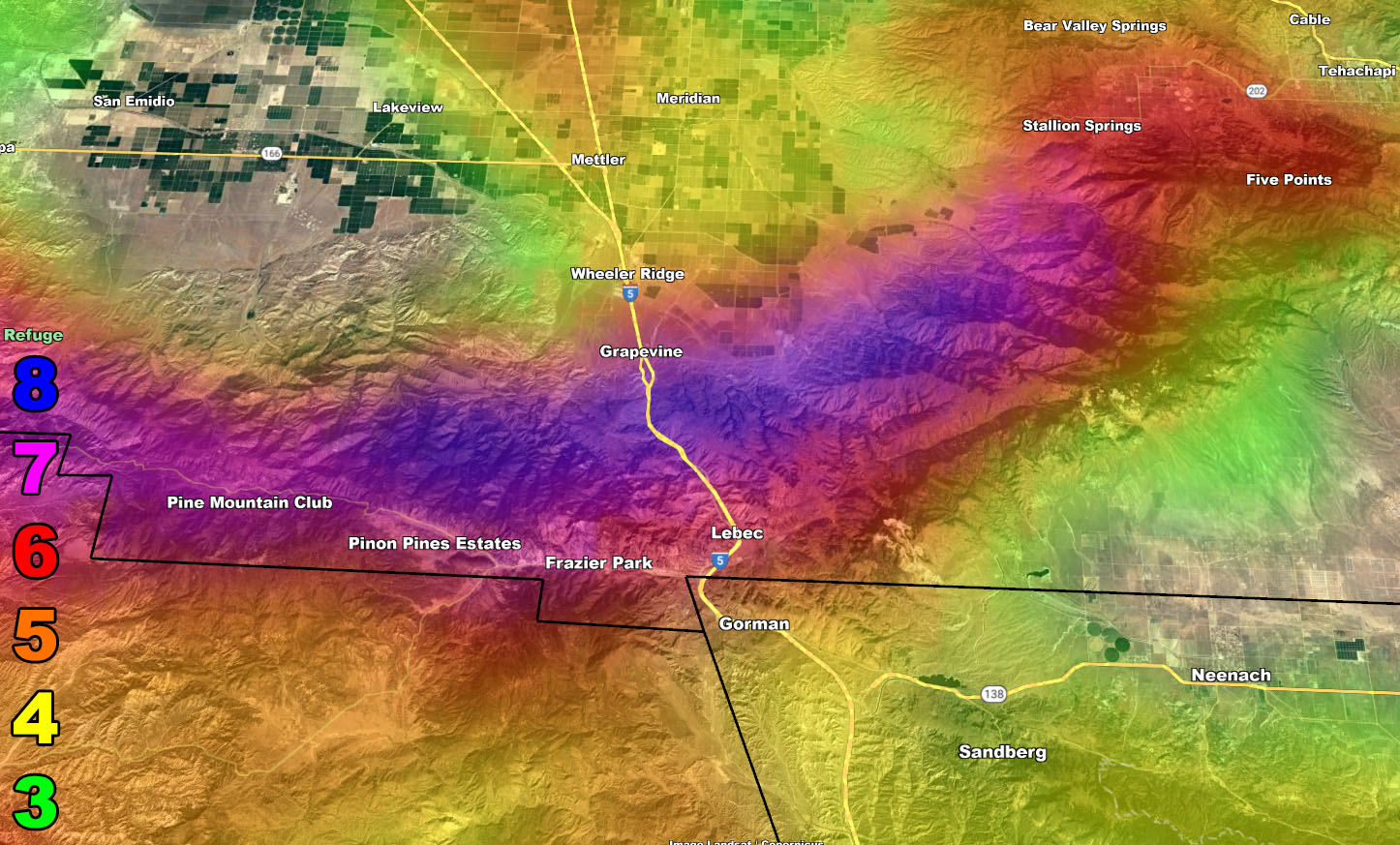
Also on Wednesday, the bomb cyclone will be placed northwest of the forecast area, which will suck in low-level winds out of the southeast. These winds will impact the mountains of Kern and Ventura, with the entire county zones of Santa Barbara and San Luis Obispo being affected as well. This is High Wind Warning criteria in these areas, but I did issue the rare Hurricane Wind Speed Warning for the Cuddy Valley, including the top of the Gorman Pass. As shown in the Southern California Weather Force wind models below, the blue shade is a Level 8, the highest in the Raiden Storm Wind Intensity Scale. I did decide to add a 7th image to the wind models that zoom into this alert zone, which also includes Pine Mountain Club.
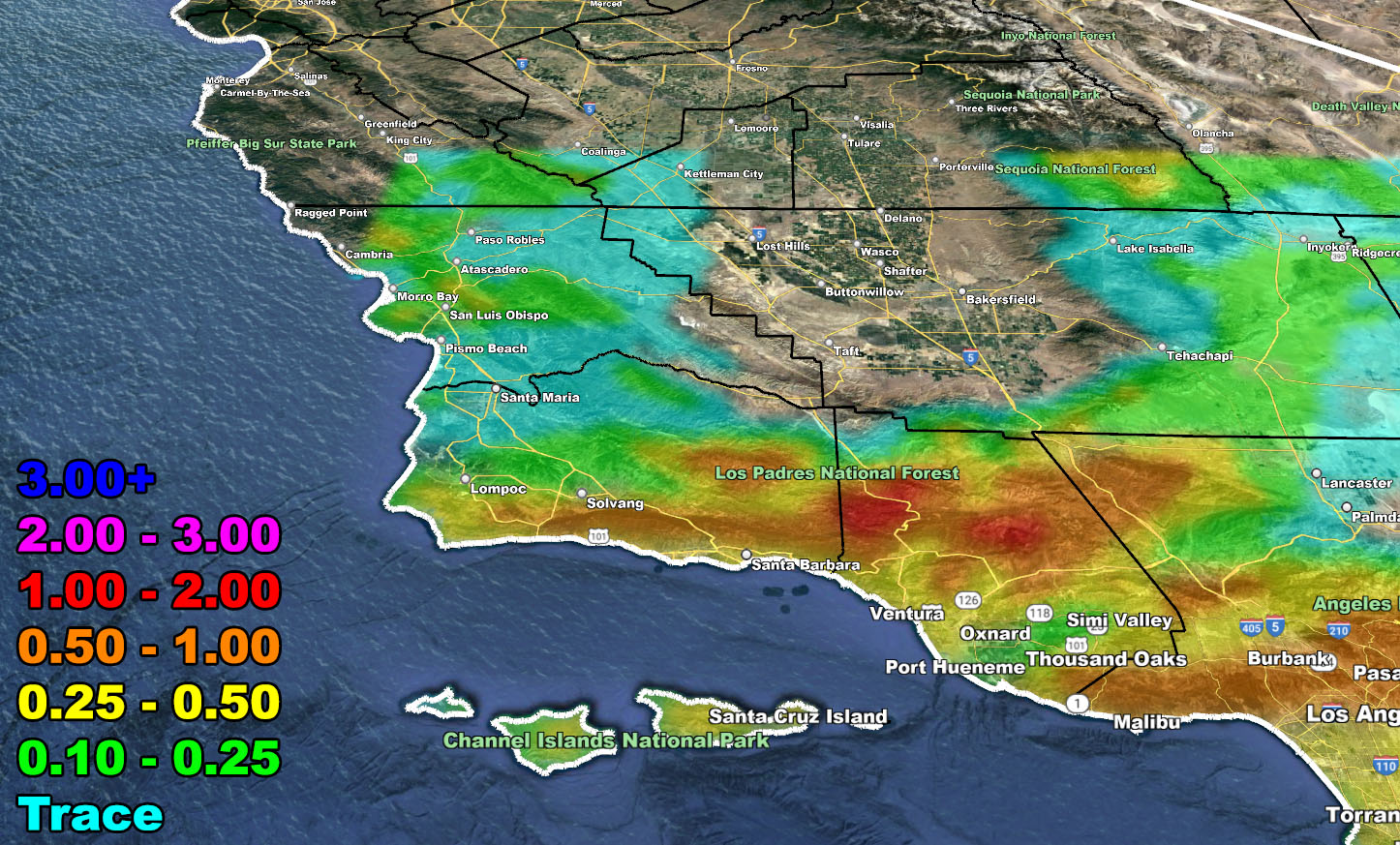
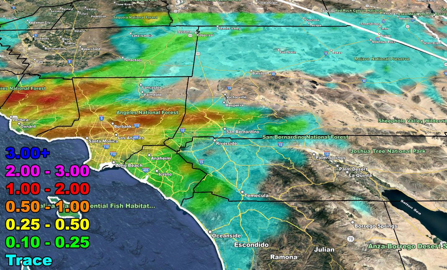
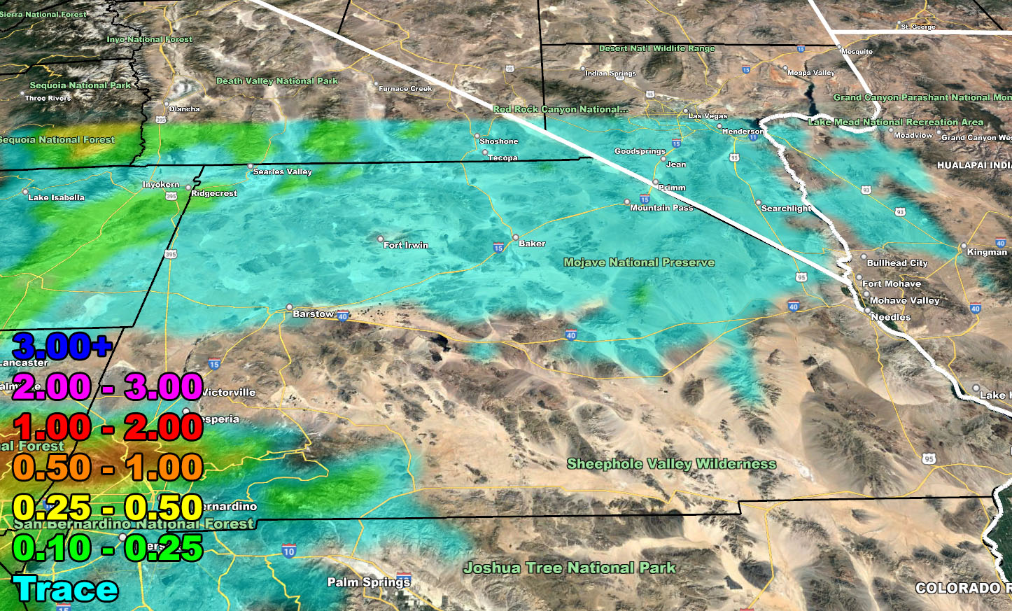
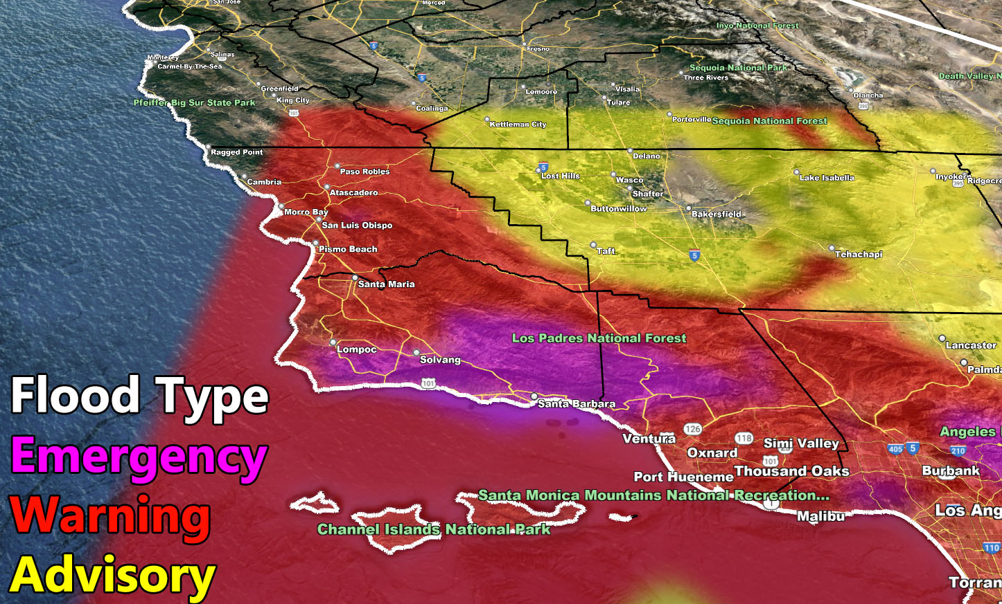
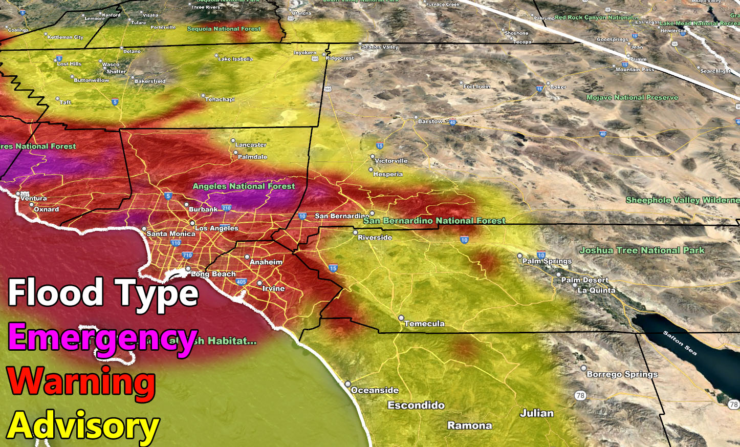
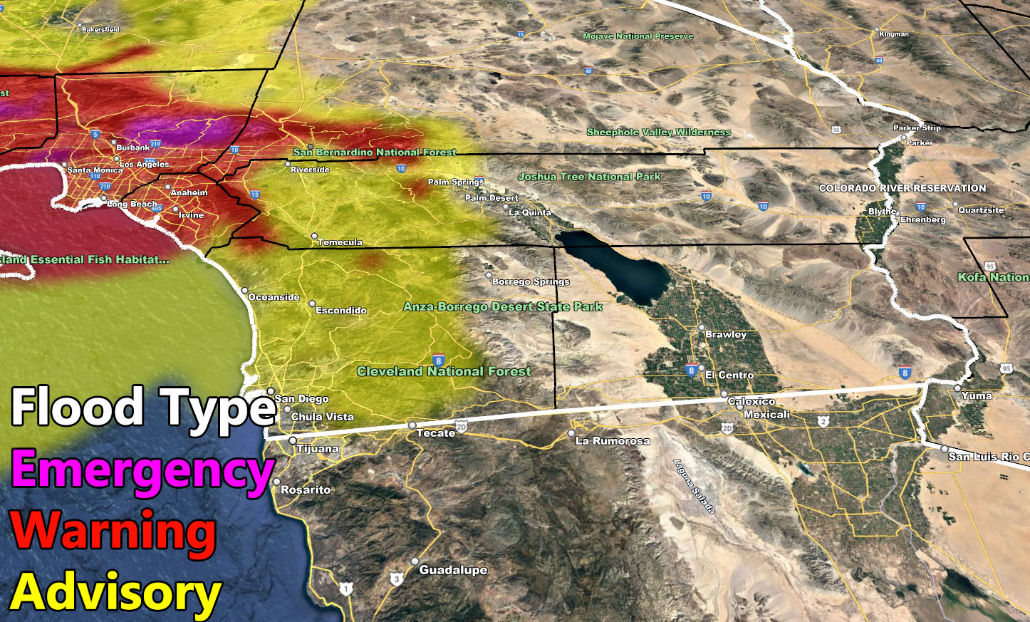
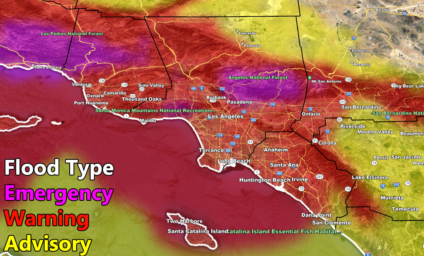
The flood risk models here at SOuthern California Weather Force for Thursday has prompted me to issue the official Flood Watch as well. These locations include, SLO, SBA, VT, LA, OC, SD County, north through the Inland Empire, and off into the Hesperia, Lancaster, and all of the Kern County zones as well. This will stop short of Barstow to the north and Palm Springs to the east, where far less rainfall will fall in those areas.
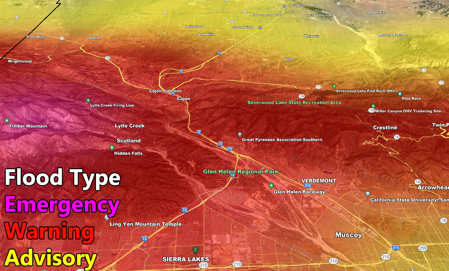
The highest risk will be the pending Flood Emergency zone for the Santa Barbara area. If you are there, you should take tomorrow with the weaker warm front to get everything ready as a Flood Emergency will pose the greatest threat to life, property, and travel. Flood Warning criteria expands through the population zones of Ventura, SLO, LA, OC, and parts of the Inland Empire zones, mainly from Fontana to Corona/Lake Elsinore along Interstate 15. The yellow indication on the flood risk model is the pending Flood Advisory product. While you will see advisory level street flooding, it is a lower risk for damaging flood conditions. This expands for most of the Inland Empire, High Desert, Kern County, and San Diego County areas.
As you can see from the Flood Risk Model below, this system will clearly affect areas from OC/LA westward more than south and eastward. As such, this system has been assigned a Category Five, which like a hurricane means that some of you are in that category, and others on the outskirts. The center of Category Five conditions will be Santa Barbara, which means debris flows as well.
High Winds will accompany the frontal zone in all areas, which means in the metros you will have the risk of trees and power poles falling down. This can and will affect some of you with a loss of power.
LONG RANGE: As stated in the Long-Range Weather Advisory, a secondary atmospheric river event will happen after a lull in activity when this current storm departs, targeting next week into mid-month. This is the second Raiden Storm Pattern, dubbed the Raiden Storm Pattern of January 2023 when it hits.
Southern California Weather Force will officially finalize the flood areas on Wednesday, when the warm front precipitation is in progress. rain and wind models will be updated for the main part of the coming system. But for now, the rain and wind models are only updated for Wednesday’s warm front.
Rain Model – VALID WEDNESDAY
SUPPORTING MEMBERS: Click Here To See The GPS Version Of This Model In Your Member Section Tab.


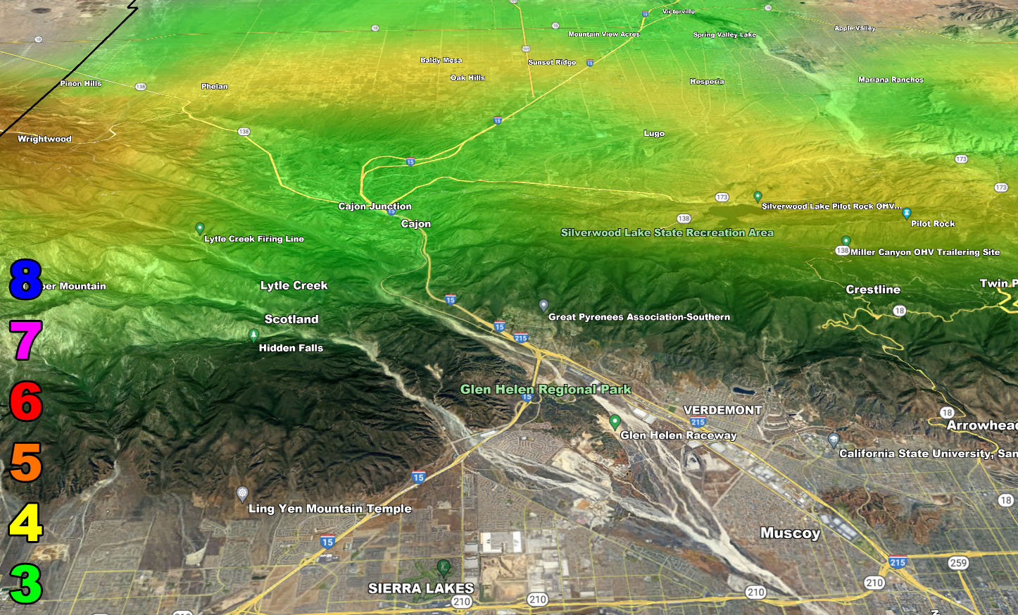
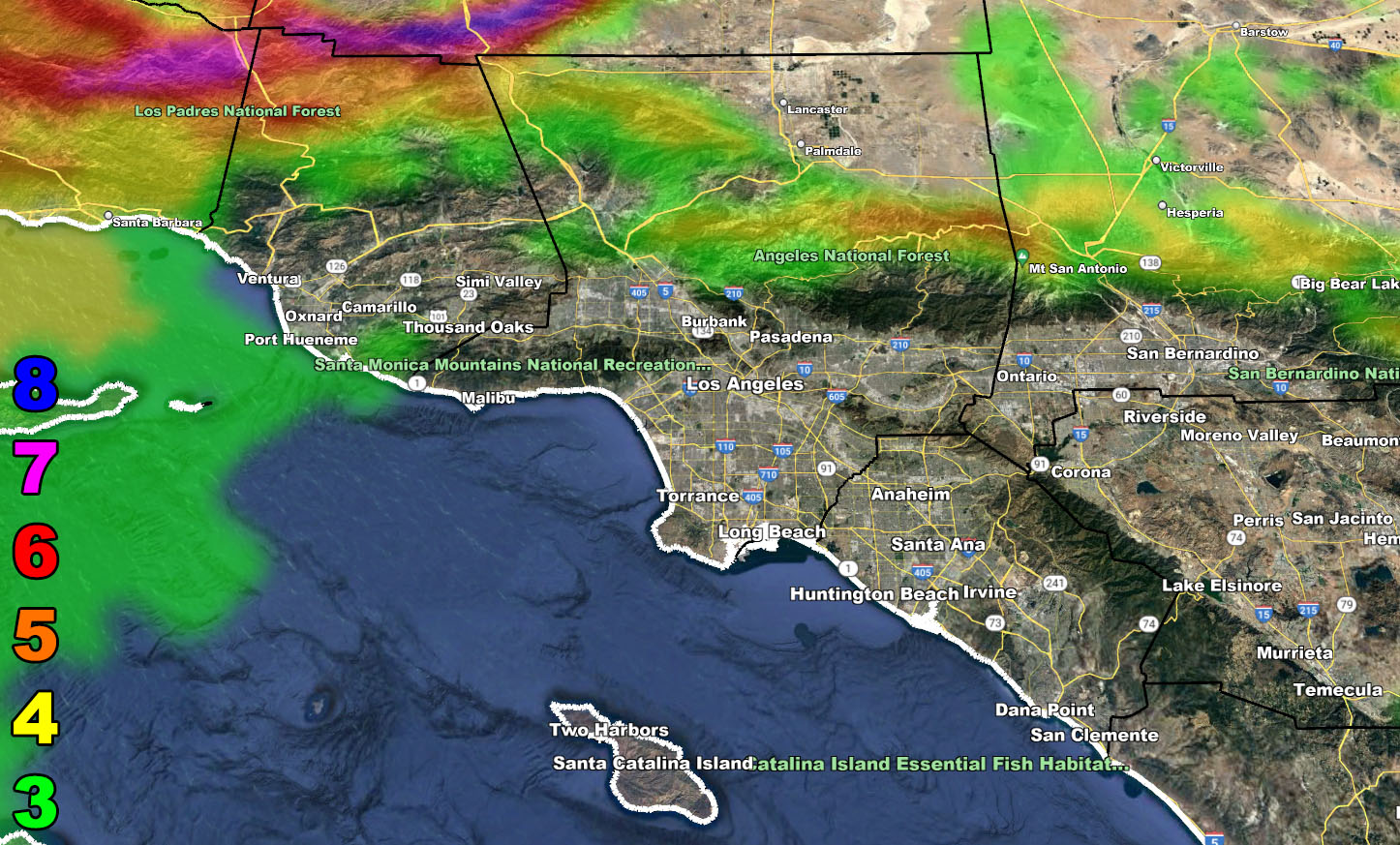
Wind Model – VALID WEDNESDAY – NOTE That the last image is a special zoom-in to Gorman Pass
SUPPORTING MEMBERS: Click Here To See The GPS Version Of This Model In Your Member Section Tab.
Raiden Storm Wind Gust Intensity Scale –
8. Extensive widespread damage.
7. Trees are broken or uprooted, building damage is considerable. – High Profile Vehicle Roll-Over CERTAIN.
6. SOME Trees are broken or uprooted, building damage is possible. – High Profile Vehicle Roll-Over Likely, Do NOT recommend Traveling in this zone. This zone also is the starting zone where trees and powerlines will fall and damage cars and even kill people near or in them!
5. Slight damage occurs to buildings, shingles are blown off of roofs. HIGH WIND WARNING CRITERIA – High Profile Vehicle Roll-Over Possible if weight is not corrected.
4. Twigs and small branches are broken from trees, walking is difficult.
3. Large trees sway, becoming difficult to walk. POWER SHUTDOWN THRESHOLD DURING FIRE WEATHER / WIND ADVISORY CRITERIA
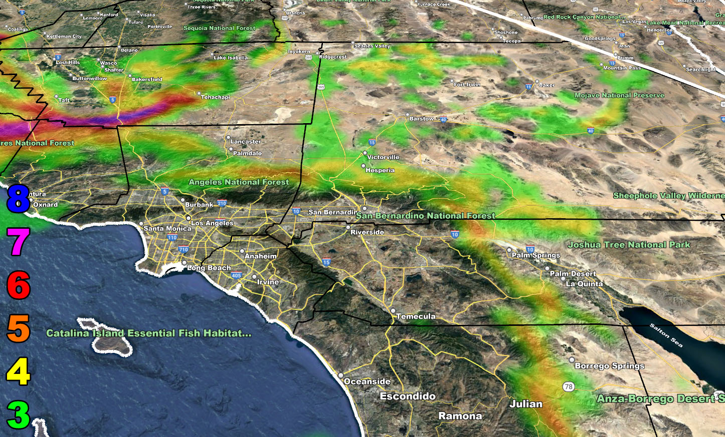

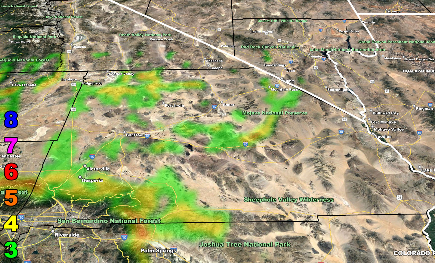
Flood Risk Model – VALID OVERNIGHT WEDNESDAY INTO THURSDAY

WANT THESE DELIVERED WITH ALL THOSE PERKS INCLUDING BEING ON THE MICRO-CLIMATE ALERT SYSTEM AND MODELS DURING EVENTS BECAUSE NOT EVERY ALERT IS POSTED ON SOCIAL MEDIA FROM THIS WEATHER OFFICE – JOIN TODAY BY CLICKING HERE – Southern California Weather Force Subscriber System – Southern California Weather Force
Join The Main Southern California Weather Force Facebook Group (50 percent delivery time) – You can join the main SCWF page as well through that group.
Click Here To Join The Page Today