
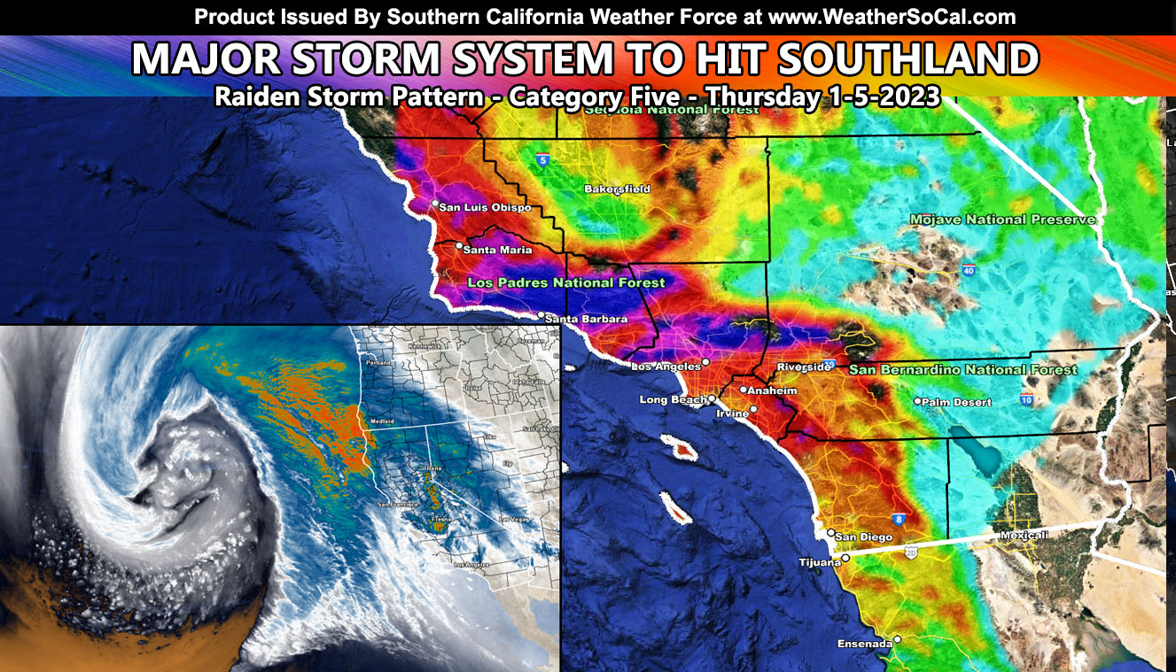
Southern California Weather Force has issued five additional weather alerts for the system expected to mainly impact overnight tonight west of Los Angeles and Thursday through the rest of the forecast area. The alerts issued contain the Flood Emergency, Flood Warning, Flood Advisory, Winter Storm Warning, and Winter Weather Advisory along with a complete in-office model suite for you to view for rain, snow, wind, and flood risk impacts. Within this update you will also notice a change in the snow model, which now zooms in on mountain range locations instead of the standard grid locations of the other models so for your area, read on for details …
WANT THESE DELIVERED WITH ALL THOSE PERKS INCLUDING BEING ON THE MICRO-CLIMATE ALERT SYSTEM AND MODELS DURING EVENTS BECAUSE NOT EVERY ALERT IS POSTED ON SOCIAL MEDIA FROM THIS WEATHER OFFICE – JOIN TODAY BY CLICKING HERE – Southern California Weather Force Subscriber System – Southern California Weather Force
Join the Facebook Page for Further Updates If You Have Not Yet!
SOUTHERN CALIFORNIA WEATHER FORCE MAIN:
As per the Wednesday forecast (Click Here To Read That Archive), we are having a warm front sweep out of the south, moving over mainly the Los Angeles to Santa Barbara County locations, with some of you by the time this is released on social media (10am) seeing rainfall already, well ahead of the main storm front.
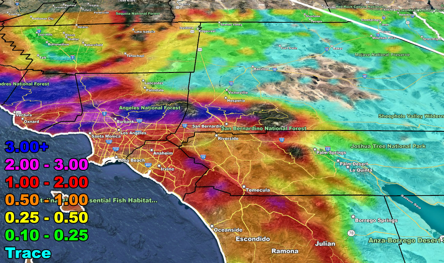
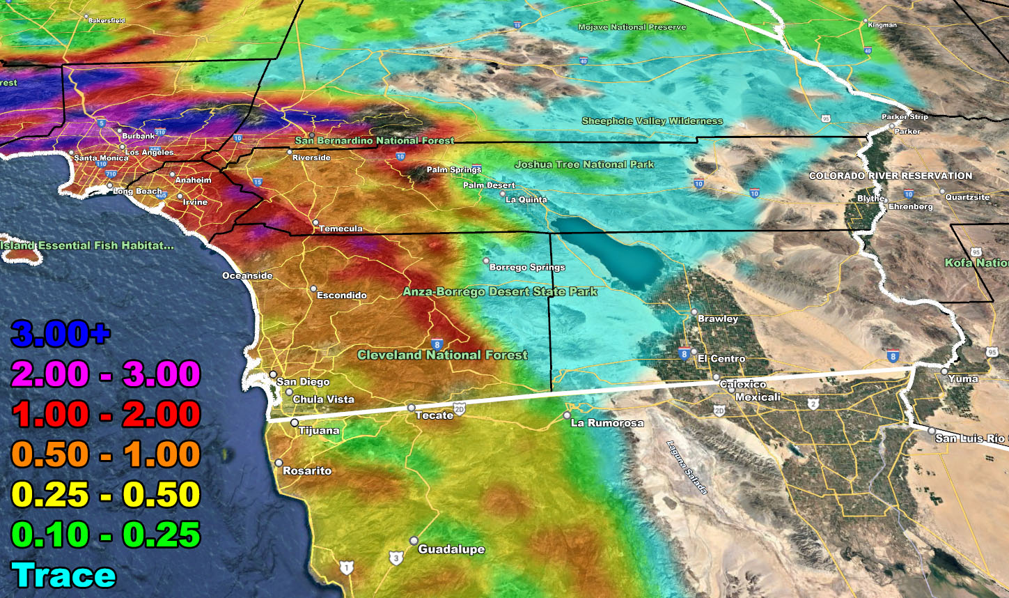
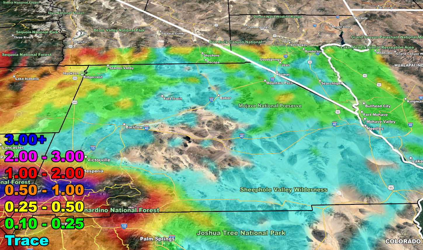
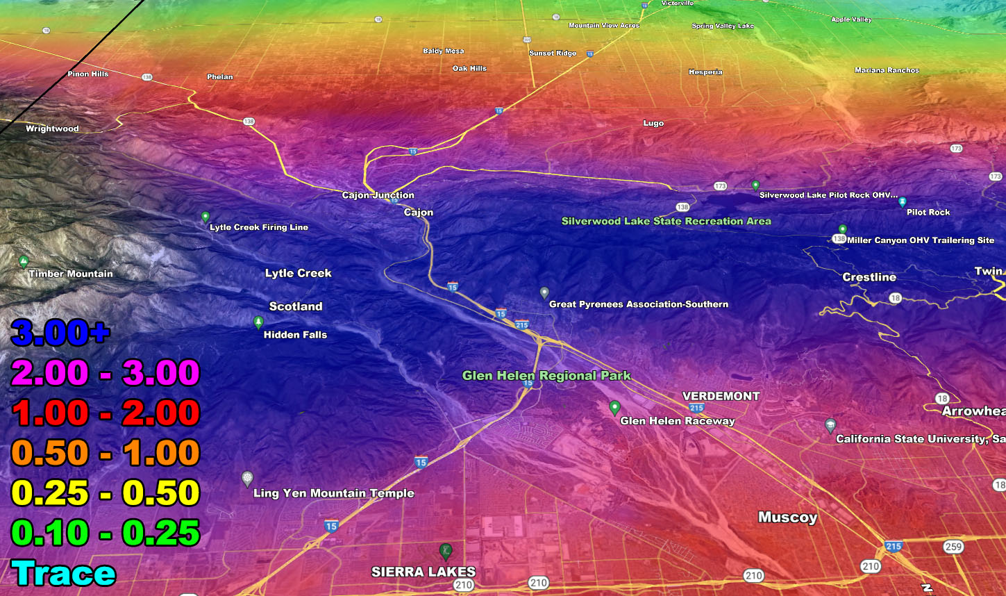
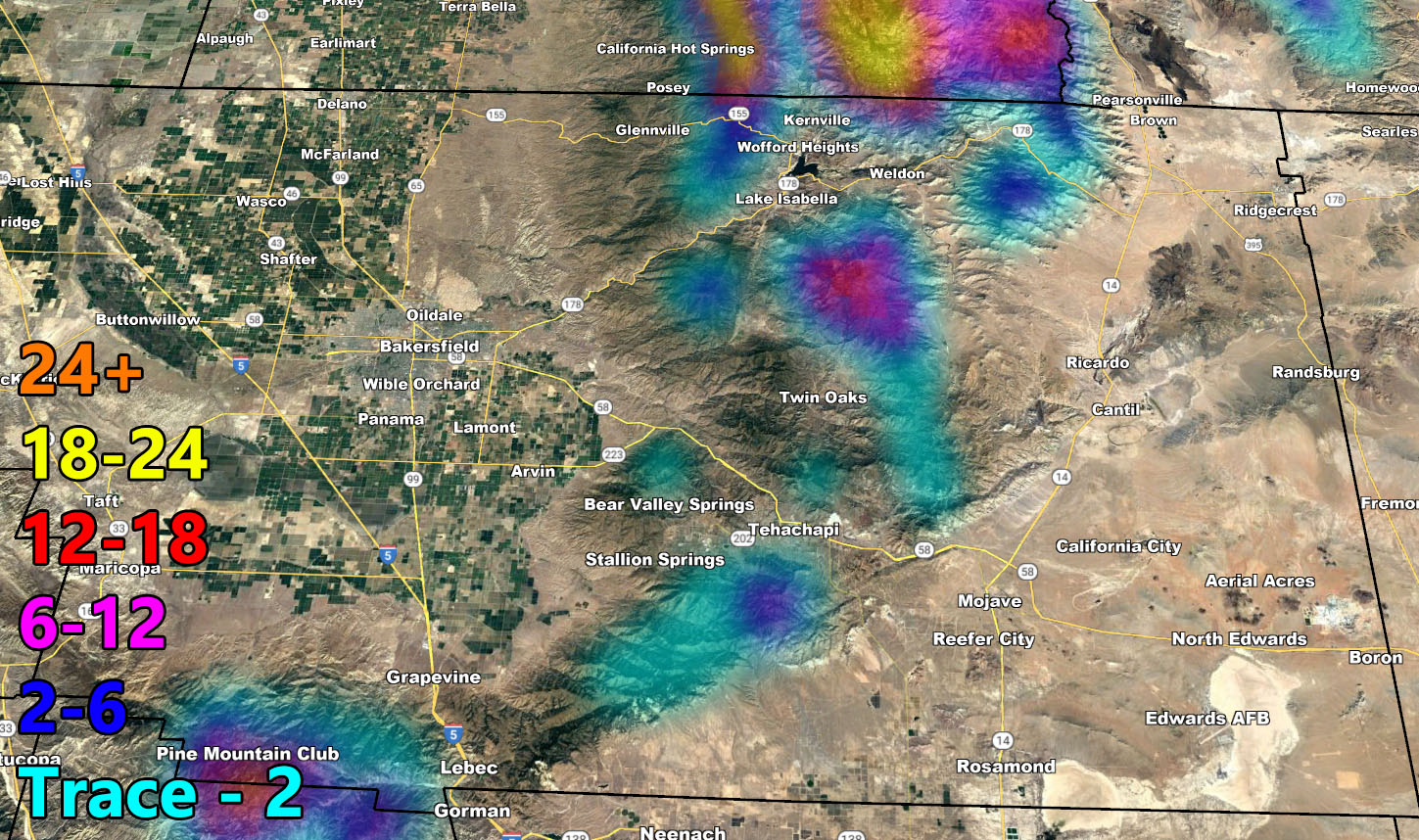
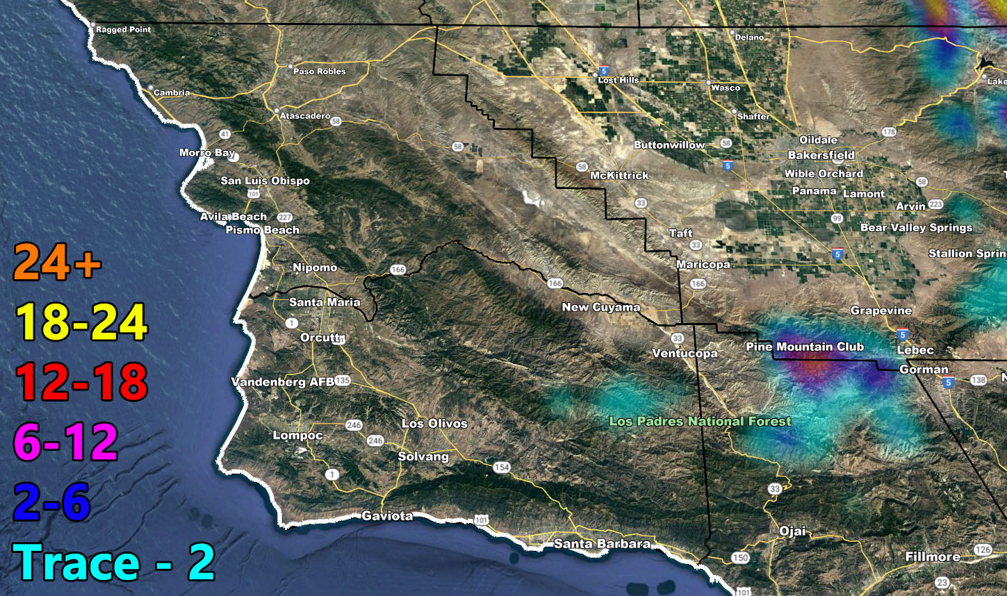
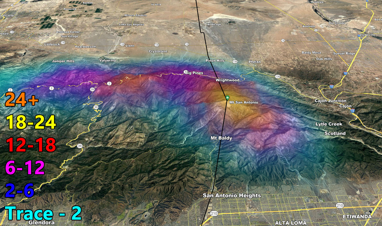
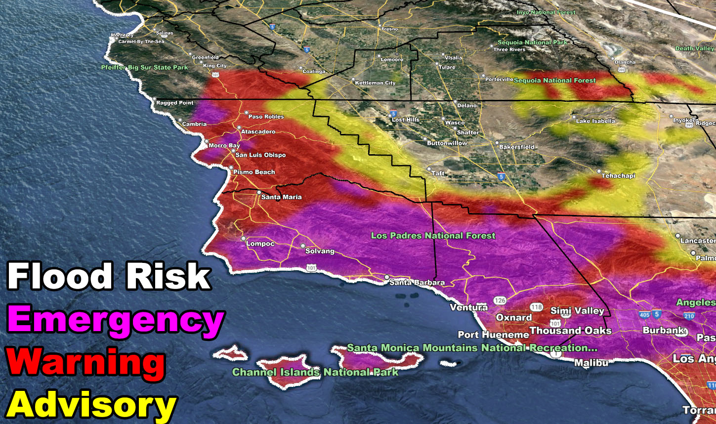
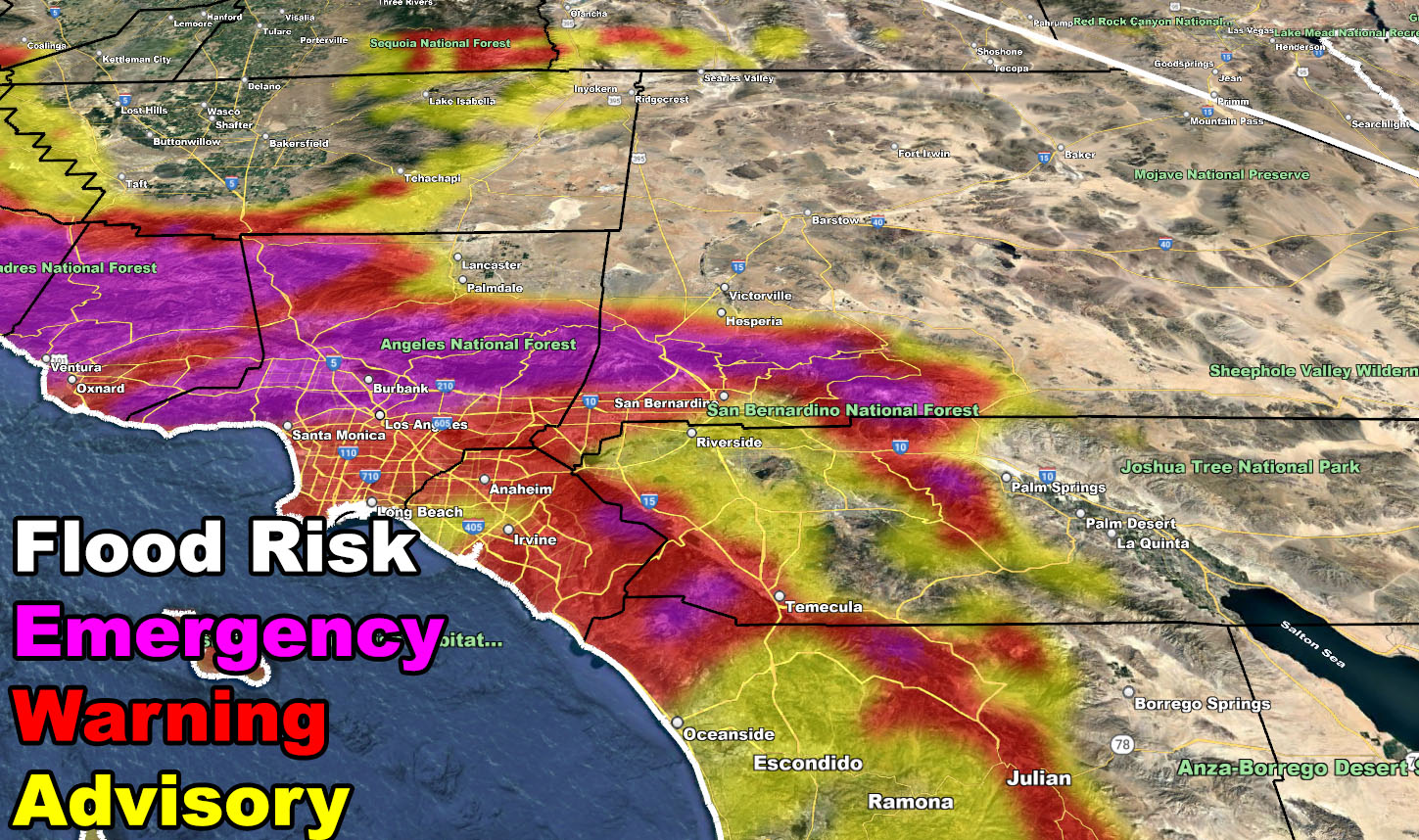
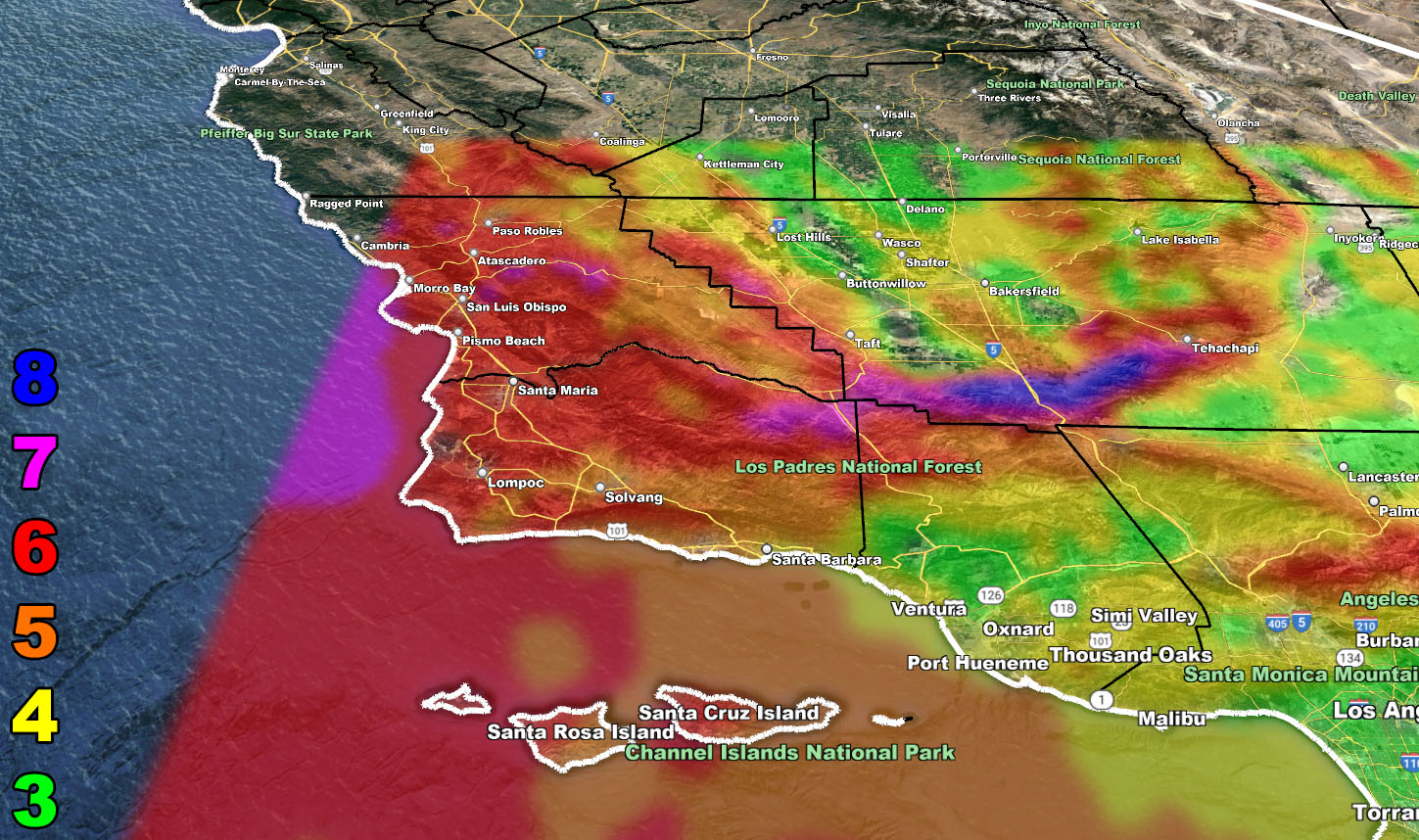
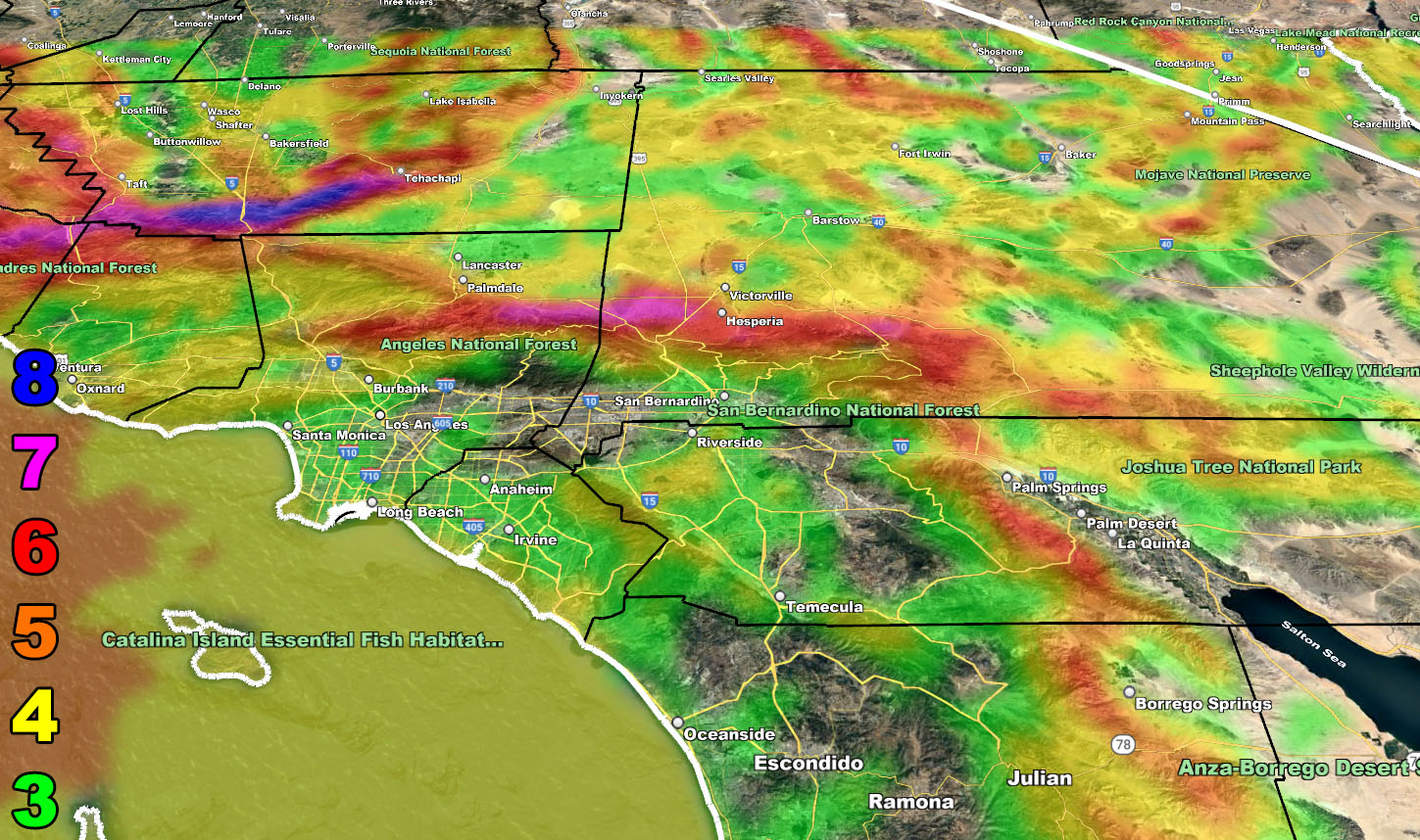
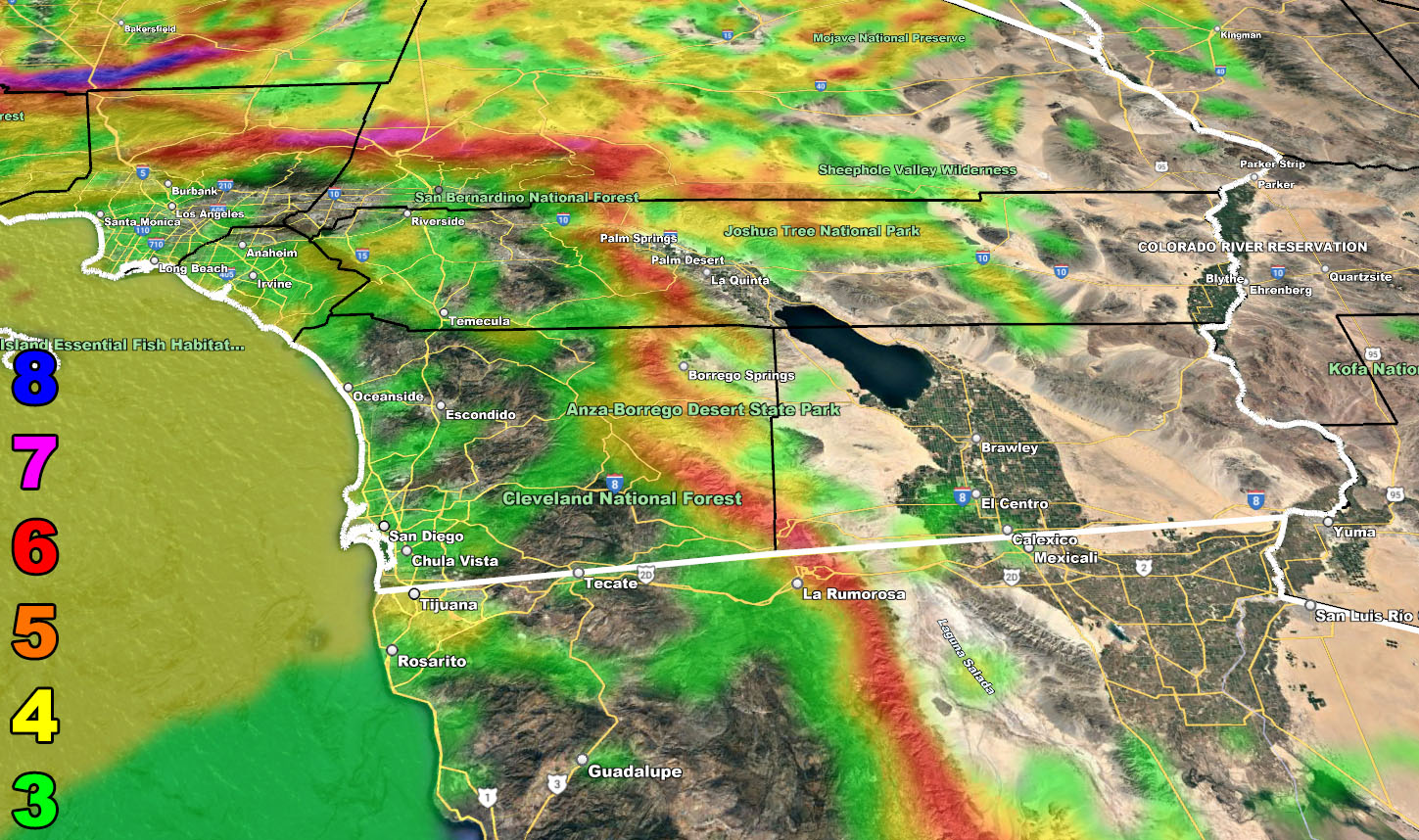
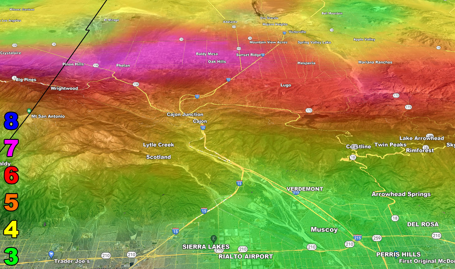
MAIN FRONT TIMING: The main storm front will start to impact San Luis Obispo to Vandenberg by around 9pm tonight, Santa Barbara by 11pm, Ventura by midnight, Downtown Los Angeles 3am on Thursday morning, Orange County and Ontario by 5am, San Diego by 7am and Las Vegas by 11am. One thing I will certainly note is the amount of rain shadow effect that will accompany the front in the Bakersfield zone. As per my models, during the overnight passage tonight, far less amounts will be expected there than south of the mountains. That is how it works, the mountains block most of the moisture to the north of them, which is the rest we have the Mojave Desert of today as well. This rain-shadow will also be for parts of the Inland Empire with the Santa Ana Mountains blocking moisture to the northeast as well so use the rain models below.
WIND: Wind will be everywhere, the strongest along the frontal zone. Trees and powerlines will go down at times, and it can lead to the loss of power. The strongest winds will be in the Cuddy Valley, including Gorman with 100 mph wind gusts later this evening into overnight tonight.
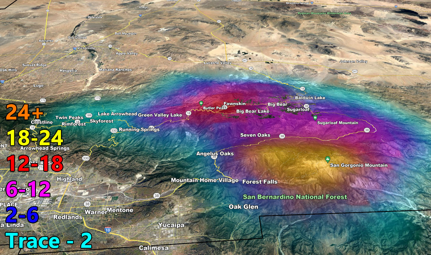
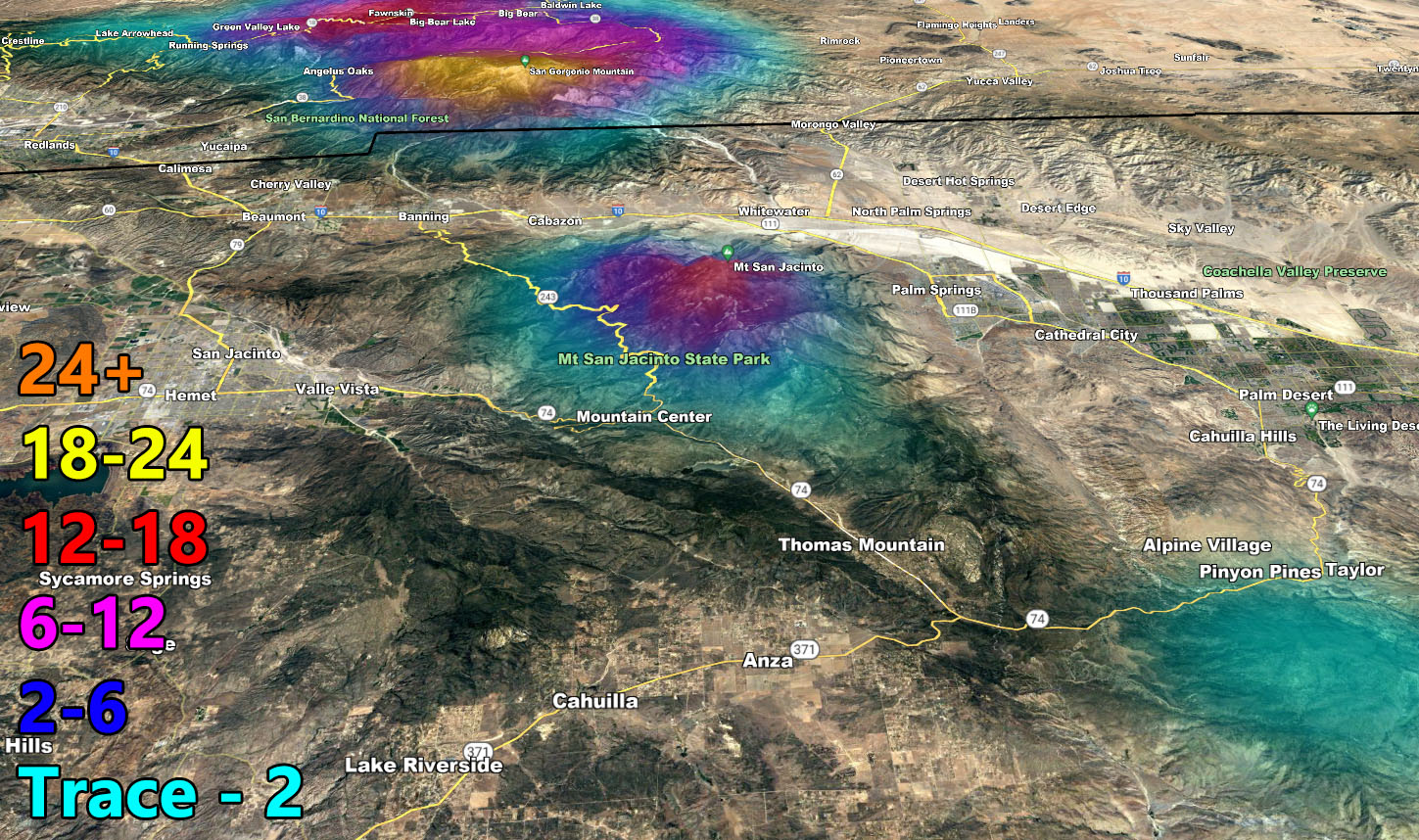
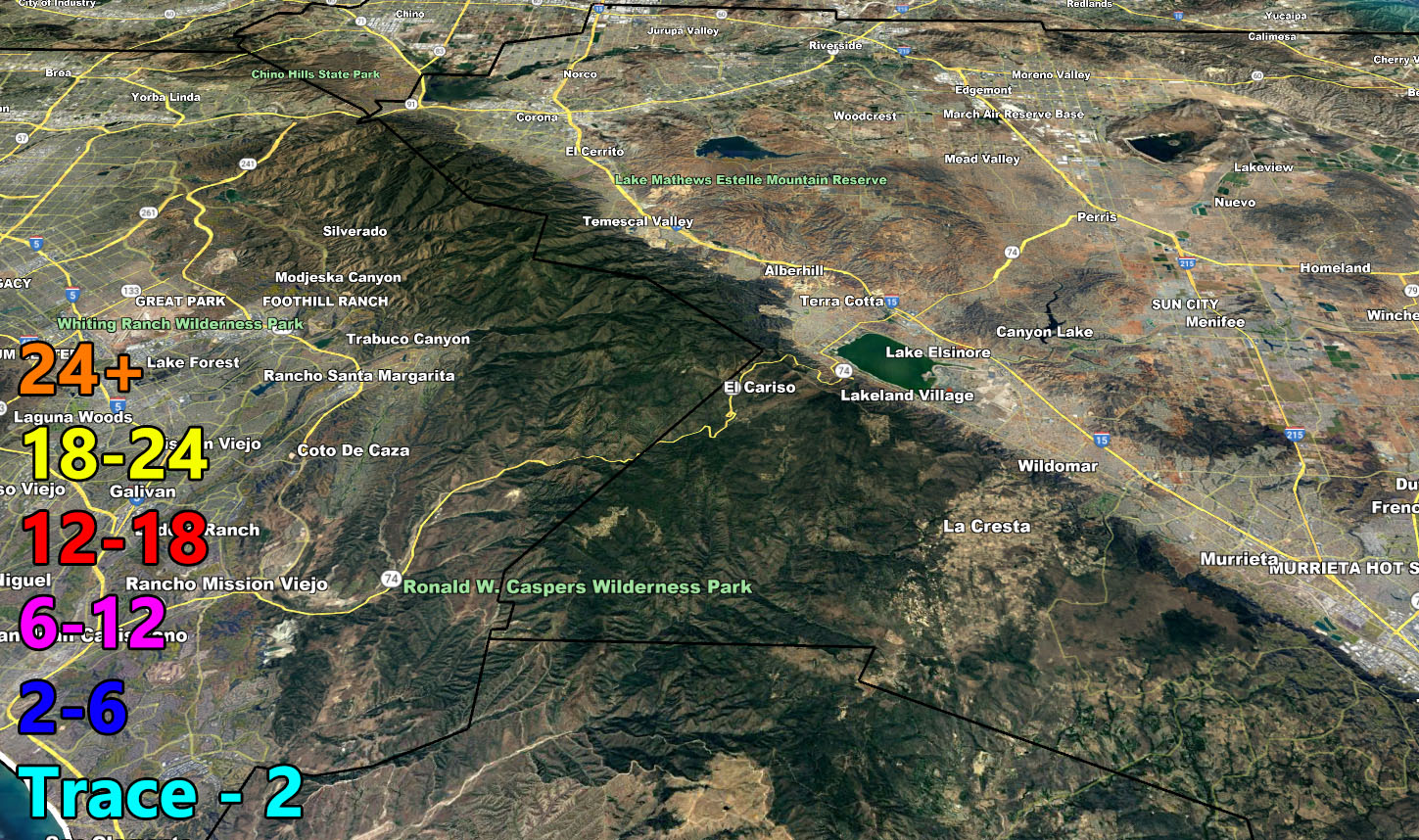
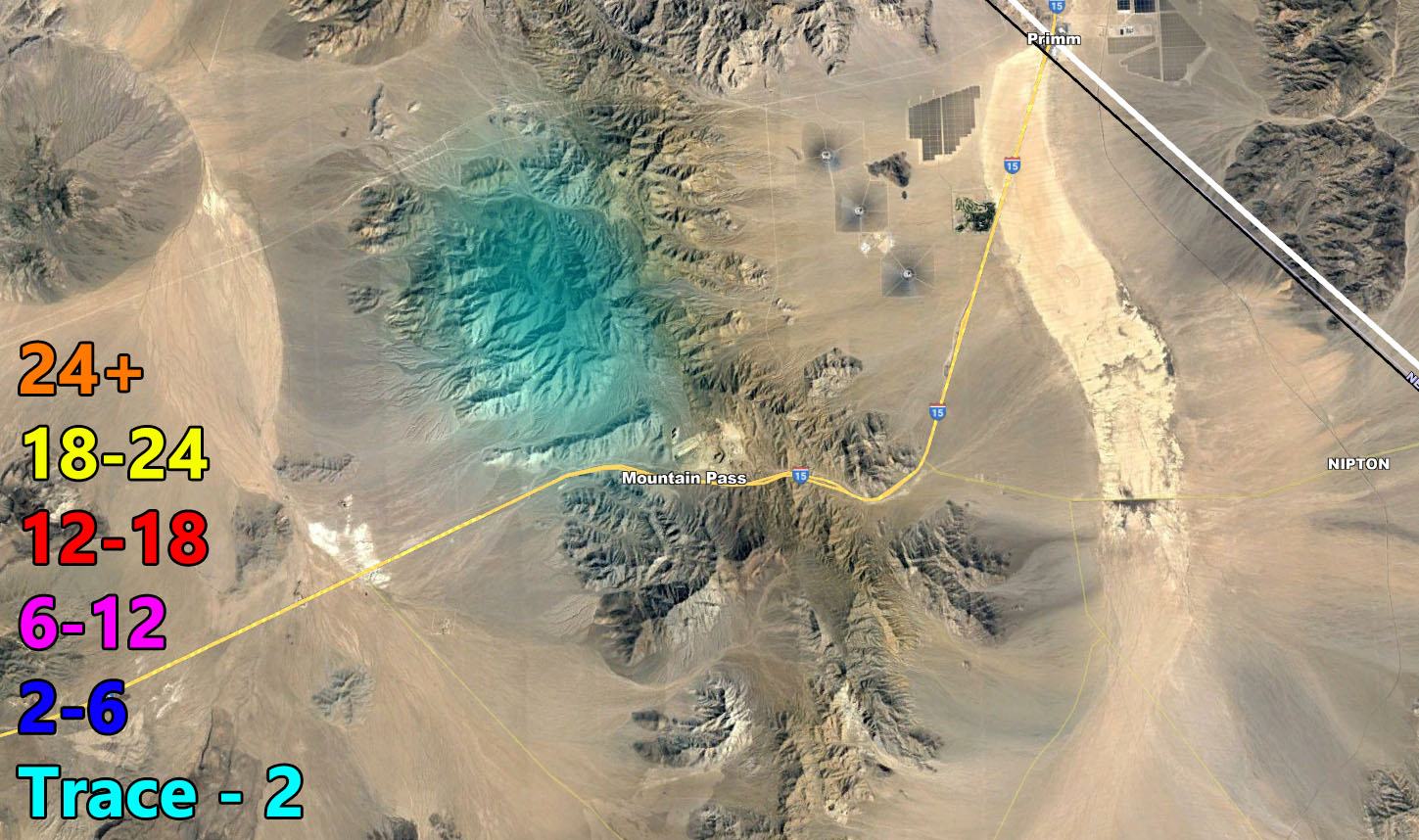
SNOW: Snow-levels will be over 8,000 FT with the main frontal zone passage. However, indications are that the continued onshore flow and upper dynamics will support multiple rounds of precipitation behind the main front on Thursday, so I do expect that over the day on Thursday, snow-levels will lower through 6,000 FT, finally bringing the mountain resorts some snowfall. Southern California Weather Force models are picking up on this affecting the San Bernardino Mountain areas of Big Bear with 6-8″ of snowfall, locally higher above 7,000 FT as such the official Winter Storm Warning has been issued up there for your Thursday when the rain switches to snow, probably sometime after 9am-10am at lake level.
THUNDERSTORMS: Convective activity (Thunderstorms) will be likely behind the main front on Thursday with the colder air aloft. Thunderstorm Alerts will be issued accordingly on Thursday morning. The risk zones will be SLO, SBA, KERN, VENTURA, LOS ANGELES, ORANGE, AND THE INLAND EMPIRE zones. So continue to monitor Southern California Weather Force through Thursday morning when the official Thunderstorm Watches will be issued.
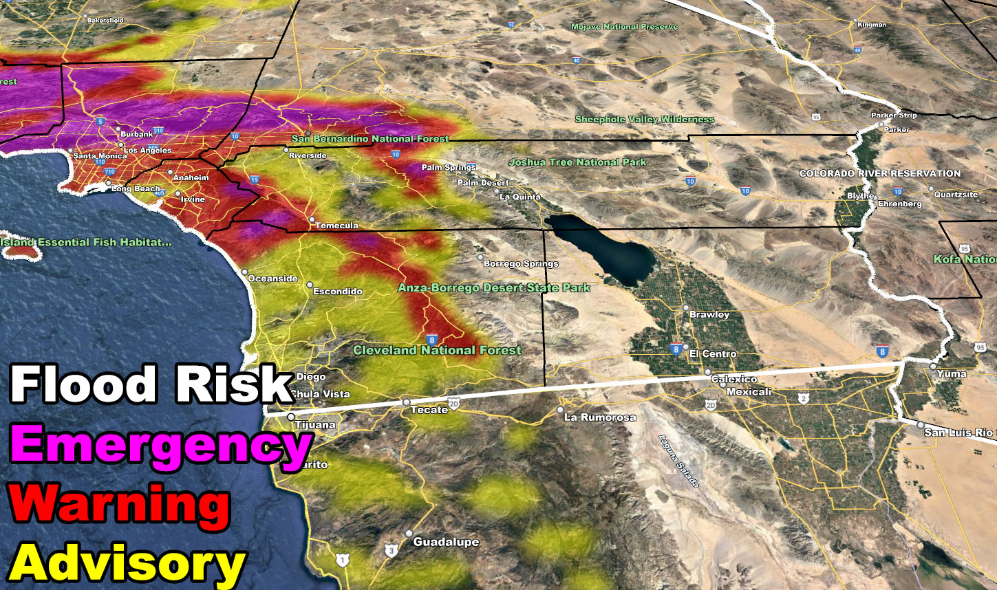
The thing many need to understand about this type of storm is that if you do not live in Santa Barbara, Ventura, or Los Angeles County then you will not see the major effects they will bring. This is officially a category five out of six system for those areas. San Diego will see far less precipitation, hence why you’re only in a Flood Advisory. Southern California Weather Force jurisdiction is for all 10 counties of Southern California. At times, you will not be a main focus spot, but others will. This system will bring a lot of damage with it, likely even a loss of life to those who ignore it and within the Flood Emergency zones.
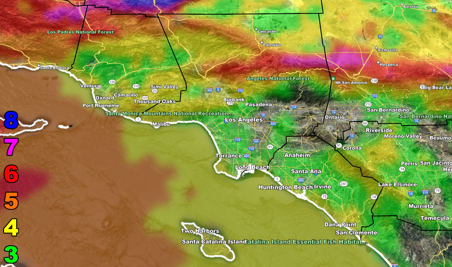
So, with that being said, please use the rain, snow, wind, and flood risk models below and DO NOT FORGET TO LOOK AT THE VALID TIMING IT IS FOR
Rain Model – VALID TODAY INTO THURSDAY
SUPPORTING MEMBERS: Click Here To See The GPS Version Of This Model In Your Member Section Tab.


Snow Model – VALID THURSDAY
SUPPORTING MEMBERS: Click Here To See The GPS Version Of This Model In Your Member Section Tab.

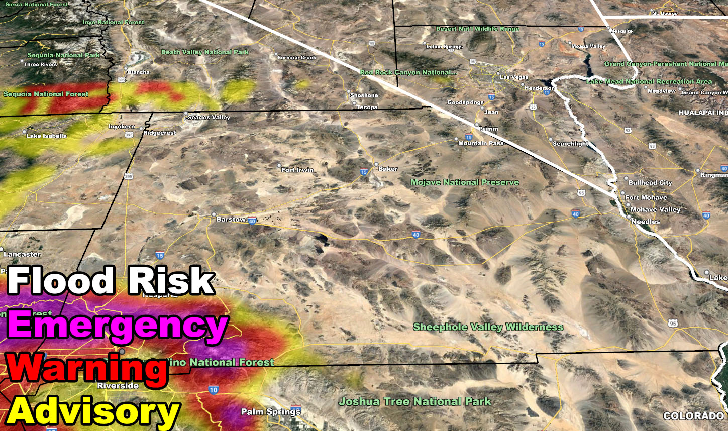
Flood Alert Model – VALID TODAY INTO THURSDAY


Wind Model – VALID TODAY INTO THURSDAY
SUPPORTING MEMBERS: Click Here To See The GPS Version Of This Model In Your Member Section Tab.
Raiden Storm Wind Gust Intensity Scale –
8. Extensive widespread damage.
7. Trees are broken or uprooted, building damage is considerable. – High Profile Vehicle Roll-Over CERTAIN.
6. SOME Trees are broken or uprooted, building damage is possible. – High Profile Vehicle Roll-Over Likely, Do NOT recommend Traveling in this zone. This zone also is the starting zone where trees and powerlines will fall and damage cars and even kill people near or in them!
5. Slight damage occurs to buildings, shingles are blown off of roofs. HIGH WIND WARNING CRITERIA – High Profile Vehicle Roll-Over Possible if weight is not corrected.
4. Twigs and small branches are broken from trees, walking is difficult.
3. Large trees sway, becoming difficult to walk. POWER SHUTDOWN THRESHOLD DURING FIRE WEATHER / WIND ADVISORY CRITERIA

WANT THESE DELIVERED WITH ALL THOSE PERKS INCLUDING BEING ON THE MICRO-CLIMATE ALERT SYSTEM AND MODELS DURING EVENTS BECAUSE NOT EVERY ALERT IS POSTED ON SOCIAL MEDIA FROM THIS WEATHER OFFICE – JOIN TODAY BY CLICKING HERE – Southern California Weather Force Subscriber System – Southern California Weather Force
Join The Main Southern California Weather Force Facebook Group (50 percent delivery time) – You can join the main SCWF page as well through that group.
Click Here To Join The Page Today